Elevation: 5,947 ft
Prominence: 367
This peak is not in the book. Livingston Douglas added the East Face/Shoulder Route to this page. Updated November 2022
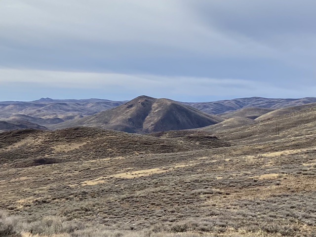
This attractive peak sits at the east end of the divide that splits Kent Gulch and Hatty Gulch which both dump into Rock Creek. It is a treeless peak and can be climbed through the sagebrush from any direction. USGS Richardson Summit
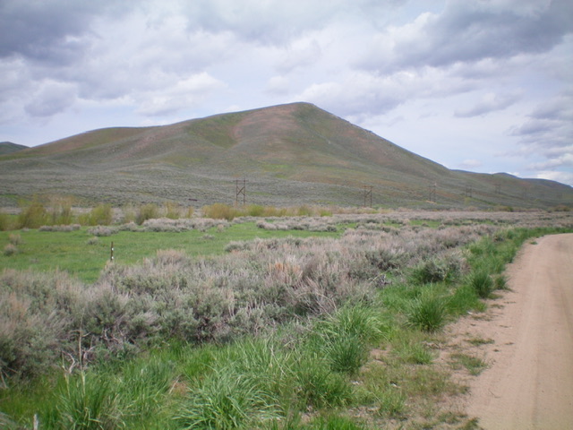
Peak 5947 as viewed from Gilman Butte
Access
Access this peak from Rock Creek Road, which can be reached from Hailey to the north or via US-20 to the south. Rock Creek Road is not maintained in the winter. Its northern end is a good, graded gravel road and its southern end is a graded dirt road. Much of the land in the Rock Creek drainage is now owned by the University of Idaho. The land was purchased by the Wood River Land Trust and transferred to the University in 2019. The land is accessible to the public through the Idaho Fish & Game’s Access Yes program. Peak 5947 is located on BLM land but access is through University land. Be sure to follow the access rules.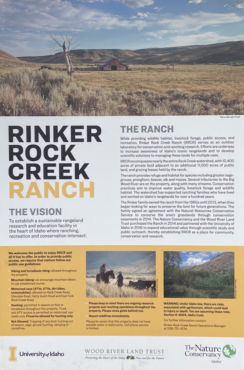
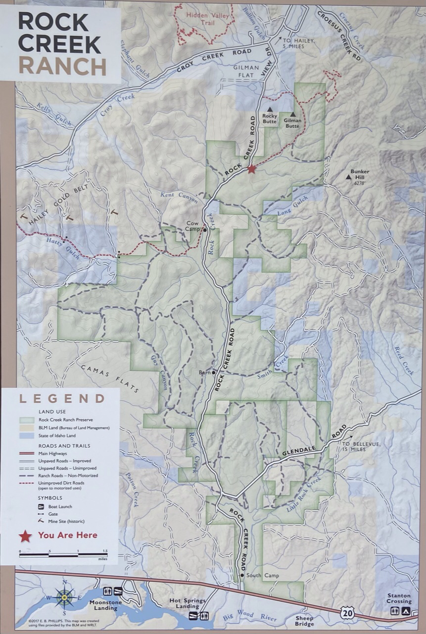
Hailey Access: From the junction of ID-75 and Bullion Street in Hailey, ID, drive west on Bullion Street/Road for 4.6 miles to a signed junction with Rock Creek Road. Turn left/south on Rock Creek Road and drive 3.6 miles to an unmarked junction at a fenced compound.
US-20 Access: Rock Creek Road is accessed from US-20 at a signed intersection that is located 21.0 miles east of Fairfield or 5.3 miles west of the US-20/ID-75 intersection. Follow Rock Creek Road north for 7.2 miles to an unmarked junction at a fenced compound.
From the unmarked junction at the fenced compound, follow the 2-track south then west for 0.55 miles where there is a fence line and room to park.
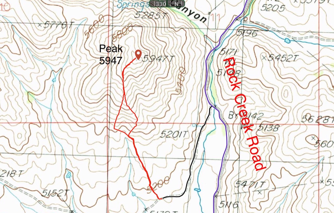
Access and route map
South Ridge, Class 2
From the parking spot, cross through the fence. A trail with a sign prohibiting motorized vehicles leaves the road on its north immediately. Although prohibited, it appears that the trail is heavily used by motorcycles. Follow the trail across the undulating flats to base of the south ridge then climb the ridge to the summit. I measured 1.65 miles with 605 feet of elevation gain round trip.
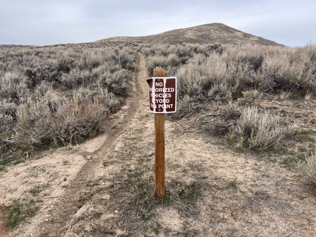
The start of the trail
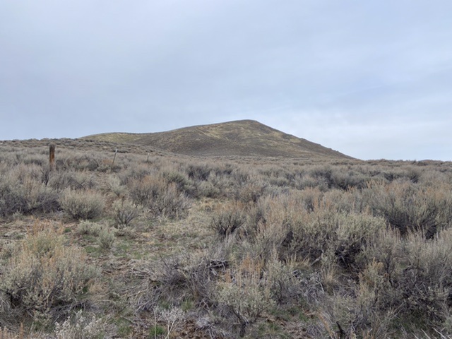
Peak 5947 as viewed from the trailhead
East Face/Shoulder by Livingston Douglas
Access
From the turnoff for the Lopez Route, drive another 0.3 miles up Rock Creek Road and park in a small gully alongside the road, just past a cattle guard (5,171 feet on the USGS topo map). GPS coordinates: 43⁰25’55”N, 114⁰23’48”W. The mouth of this gully sits at the base of the steep east face/shoulder of Peak 5947. This is a shorter, steeper route to the summit than the Lopez Route.
East Face/Shoulder, Class 2
The Climb
From the mouth of the gully, climb directly up onto the east face/shoulder (it is more of a shoulder here) on a mix of loose scree and sagebrush. Cross underneath a powerline and its access road. Once across the road, head west-northwest up the steep slope of field grass and sagebrush all the way to the cairned summit.
The steep east face of Peak 5947 (my ascent route). Livingston Douglas Photo
Peak 5947 as viewed from the south. Livingston Douglas Photo
Additional Resources
Regions: Smoky Mountains->WESTERN IDAHO
Mountain Range: Smoky Mountains
Year Climbed: 2021
Longitude: -114.40379 Latitude: 43.43101