Elevation: 5,998 ft
Prominence: 858
This peak is not in the book. This page is based on information from John Platt. His trip report is linked below. Published November 2018
Peak 5998 is located west of the confluence of the East Fork South Fork Salmon River and the South Fork Salmon River. The rocky point directly above the confluence is named Indian Point. Consequently, John Platt calls this peak (which sits due west of Indian Point) “Indian Point Point.” This peak has significant prominence as it rises steeply out of the deep river canyons. USGS Williams Peak
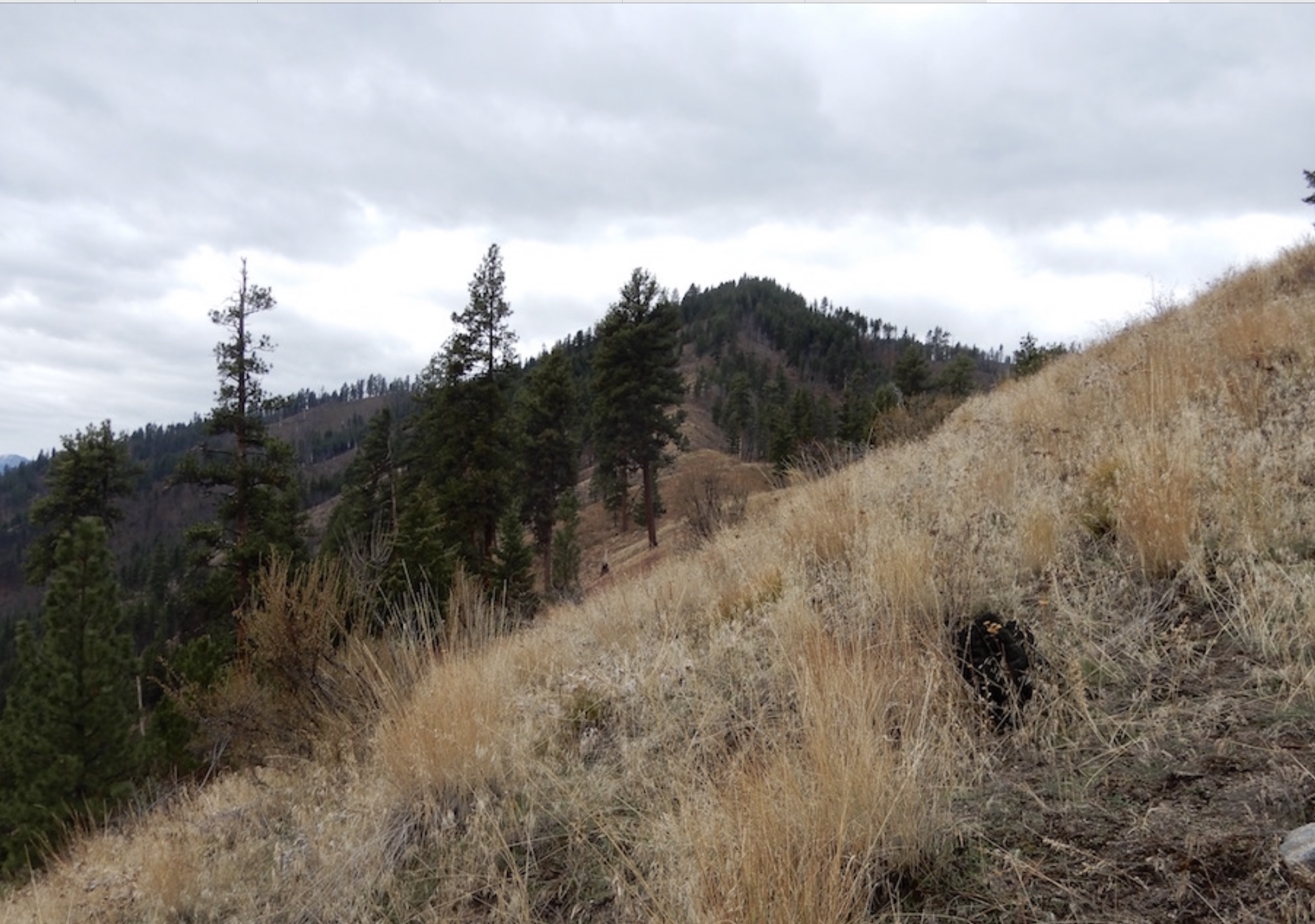
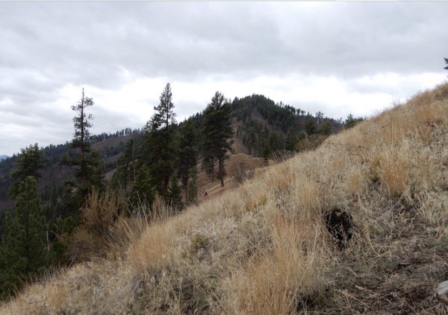
Indian Point Point. John Platt Photo
Access
The starting point for this peak can be reached from two directions. From McCall, follow FH-48 [(B)(3) on Page 136] over Lick Creek Summit down to the point where the Secesh River flows into the South Fork. From Cascade, take Warm Lake Highway to South Fork Road [(C)(1.1) on Page 136]. Follow South Fork Road south to its junction with FH-48. Turn left onto FH-48 and follow it to the point where the Secesh River flows into the South Fork. Park downstream from the bridge across the Secesh River.
Northeast Ridge, Class 2
Cross the Secesh River Bridge and climb up the steep road cut on a game trail to the base of the ridge. The ridge climbs steeply at first but the angle soon lessens. John Platt encountered a rock obstacle on the ridge. Bypass the rock by dropping down on its East Side. John reports: “It’s pretty easy to follow the ridge crest and that means views. Also, there are game trails pretty much the entire way.” As you can see by the GPS track, John descended a different route. His loop route covered 6.1 miles with 2,720 feet of elevation gain.
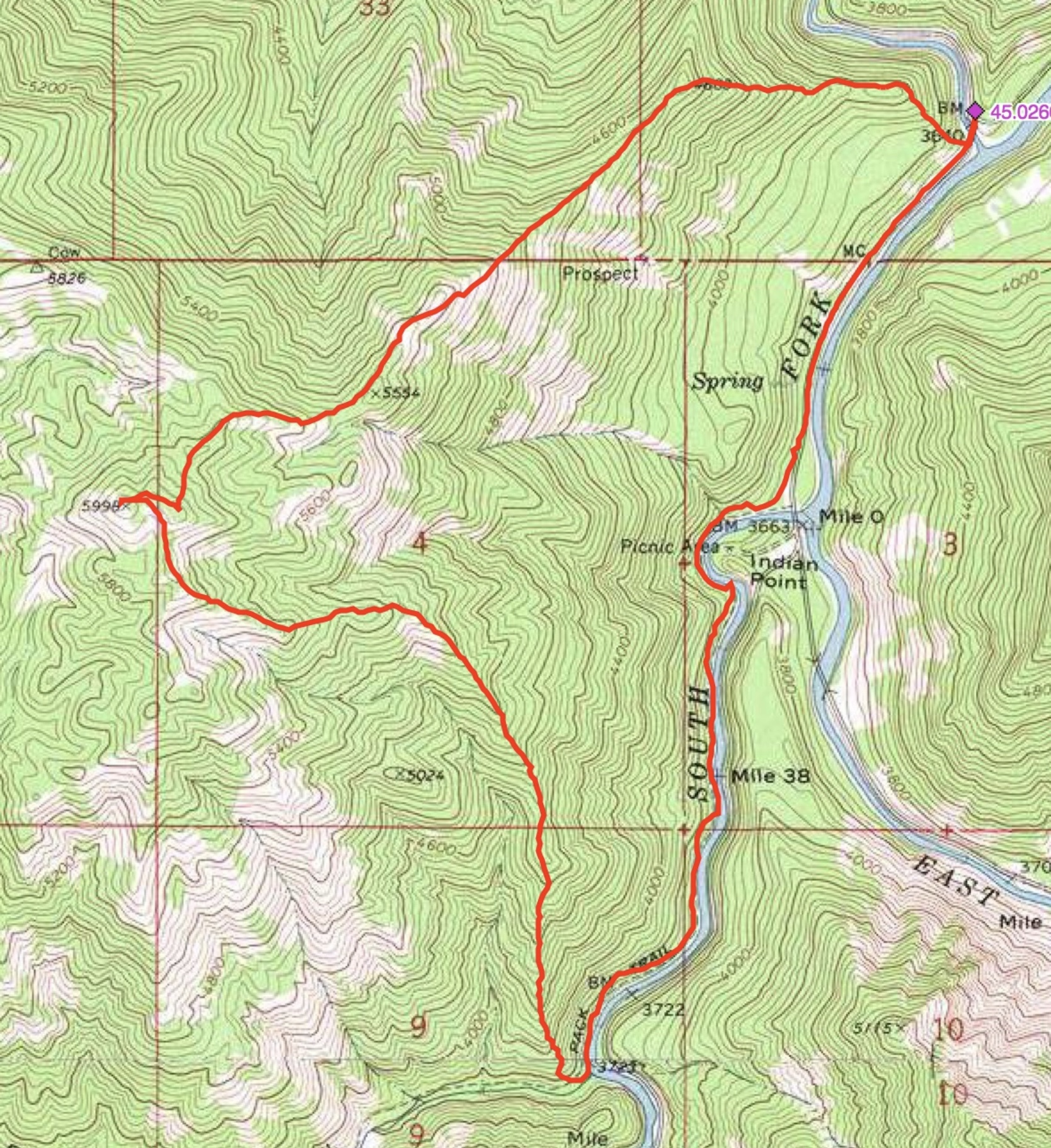
John Platt’s GPS track.
Additional Resources
Mountain Range: Western Salmon River Mountains
Longitude: -115.74039 Latitude: 45.01509