Elevation: 6,020 ft
Prominence: 440
This peak is not in the book. Published November 2023
Peak 6020 is a ridge hump on the lengthy southwest ridge of Morgan Mountain (8,308 feet). This ridgeline separates Sheep Creek to the south from Lick Creek to the north. Peak 6020 is most easily climbed from Sheep Creek Road. This climb is entirely on National Forest land. USGS Gibbonsville
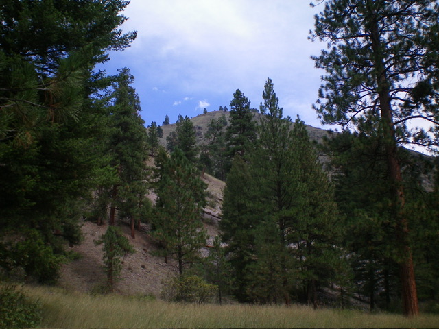
Peak 6020 as viewed from Sheep Creek Road to its southwest. Livingston Douglas Photo
Access
From US-93 south of Gibbonsville, turn right/east onto [signed]Sheep Creek Road/FSR-077. At 1.0 miles, reach the Salmon National Forest boundary. At 1.2 miles, reach a road fork and a signed road junction with a large parking area. Park here (4,430feet; 45⁰29’59”N, 113⁰55’38”W). Depending upon road conditions, you may be able to continue driving east on Sheep Creek Road (the left fork in the road) for another ½ mile to a road closure point with large boulders. However, the road is rougher and has mud holes over this final ½ mile.
South Shoulder, Class 2
The Climb
From the road junction, follow the left fork (signed for the CDT) for ½ mile to a boulder blockage where the road becomes a foot trail. Peak 6020 sits directly above the road to its left/north. Leave the road at the large boulders/closure and bushwhack diagonally right/northeast up the south face briefly in field grass. Angle diagonally left/northwest across a steep-ish talus slope to reach steep grass. Continue scrambling diagonally left up the steep field grass to reach the crest of the south shoulder.
Grind your way up the steep, open shoulder in a mix of reasonably stable scree/gravel, short grass/scrub, scattered pines, and rocky ridge outcrops. The shoulder leads directly north to the high point of Peak 6020. The high point, in my opinion, is in the forest near an open field. I found a small cairn in the open field to the southwest of the forested high point. The cairned point seems to be 3-5 feet lower than the forested high point. The summit area is a tilted, open plateau of field grass on the edge of a pine forest.

The semi-open summit of Peak 6020. Livingston Douglas Photo
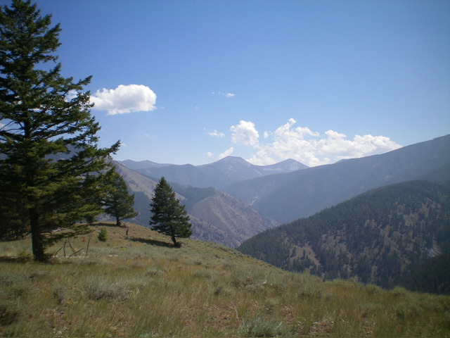
Summit view from atop Peak 6020. Livingston Douglas Photo
Additional Resources
Regions: Beaverhead Range->EASTERN IDAHO
Mountain Range: Beaverhead Range
Longitude: -113.9139 Latitude: 45.5054