Elevation: 6,073 ft
Prominence: 493
This peak is not in the book. Published January 2023
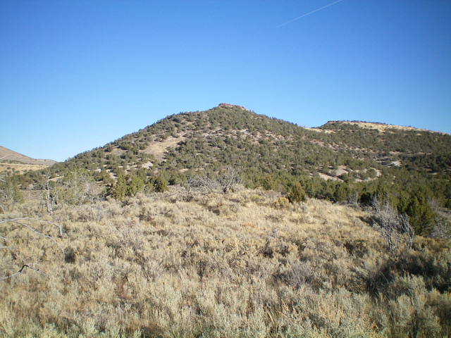
Peak 6073 is a minor hump that is located east of Daves Pass in the South Hills. It sits above Cave Gulch and at the headwaters of Coal Banks Creek. Peak 6073 has a testy cliff band that must be climbed to reach the summit. USGS Blue Hill
Peak 6073 (dead center) as viewed from the south. Livingston Douglas Photo
Access
From the end of ID-27 in downtown Oakley, turn right/west onto Main Street and drive 0.4 miles to a signed junction with Goose Creek Road (signed for the Oakley Reservoir, which is shown on maps as the Lower Goose Creek Reservoir). Turn left/south onto Goose Creek Road and reset your odometer. At 8.2 miles, reach [unsigned] Wilson Pass, the road crest for Goose Creek Road. There is an unsigned road junction here. Continue straight/south on Goose Creek Road.
At 10.0 miles, reach a signed junction with Wilson Gulch Road (right). Continue straight. At 13.9 miles, reach a signed junction with Emery Creek Road (left). Continue straight. At 15.8 miles, reach a signed junction with Coal Banks Creek Road/FSR-681. Turn right/west onto FSR-681 and drive 1.6 miles to an unsigned junction in a basin. Go right/north to stay on FSR-681 and drive 0.1 miles to a large parking area on the left/west side of the road. Park here (5,055 feet).
Please be aware that FSR-681 requires a fording of Goose Creek almost immediately after leaving Goose Creek Road. Do not attempt this fording until late Summer or Fall. And the shallowest place to ford the creek is not at the deeper, official road fording but about 50 feet downstream from the dispersed campsite that sits alongside Goose Creek.
Southeast Face, Class 3
The Climb
Please note that, depending on road conditions, you may be able to drive up FSR-681 all the way to the base of the southeast face of Peak 6073, saving considerable hiking mileage. But, having driven this section of FSR-681 a few years ago and getting a flat tire from so doing, I chose to not drive it. You must have a 4WD vehicle with good tires and decent ground clearance to navigate the upper portions of FSR-681. The road bed has sharp rock and is also rutted in some areas.
From the parking area, hike up FSR-681 for about 2.5 miles to reach a sharp left/west turn in the road at the base of the southeast face of Peak 6073. Leave the road here and follow an old 2-track straight/north briefly to its end at a dispersed campsite. From the campsite, bushwhack northwest up through a thick juniper forest. This is a bit tedious with weaving required. The underlying terrain is steep, loose rock and sand. Once above the junipers, reach the base of the Class 3 summit cliff band. Scramble up a notch (or the rock face itself) to reach the top of the elongated summit block. The high point is at the south end of the summit block. The summit has a nice cairn.
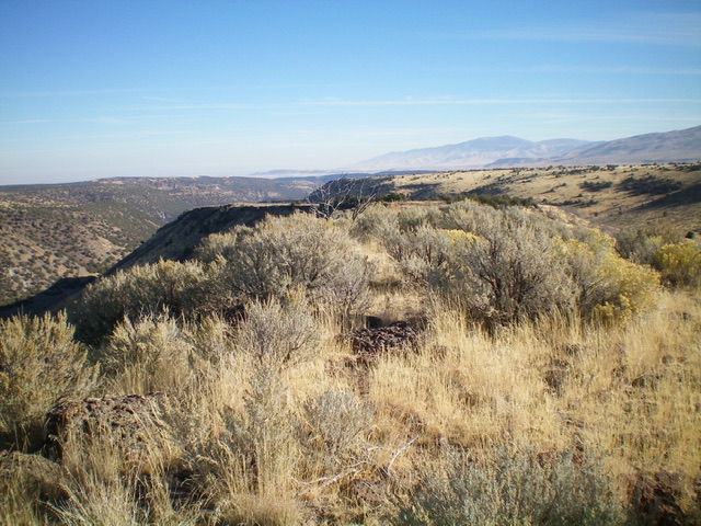
The grassy summit plateau of Peak 6073 with the lower north summit (Point 6000+) in the distance. Livingston Douglas Photo
North Ridge/East Face, Class 3
The Descent
From the summit, head northeast along the elongated summit block then downclimb the summit block (Class 3). Descend through rock, sand, and scrub to reach a ridge saddle. From the saddle, contour right-ish/northeast and descend gradually in rock/sand/scrub and scattered junipers to find an old road bed. Follow this road bed northeast to approach the connecting saddle with Peak 6062. Descend a final patch of easy, open scrub to reach the gentle, wide connecting saddle at 5,780 feet. This concludes the first leg of today’s 2-peak adventure. Peak 6062 is up next.
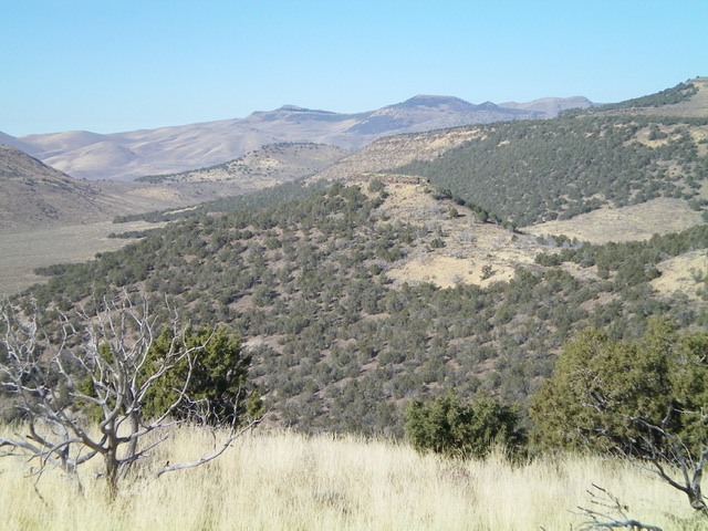
Peak 6073 (in mid-ground) and its cliff-banded summit. Livingston Douglas Photo
Additional Resources
Regions: South Hills->SOUTHERN IDAHO
Mountain Range: South Hills
Longitude: -113.00069 Latitude: 42.0798