Elevation: 6,156 ft
Prominence: 392
This peak is not in the book. Published January 2023
Peak 6156 is located west of Big Hollow and south of Holbrook Summit in the Samaria Hills. It is most easily reached from Malad Pass Road to its east. This area is a mix of private and public land, so be careful. This hike is entirely on BLM land. USGS Ireland Springs
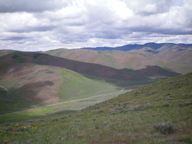
Peak 6156 (center of photo in mid-ground) as viewed from the north ridge of Sam Benchmark. Livingston Douglas Photo
Access
From Exit 13 (Malad City) on I-15, drive west on ID-38 to the 7-mile marker and a left/south turn onto 5400W (signed for “Pocatello Valley”). This is Malad Pass Road, which eventually drops into Pocatello Valley and becomes Pocatello Valley Road. Go south on Malad Pass Road for 5.1 miles to an unsigned junction with a 2-track road on the right/west side of the road. This old 2-track leads to nearby cattle cisterns and a water tank. Park here (5,107 feet). GPS coordinates: 42⁰07’22”N, 112⁰25’12”W.
Southeast Shoulder/East Ridge, Class 2
The Climb
From the road junction, there are two dry gullies coming in from the west. You want the one that is slightly to the north of the road junction. The old 2-track road goes partway up that gully. Hike up the old 2-track northwest then west to its end near a large, rusty water tank in a dry gully. From here, bushwhack northwest (or, better yet, follow a weak game trail a little farther up the gully before exiting the gully) through tall grass and sagebrush to reach a shoulder then angle left/west onto a bigger shoulder. If you follow the game trail in the gully, you can avoid the first shoulder and simply climb the bigger shoulder from its base.
Once on the bigger shoulder (i.e., the southeast shoulder), bushwhack up it through thick veg that thins out higher up to reach the easier terrain of the east ridge (short grass + scattered scrub). Follow the ridge west up to an elongated ridge point. The ridge jogs right/northwest here and drops to a minor saddle.From the saddle, continue northwest to a final ridge hump. Drop west to a final saddle and scramble west to the open summit. There was no cairn on top so I built a small one. There are two hills of similar height just to the north (Point 6093) and south (Point 6066). That is why it is critical to choose the correct gully, then ridge, to reach the summit of Peak 6156.
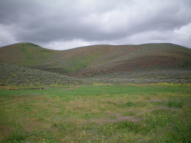
View of the east ridge of Peak 6156 from the 2-track road (start of climb). The summit hump is to the left on the ridge but is not yet in view. Livingston Douglas Photo
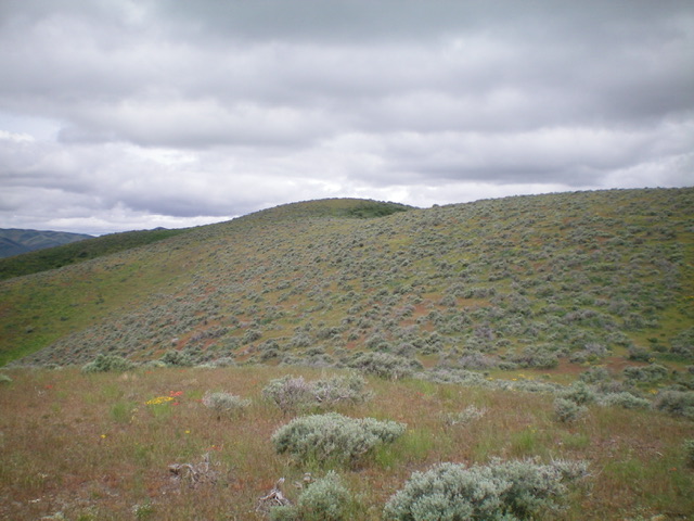
The final push to the summit hump (just left of center) of Peak 6156. Livingston Douglas Photo
East Ridge/South Spur, Class 2
The Descent
From the summit, follow the undulating, weaving east ridge down to just below 6,000 feet in relatively easy scrub. The ridge drops somewhat steeply northwest to a 5,780-foot saddle that is just west of Point 5800+. This ridge section is much thicker vegand includes some patches of dense aspens. Stay left/northwest of the aspens in the open sagebrush. Once at the saddle, follow the ridge crest up over Point 5800+ and continue east down to a ridge juncture. Turn right/south here to descend the south spur to the road junction where you are parked. There is some very thick sagebrush and tall field grass to avoid in the lower part of this descent. Stay to the right/west of that mess and intersect the old 2-track road, then follow it back to the road junction and your parked vehicle.
Additional Resources
Regions: Bannock Range->Pleasantview Hills->SOUTHERN IDAHO
Mountain Range: Bannock Range
Longitude: -112.4441 Latitude: 42.1302