Elevation: 6,165 ft
Prominence: 545
This peak is not in the book. Published November 2020
Peak 6165 is an elusive, hidden ridgeline summit that is located on the west side of Cow Canyon. It is most easily climbed via an old 2-track jeep road and its northeast shoulder. Be navigationally-alert in this area as it is a confusing mix of gullies, shoulders, and humps. It includes forested areas to limit your visibility as well, adding to the potential confusion. USGS Badger Hole Spring
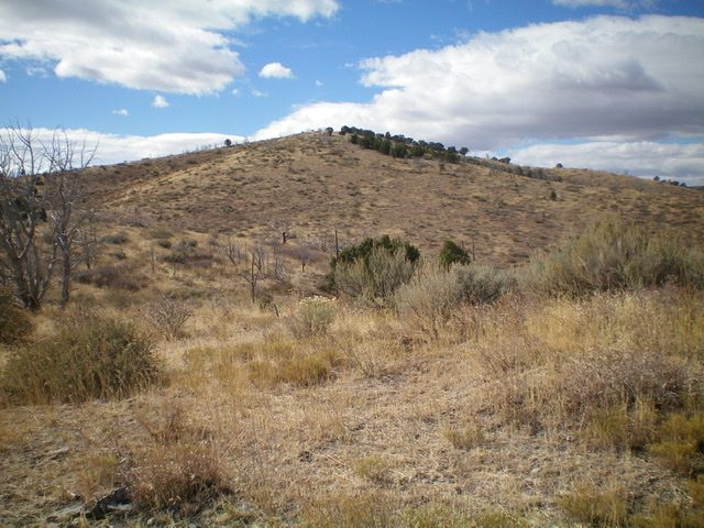
Peak 6165 as viewed from the northeast. Livingston Douglas Photo
Access
From the [signed] junction of Meadow Brook Road/BLM-027 at ID-37, drive 7.0 miles southwest then west to an unsigned junction with an old 2-track jeep road on the left/side of Meadow Brook Road. Park at the base of this side road in a large parking area (5,620 feet). This side road is located 0.3 miles west of [signed] Cow Canyon Road/BLM-603.
Northeast Shoulder, Class 2
The Climb
From the junction with Meadow Brook Road, hike southwest along the old 2-track jeep road (overgrown with grass and closed to motorized vehicles) for 1.3 miles to just past the second crossing under the powerlines. By now, the road has degraded to become a cattle/foot path and is now in a dry gully. Leave the “road” here and bushwhack left/southeast a short distance up onto a nearby shoulder.
Climb south up the brushy/grassy shoulder towards a juniper-clad hump (the east summit). Skirt the right/west side of the hump using a cattle trail to reach a saddle between the east summit and the true summit of Peak 6165. Stay to the right of the junipers as best you can. From the saddle, climb west-southwest through easy scrub to reach the summit. The summit had a small cairn so I built it up a bit.
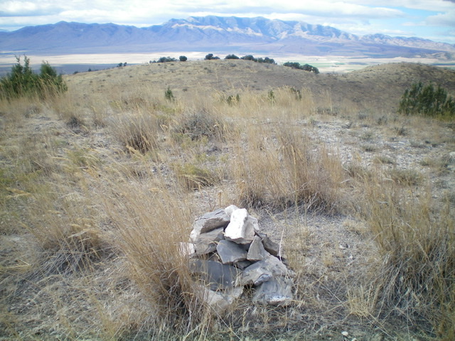
The newly-enhanced summit cairn atop Peak 6165. Livingston Douglas Photo
North Gully, Class 2
The Descent
The best descent route is the ascent route previously detailed. Fool that I am, I decided to try a new route for the descent, which I now regret. From the summit, descend east-northeast back to the saddle. From the saddle, follow a dry gully (using a cattle trail) that descends north then bends northwest. When you reach the powerlines, leave the gully and follow the powerlines east over a shoulder and down to the gully where old 2-track road (used for the ascent route) is awaiting you. The bushwhack underneath the powerlines is thick with brush and sagebrush and is brutal. Follow the old road back to Meadow Brook Road and your parked vehicle.
Additional Resources
Regions: SOUTHERN IDAHO->Sublett Range
Mountain Range: Sublett Range
Longitude: -112.85869 Latitude: 42.14829