Elevation: 6,179 ft
Prominence: 399
This peak is not in the book. Published November 2023
Peak 6179 is a rarely-climbed peak that is located southwest of Ellis on the west side of the Salmon River. It is most easily reached via its east ridge from an old bridge crossing of the Salmon River. This climb is entirely on BLM land. USGS Ellis
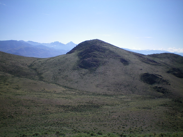
Peak 6179 as viewed from the northeast. Livingston Douglas Photo
Access
From US-93 exactly 1.3 miles south of Ellis, head west on an unsigned BLM road (shown on the USGS topo map) that heads west for 0.3 miles down to the Salmon River and an old bridge crossing. Park in a parking area on the east side of the Salmon River at the bridge crossing. This parking area is at 4,680 feet.The old bridge is closed to motor vehicles but is open to foot/horse traffic. This is the first leg of a 2-peak adventure that includes Peak 6179 and Peak 7100. It covers 9.5 miles with 3,600 feet of elevation gain round trip.
East Ridge/North Face, Class 3
The Climb
From the parking area, walk across the old bridge to the west side of the Salmon River. Once across the bridge, leave the road (which heads right/north to a private ranch) and cross a dilapidated fence row. Bushwhack diagonally left/southwest (using a lateral cattle trail to assist initially) up through sagebrush to reach a ridge saddle southeast of Point 5235. Follow the easy, open ridge northwest to Point 5235. Given the steep, loose talus/scree on the east face of Point 5235, this is an easier route than a direct climb up over Point 5235.
From Point 5235, follow the weaving, undulating ridge crest west then southwest to approach the saddle between Peak 6179 and Point 6144. Scramble up the steep face of sagebrush and boulders to reach the saddle. I stayed close to the left/north-side cliffs on the ascent in a narrow gully but found a much easier dry gully (with a cattle trail) more in the center of the saddle on the descent. The latter option is not visible when ascending from the east.
Once on the gentle, grassy saddle, you have two options. You can either scramble directly south up the steep mix of sagebrush and boulders (Class 3) or head southwest to find a grassy ramp that is a gentler, less rocky route to the summit. I chose the former, more direct option. The summit of Peak 6179 showed no signs of previous ascent. I built a modest cairn on top.
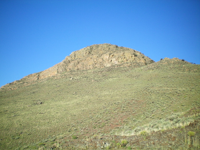
Peak 6179 (center) as viewed from the west. Livingston Douglas Photo
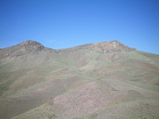
Peak 6179 (left) and Point 6144 (right) as viewed from the east ridge. The ridge leads up to the saddle between the two rocky humps and follows the left side of the gully in the center of the photo. Livingston Douglas Photo
North Face/West Gully, Class 3
The Descent
From the summit, descend the north face to the saddle between Peak 6179 and Point 6144. From the saddle, bushwhack west-southwest then west down a dry gully to reach a lower saddle at 5,780 feet. This is the connecting saddle between Peak 6179 and Peak 7100. It concludes the first leg of today’s 2-peak adventure. Peak 7100 is up next.
Additional Resources
Regions: Eastern Salmon River Mountains->Salmon River Mountains->Southeast Corner Peaks->WESTERN IDAHO
Mountain Range: Eastern Salmon River Mountains
First Ascent Information:
- First Ascent Year: 2023
- Season: Summer
- Route: East Ridge/North Face
- Party: Livingston Douglas
- Other First Ascent: North Face/West Gully (Descent)
- Year: 2023
- Season: Spring
- Party: Livingston Douglas
Longitude: -114.0982 Latitude: 44.6714