Elevation: 6,180 ft
Prominence: 360
This peak is not in the book. Published November 2023
Peak 6180 sits above the Lewis and Clark Backcountry Byway on the west side of Warm Spring Creek. It is a short sagebrush scramble from the Byway via the southeast shoulder. USGS Goldstone Mountain
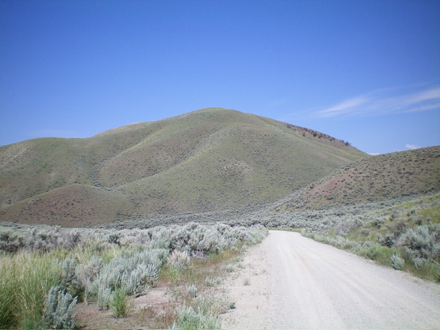
Peak 6180 as viewed from the Lewis and Clark Backcountry Byway to its east. Livingston Douglas Photo
Access
From ID-28 at Tendoy, drive east on [signed] Tendoy Lane for 0.1 miles to a “T” junction. Go left/north onto the [signed] Lewis and Clark Backcountry Byway and drive 2.7 miles to a signed junction. Go right/east here to continue on the Byway. This junction is also 1.9 miles south of 17 Mile Lane which goes 0.4 miles west to reach ID-28 north of Tendoy. Reset your odometer at this junction. Drive 2.6 miles up the Byway andpark in a roadside pullout at the toe of the southeast shoulder. This pullout is at 5,525 feet and 45⁰00’55”N, 113⁰36’06”W).
Southeast Shoulder, Class 2
The Climb
From the roadside pullout, cross to the west side of the road and bushwhack up thick sagebrush to reach the crest of the southeast shoulder. A bit higher up, the sagebrush thins out and it is an easy scramble to the summit with a 10-foot drop to a minor saddle early on. The ridge crest heads northwest then bendswest to reach the summit. The summit of Peak 6180 is at a cattle fence corner. It has a BLM survey benchmark nearby. There is no summit cairn and no loose rocks with which to build one.
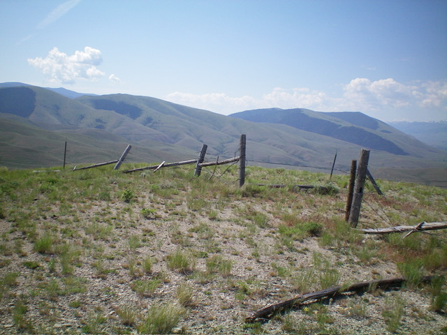
The summit of Peak 6180 is at a fence corner. Livingston Douglas Photo
Additional Resources
Regions: Beaverhead Range->EASTERN IDAHO
Mountain Range: Beaverhead Range
Longitude: -113.6089 Latitude: 45.0194