Elevation: 6,186 ft
Prominence: 578
This peak is not in the book. I updated this post with additional access information, a map, and a photo. Updated November 2021
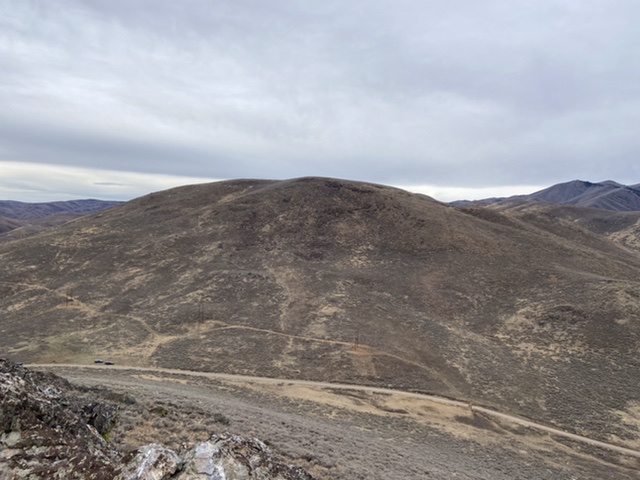
Peak 6186 sits above Gilman Flat and is the largest of three peaks in the immediate vicinity that look northward to the lush, green ranch land of Gilman Flat. Beware of rattlesnakes and copperheads in this area. Consult the BLM Fairfield map as there is private land to the north of Gilman Hill. USGS Richardson Summit
Gilman Hill as viewed from Rocky Butte
East Face, Class 2+
Access
Access this peak from Rock Creek Road which can be accessed from Hailey in the north of US-20 in the south. Rock Creek road is not maintained in winter. It north end is a good, graded gravel road and its south end is a graded dirt road. Rock Creek Road is a public thoroughfare. Much of the land south of the peak in the Rock Creek drainage is now owned by the University of Idaho. The land was purchased by the Wood River Land Trust and transferred to the university in 2019. The land is accessible to the public through Idaho Fish & Game’s Access Yes program.
Hailey Access: From the junction of ID-75 and Bullion Street in Hailey, ID, drive west on Bullion Street/Road for 4.6 miles to a signed junction with Rock Creek Road. Turn left/south on Rock Creek Road and drive 1.4 miles to a saddle just east of Gilman Hill. The elevation here is 5,580 feet.
US-20 Access: Rock Creek Road is accessed from US-20 at a signed intersection which is located 21.0 miles east of Fairfield or 5.3 miles west of the US-20/ID-75 intersection. Follow Rock Creek Road north for 9.3 miles to an unmarked junction at the 5,580-foot saddle between Gilman Hill and Rocky Butte.
The Climb
From the saddle, scramble directly west up the east face. The terrain is a loose, unpleasant combination of talus/boulder/scree fields, thick sagebrush, and rocky outcrops. (Class 2+). The summit area is covered with sagebrush but does have a decent cairn in an open area.
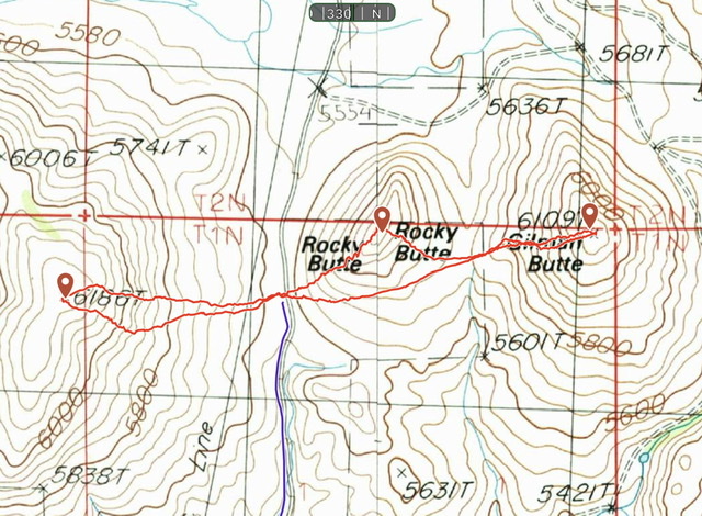
My GPS tracks for Gilman Hill, Rocky Butte, and Gilman Butte. The Gilman Hill climb covered 0.9 miles with 531 feet of elevation gain round trip. The Rocky Butte/Gilman Butte route covered 1.4 miles with 580 feet of elevation gain round trip.
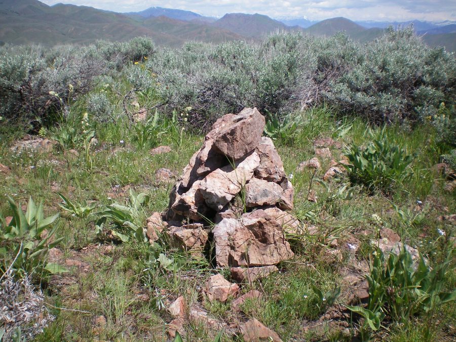
The summit cairn atop Gilman Hill. Livingston Douglas
West Face, Class 2
Access
Same as for the east face
The Descent
From the summit, descend down a face of thick sagebrush (lots of weaving required) to a gentle area just below, and south of, Saddle 5608. This saddle sits at the head of the West Fork Rock Creek drainage. There is a large home just north of the saddle and a cattle fence at the saddle. This is the base of the west face and northwest ridge of Peak 6186. This is the first leg of a ridge traverse from Gilman Hill to Peak 6492.
Northwest Ridge, Class 2
Access
Same as for the east face. This climb is the final leg of a ridge traverse from Peak 6492 to Gilman Hill then back to Rock Creek Road. This route is an alternative to the west face.
The Climb
From just south of Saddle 5608, scramble east up through thick sagebrush to reach Point 6006 on the northeast ridge of Peak 6186. From that point, follow the ridge southeast to the summit. This ridge has a lot of thick sagebrush to bash through in order to reach the summit.
Additional Resources
Regions: Smoky Mountains->WESTERN IDAHO
Mountain Range: Smoky Mountains
Longitude: -114.38759 Latitude: 43.45349