Elevation: 6,190 ft
Prominence: 330
This peak is not in the book. Published December 2019
Peak 6190 is at the north end of a long ridge that follows the right/east side of Long Canyon, just south of Fish Creek Reservoir. Peak 6190 probably offers the single best view of Fish Creek Reservoir of any of the peaks in this area, particularly of the dam itself. Other than that, it’s just another scrub hill that barely meets the requirements to be a ranked summit. USGS Fish Creek Reservoir
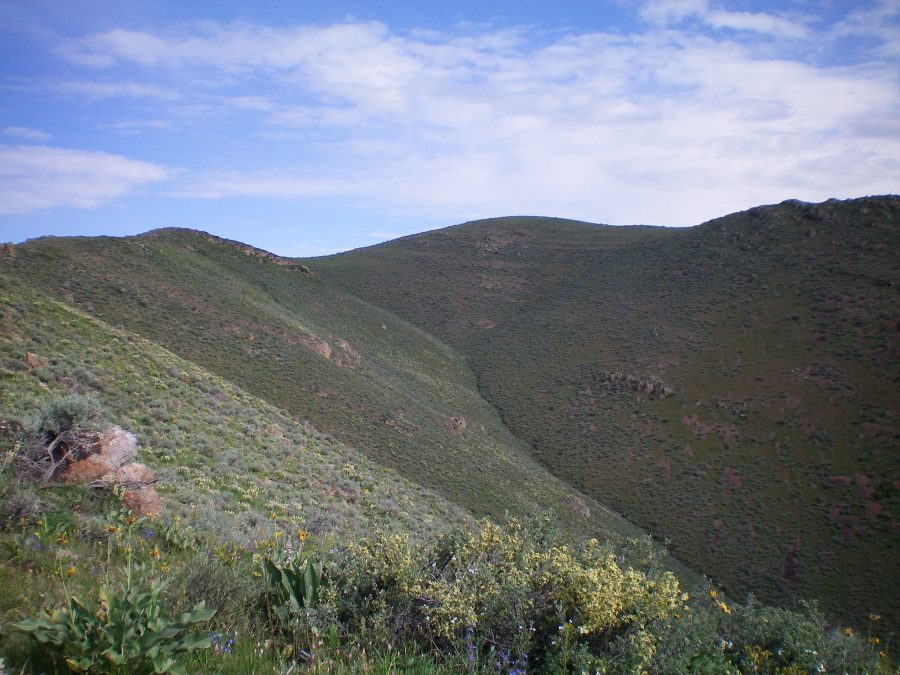
Peak 6190 (center hump) as viewed from the lower part of the southeast ridge. The upper southeast ridge is the left skyline. Livingston Douglas
Southeast Ridge, Class 2
Access
Fish Creek Road is located along US-20. It is 17.2 miles west of the entrance to Craters of the Moon National Monument and 25.4 miles east of the junction of US-20/ID-75. The junction is signed. Reset your odometer at the base of Fish Creek Road at US-20. At 2.9 miles, the road crosses to the right/east side of Fish Creek. Just before the creek crossing, there is an unsigned road junction with a 2-track jeep road heading left/west. Park in a pullout area near a cattle fence/gate at the base of the 2-track jeep road. The elevation here is 5,121 feet.
The Climb
From Fish Creek Road, hike west along the 2-track jeep road (public access through private land) for about 0.4 miles to an unsigned road junction. Go left/west here on a jeep road that is heading toward the large gulch that separates Peak 6190 and Peak 6014. This road climbs all the way up to a saddle on the ridge that connects the two aforementioned peaks. Let’s call this the “Gulch Road.” Follow the Gulch Road west for about 0.2 miles to reach the base of the southeast ridge of Peak 6190.
Leave the road and scramble up through sagebrush/scrub to reach Point 5450. Follow the ridge on easy, open scrub and talus/scree west then northwest then north to the unimpressive hump that is the summit of Peak 6190. There is a modest cairn on the summit high point, thanks to my hard work. Not much loose talus up here. The view of Fish Creek Reservoir is stunning.
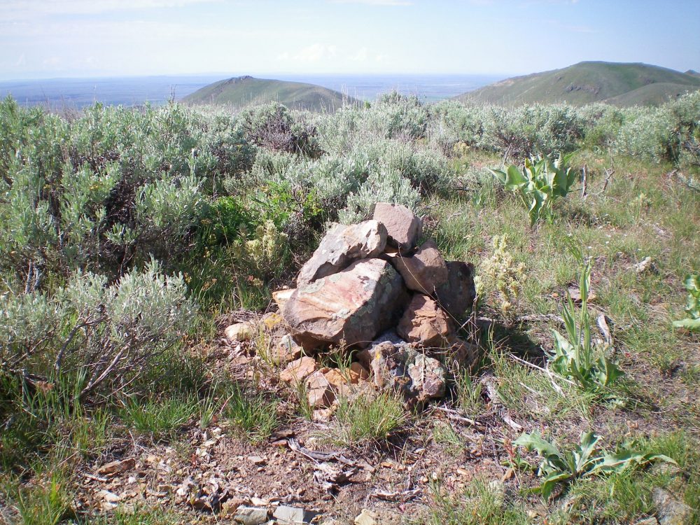
The newly-enhanced summit cairn atop Peak 6190. Livingston Douglas Photo
South Ridge, Class 2
Access
Same as for the southeast ridge. This route is the first leg of a ridge traverse from Peak 6190 to Peak 6041.
The Descent
The ridge traverse from Peak 6190 to Peak 6041 is not fun. The first leg of this ridge is not well defined and includes two crossings of sagebrush-clogged gullies, so be prepared. From the summit, descend the ridge in easy, open terrain south then southwest to reach rocky Point 6046. Skirt this point on either its east side (bad choice) or its west side (better choice) in thick sage/brush and loose scree to cross a gully and reach the next section of “ridge.” The terrain is significantly easier once you regain the “ridge.” Pass the top of a second gully and continue south, dropping 110 vertical feet to reach a final minor gully near Point 5731. This is the low point/saddle between Peak 6190 and Peak 6041.
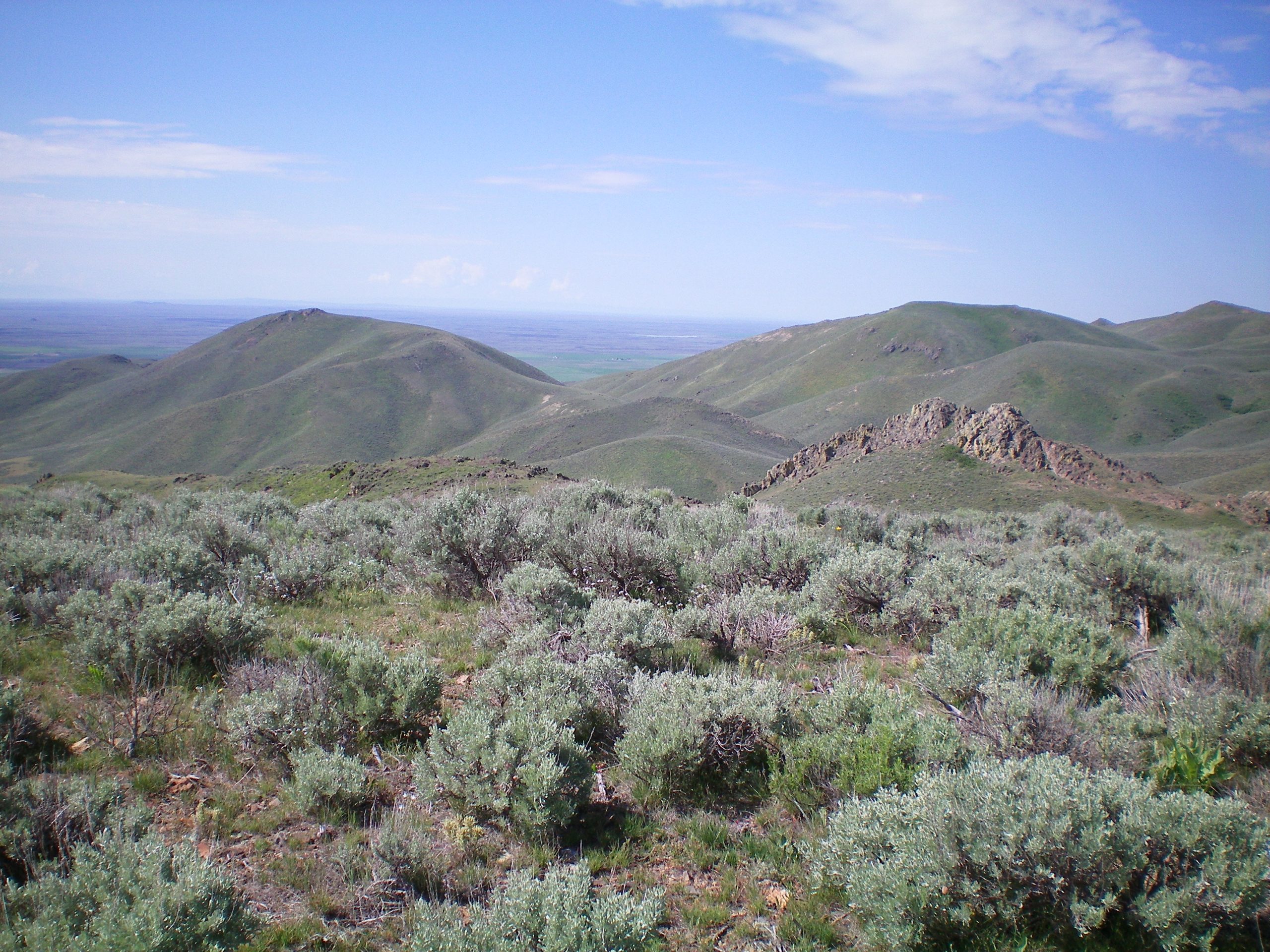
Rocky Point 6046 (right of center) as viewed from the summit of Peak 6190. Livingston Douglas Photo
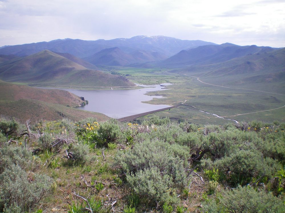
Fish Creek Reservoir as viewed from the summit of Peak 6190. Livingston Douglas Photo
Additional Resources
Regions: EASTERN IDAHO->Pioneer Mountains
Mountain Range: Pioneer Mountains
Longitude: -113.84559 Latitude: 43.41539