Elevation: 6,230 ft
Prominence: 370
This peak is not in the book. Published November 2020
Peak 6230 is a small rock-and-forest hump situated on the north side of Twomile Canyon, southeast of Malad City. It is overshadowed by its neighbor to the south, Peak 7020. The easiest access to Peak 6230 is via a large parking pullout along Twomile Canyon Road at the base of the southeast side of the peak. Please be advised that there is a lot more rock, cliff bands, and rocky buttresses on Peak 6230 than is visible, thanks to a thick cover of forest. Peak 6230 is not a simple walk-up. It gets dangerously steep in numerous spots and requires care in scrambling up or down it. USGS Malad City East
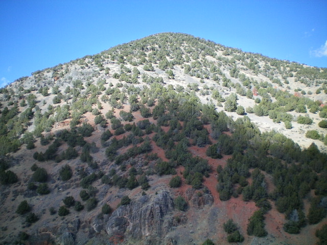
Peak 6230 as viewed from the south. The south ridge is surprisingly rocky. Livingston Douglas Photo
Access
From the Maverik Gas Station at Exit 13 off I-15 at Malad City, drive south on [signed] 3rd East for 1.5 miles to an unsigned road junction. Turn left/east onto [unsigned] Twomile Canyon Road. Drive 2.7 miles east on Twomile Canyon Road to a large, flat open area with a large pullout parking/camping area on the left/north side of the road. Park here (5,330 feet). Please be advised that this open area is also used for target practice by locals.
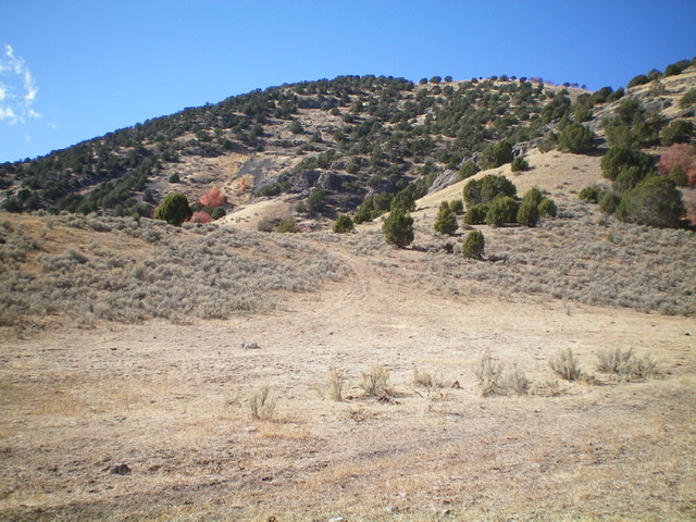
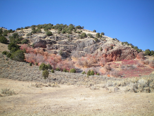
The east face (dead center) and south ridge (left skyline) of Peak 6230 as viewed from the parking area. Livingston Douglas Photo
East Face/South Ridge, Class 3
The Climb
From the parking area, bushwhack west diagonally right and upward to skirt the left side of the imposing southeast shoulder. Cross a dry gully and reach a face section. Bushwhack diagonally left up across a thick, small, forested gully to reach the east face. Climb straight up the slope to reach the south ridge. This is a BRUTAL bushwhack through dense forest, thick brush, and loose scree/gravel on a steep slope. The south ridge is not as brutal but is no picnic.
The south ridge is steep. It is a combination of pines, cliff bands/ledges, rocky outcrops/buttresses, sections of loose scree/gravel, and brush. Higher up, the slope eases and the terrain becomes quite easy. The summit cap is open terrain of field grass, sagebrush, and other brush. Bushwhack north then northeast to reach the elusive high point at the northeast corner of the summit cap. I rebuilt the torn-down summit cairn.
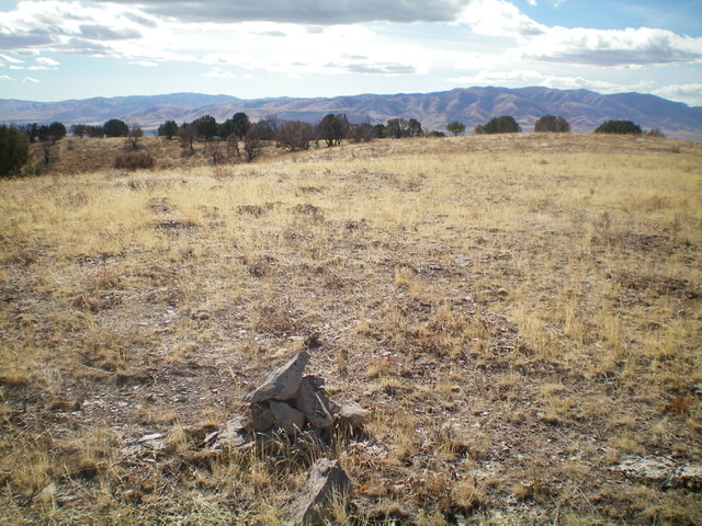
The flat, gentle summit of Peak 6230. Livingston Douglas Photo
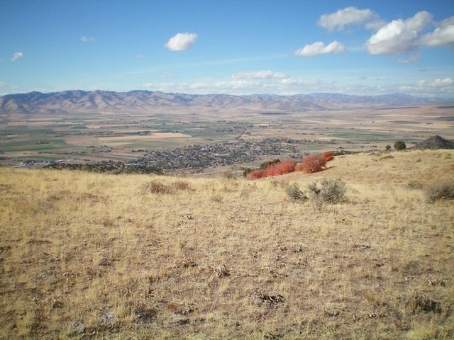
Malad City as viewed from the summit of Peak 6230. Livingston Douglas Photo
The rugged lower section of the southeast shoulder of Peak 6230. Avoid the impassable cliffs by veering to the north side of the shoulder. Livingston Douglas Photo
Southeast Shoulder, Class 3
The Descent
I sure as heck was not going to descend the awful east face/south ridge. The USGS topo map makes the southeast shoulder look doable if you stay clear of (i.e., north of) the cliffs lower down on the shoulder. And that is true. From the summit, cruise down the upper section of the southeast shoulder in open, easy scrub down to a flat ridge area with a forested gully on its left/north side. The gully looks like a thick mess, so avoid it. The next 250 vertical feet is the crux.
Descend east through STEEP face rock and buttresses, using ledges and narrow gullies/cracks as necessary, to reach the flatter ground below. When in doubt, move left/north to find workable downclimbs. Once at the base of the steep section, cruise southeast then south through the brush back to your parked vehicle.
Additional Resources
Regions: Malad Range->SOUTHERN IDAHO
Mountain Range: Bannock Range
Longitude: -112.20201 Latitude: 42.18039