Elevation: 6,232 ft
Prominence: 492
This peak is not in the book. Published November 2023
Peak 6232 is the northernmost peak in the Pahsimeroi Range. It is a rugged, rocky affair that sits above the Salmon River a few miles south of Ellis. Peak 6232 is most easily climbed via a gully on its southwest side. USGS Ellis
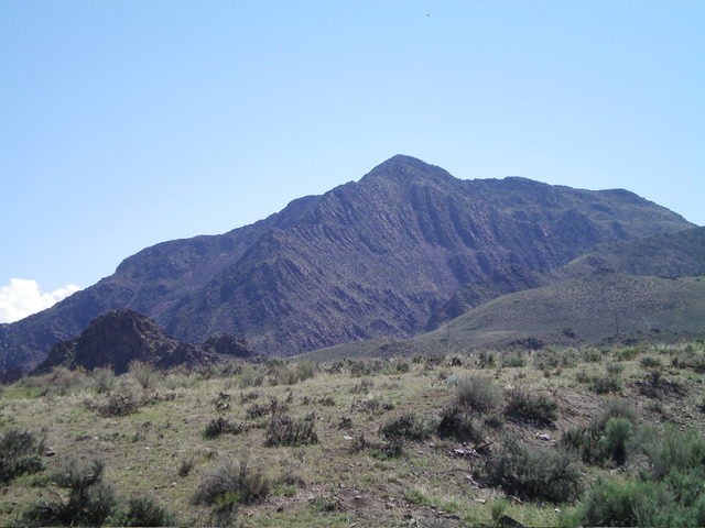
Peak 6232 as viewed from the west. Livingston Douglas Photo
Access
Park in a pullout along US-93 that is 3.7 miles south of Ellis and is about 150 yards south of MM260. This pullout is close to the Salmon River and sits just south of the final cliffs on the west side of Peak 6232. The pullout is at 4,700 feet and 44⁰38’52”N, 114⁰05’21”W.
This area is a mix of private land and BLM land, so be careful. This climb is entirely on BLM land. Please note that LOJ’s land management map shows BLM land extending north to cover a second gully (and shoulder) that is north of the gully that I climbed from US-93. That land is fenced (but not posted) and belongs to a ranch that is located 0.4 miles north on US-93 from the pullout. Avoid it.
North Gully/North Ridge, Class 3
The Climb
From the pullout, walk about 200 feet north on US-93 to reach a narrow gully that is on the right/east side of the highway, just left/north of the rocky cliffs of Peak 6232. The mouth of this gully is about 100 feet south of MM260. Leave the highway and bushwhack southeast up the narrow, but easy, dry gully in gapped sagebrush and field grass, crossing an old cattle fence near the highway. Reach the head of the gully as it tops out on the crest of a shoulder/ridge coming up from the left/northwest. This shoulder leads up to the north ridge proper.
Scramble right/southwest up the crest of the shoulder (somewhat diagonally), skirting just past the steep, loose talus of the east face of the north ridge proper and skirting just past a cliff band. Bushwhack up steep sagebrush with a loose scree/gravel base, avoiding sections of steep, loose talus/scree. Reach the crest of the north ridge at about 5,800 feet, where there is a cairn-like rocky outcrop on the ridge. The prospects from here upward look rather ominous—a very rocky, choppy ridge that is narrow and is clogged with sagebrush.
Climb up the obvious ridge, moving slightly off the ridge crest as necessary to make progress. This is tedious, unending Class 3 work. High up, the slope eases and the ridge widens. The final push to the summit goes at Class 2. The boulders on the ridge crest are covered with lichen and are very slipper if wet. The small, rocky summit has a summit cairn that shows signs that birds of prey use it as a launching point for their flights. Not surprisingly, the summit view of the Salmon River is stunning. The USGS topo map makes the north ridge look much easier than it actually is. The ridges on Peak 6232 are narrow, rocky, and tedious. The gullies and faces, though steep, are much easier to climb.
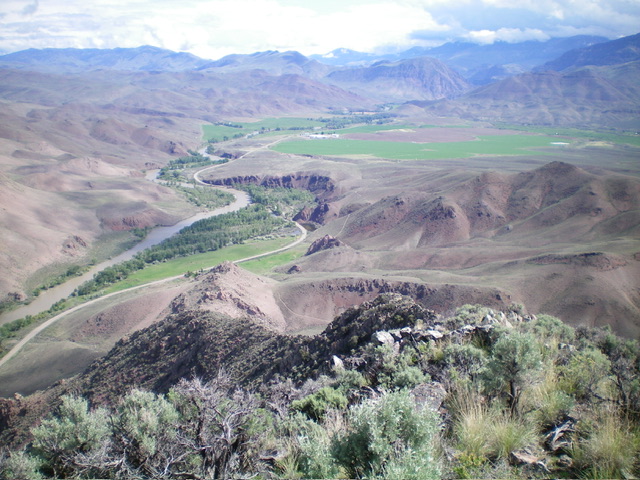
View of the Salmon River Valley (looking north) from the summit of Peak 6232. The north ridge is in the foreground and heads diagonally downward and left. Livingston Douglas Photo
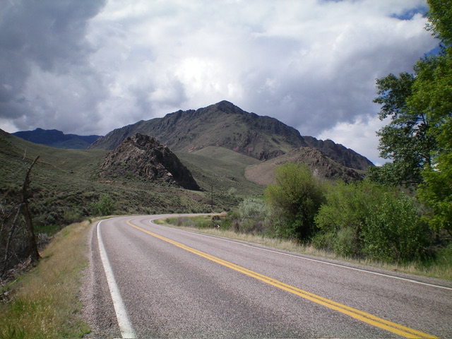
Peak 6232 (dead center) as viewed from US-93 to its north. Livingston Douglas Photo
Additional Resources
Regions: EASTERN IDAHO->Lost River Range->Pahsimeroi Range
Mountain Range: Lost River Range
First Ascent Information:
- Other First Ascent: North Gully/North Ridge
- Year: 2023
- Season: Summer
- Party: Livingston Douglas
Longitude: -114.0872 Latitude: 44.6397