Elevation: 6,260 ft
Prominence: 360
This peak is not in the book. Published November 2022
Peak 6260 is a rather unimpressive hump that is located east of Campbell Flats on the east side of the Little Wood River Reservoir. Thanks to ACCESS YES, this peak is accessible since a short section of private land must be crossed in order to reach the public land that comprises much of the higher land east of, and above, Campbell Flats. USGS Lake Hills
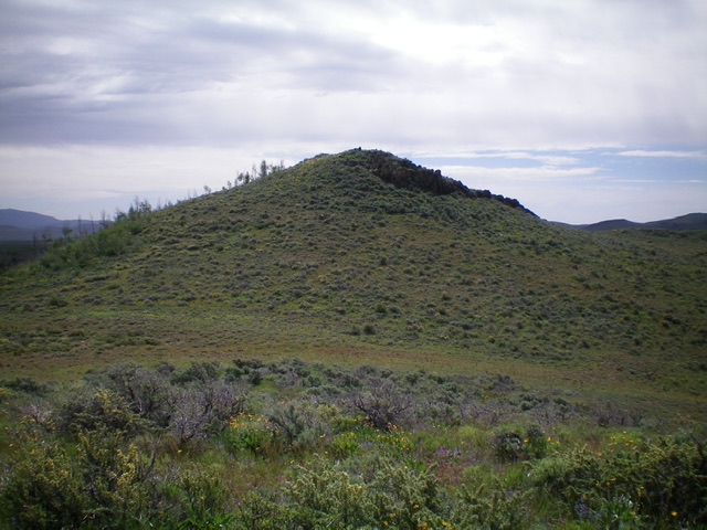
The elusive summit hump of Peak 6260. Livingston Douglas Photo
Access
Park along Little Wood River Reservoir Road at an unsigned junction with a 2-track road that heads east. Park at a fence gate where there is an ACCESS YES sign (5,321 feet). GPS coordinates: 43⁰26’55”N, 114⁰01’40”W. This unsigned junction is located exactly 1.3 miles north of the turnoff for the Little Wood River Reservoir Campground. Use this link—ACCESS YES—to read about the ACCESS YES program and to learn the terms governing use of this access point.
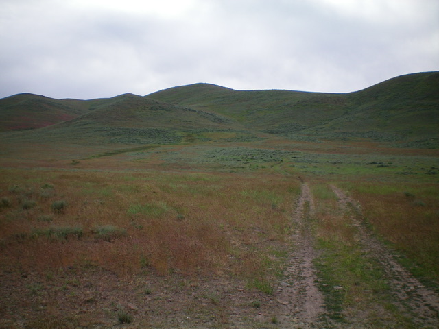
Peak 6260 as viewed from the west. The summit hump sits behind the high hump left of center. Livingston Douglas Photo
West Face/Southwest Spur/West Ridge, Class 2
The Climb
From the base of the 2-track road, walk east on the 2-track road through a cattle pasture. The road heads directly at the southwest spur of the west ridge of Peak 6260. The summit sits well back from the ridge and is not visible from here. The road reaches public land after only 1/8 mile or so of hiking from the base of the road. The 2-track road makes a sharp left/north turn after beginning its climb out of the flat cattle meadow to ascend a dry gully.
Leave the 2-track road here and bushwhack southeast through sagebrush to reach the crest of the southwest spur somewhere northeast of Point 5761. Once on the ridge crest, follow the ridge northeast then east, with a few ridge humps to either climb or skirt, to cross the head of a major gully. Continue east over two more ridge humps to finally reach the rocky summit of Peak 6260. A final scramble up talus/boulders (with sagebrush mixed in) puts you atop the cairned summit.
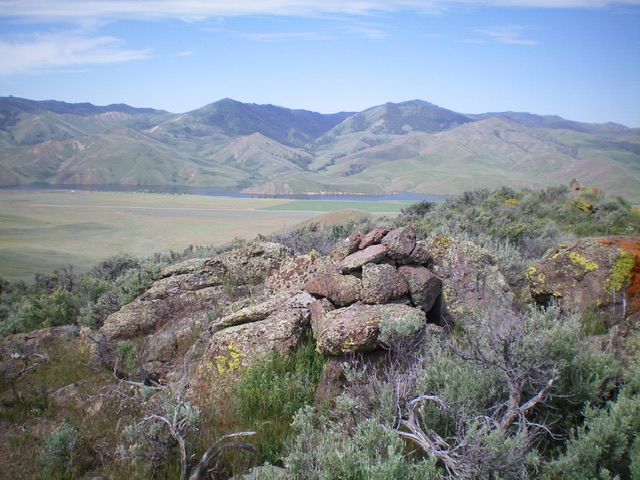
The summit cairn atop Peak 6260 with Little Wood River Reservoir in the distance. Livingston Douglas Photo
Additional Resources
Regions: EASTERN IDAHO->Pioneer Mountains
Mountain Range: Pioneer Mountains
Longitude: -113.99389 Latitude: 43.45189