Elevation: 6,273 ft
Prominence: 533
This peak is not in the book. Published October 2025
Peak 6273 sits at the headwaters of Corral Creek in the Boise Mountains. It is most easily climbed from a MC trail that comes up the Corral Creek drainage. USGS Twin Springs
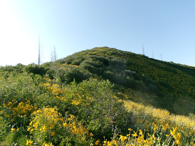
Peak 6273 as viewed from high on the west shoulder. This was my ascent route. Livingston Douglas Photo
Access
The Corral Creek trailhead is located along FSR-213 but is about 0.6 miles east of Corral Creek. Aggressively posted private property blocks access directly from the mouth of Corral Creek along FSR-213 and there are no parking pullouts there anyway. The Corral Creek trailhead is at 3,735 feet and 43°35’22.4”N, 115°41’58.7”W.
Map Updates
The USGS topo map fails to show the foot/MC trail from the actual Corral Creek trailhead heading west over to the Corral Creek drainage.
West Shoulder, Class 2
The Climb
From the Corral Creek trailhead, cross a cattle fence and hike west on the narrow foot trail for about 0.6 miles to reach a junction with the Corral Creek trail alongside Corral Creek. This connecting trail crosses a few shoulders and dry gullies to reach [small] Corral Creek. Cross the creek on rocks/boulders or tree logs to reach a “T” junction with the much better, wider Corral Creek Trail. Follow this sometimes narrow, sometimes rocky MC trail up Corral Creek for about 3-3/4 miles. Find an open, easy spot to cross the creek and reach a viable (not too brushy) access point to head east toward the summit.
Scramble east-southeast up steep but reasonable veg and brush to reach a ridgeline heading right-ish/southeast. Stay just left/north of a dry gully. Once on the high ridge, scramble southeast up this veg-and-brush ridge (which gets difficult and thick in sections) to reach a higher ridge that heads right-ish/south to the summit. This final ridge section has a few thick spots. Stay near the ridge crest for the easiest going and look for any game trails to get through the thick willows. The summit has multiple rocky boulders vying for the high point designation, so stand on them all. The ½-mile bushwhack/climb gains 1,000 vertical feet and is difficult in spots—not a picnic, but do-able with perseverance. The summit is mostly open and free of brush
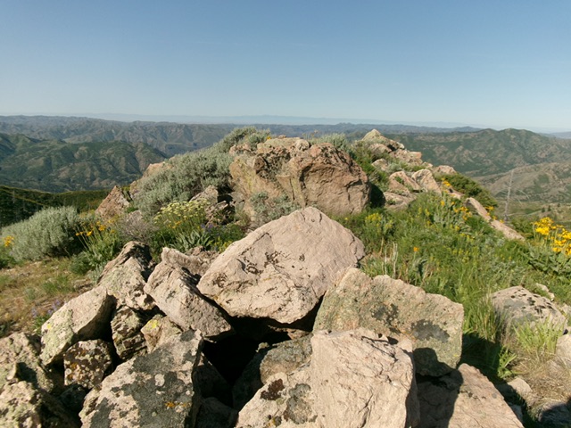
The summit boulders atop Peak 6273. Livingston Douglas Photo
Additional Resources
Regions: Boise Mountains->WESTERN IDAHO
Mountain Range: Boise Mountains
Longitude: -115.6686 Latitude: 43.6279