Elevation: 6,331 ft
Prominence: 351
This peak is not in the book. Published December 2019
Peak 6331 is one of a trio of ranked summits that form a horseshoe around an unnamed drainage/meadow just north of Fish Creek Reservoir. The ridge traverse between these three peaks (Peak 6331, Peak 6326, and Peak 6390) is my favorite ridge traverse in the Fish Creek Reservoir area. It is magnificent and offers stunning views of the reservoir and the surrounding peaks and valleys. You are likely to see black-tailed deer in this area. Fish Creek Reservoir
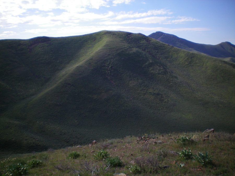
The western aspects of Peak 6331 as viewed from high on Peak 6390. The summit of Peak 6331 is the highest bump just left of center, at the top of the north shoulder. Livingston Douglas Photo
West Ridge, Class 2
Access
From US-20, drive north up Fish Creek Road for 5.5 miles to a junction signed for the “Boat Ramp.” This is West Fork Fish Creek Road. West Fork Fish Creek Road is a curvy, narrow dirt road with some blind curves, so be very careful when driving it. Turn left/west onto West Fork Fish Creek Road and drive 2.7 miles to a meadow with an unsigned road junction and a gated cattle fence on the left/west side of the road. This is the old Stinson Canyon Road. Park in a large parking/pullout area near the gate. The elevation here is 5,350 feet.
The Climb
From the parking area, cross to the east side of West Fork Fish Creek Road. Bushwhack southeast across a meadow of sagebrush and tall field grass to reach the toe of the west ridge. Scramble southeast then east up the ridge to the summit. The vegetation thins out as you go higher and isn’t too bad once you leave the meadow. This route gets steep at points and the underlying scree base gets a bit loose. The summit has a cairn and a splendid view of Fish Creek Reservoir.
Northeast Ridge, Class 2
Access
Same as for the west ridge. This is the first leg of a ridge traverse between Peak 6331 and Peak 6326.
The Descent
From the summit, follow the undulating, curving ridge crest northeast on easy, open terrain (short scrub/grass and broken scree). The ridge jogs to the left/north to make its final descent to a 6,020-foot saddle on the east side of Peak 6326. The ridge goes up over a few ridge humps and down to a few saddles to reach this final saddle. This is the base of the northeast ridge.
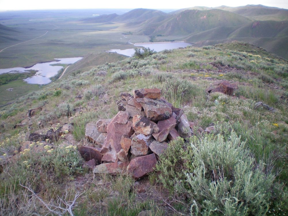
The summit cairn atop Peak 6331 looking south toward Fish Creek Reservoir. Livingston Douglas Photo
Additional Resources
Regions: EASTERN IDAHO->Pioneer Mountains
Mountain Range: Pioneer Mountains
Longitude: -113.81429 Latitude: 43.44389