Elevation: 6,358 ft
Prominence: 298
This peak is not in the book. Published November 2020
Peak 6358 sits above the Mink Creek drainage and the Bannock Highway. It is overshadowed by its much-higher neighbors, Scout Mountain (to the east) and Slate Mountain (to the west). However, it is still a worthy peak (only two feet shy of being a ranked summit) and makes for a nice scramble from the Bannock Highway. USGS Clifton Creek
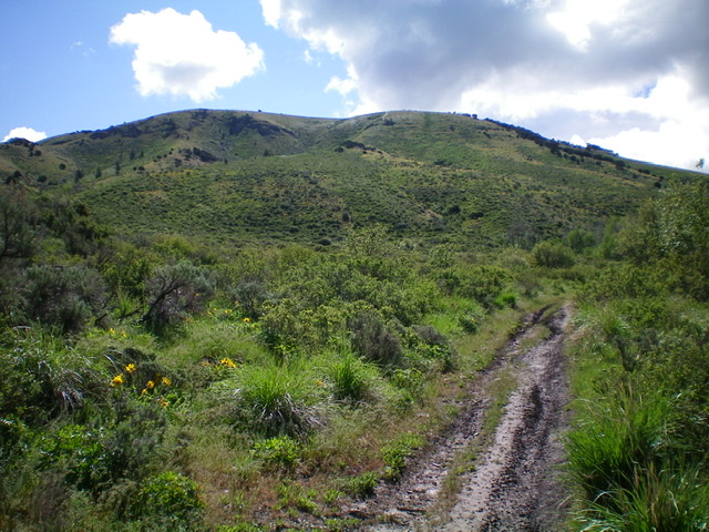
Peak 6358 as viewed from low on the Valvehouse Trail. The summit is just right of center and the west shoulder is a bit farther to the right. Livingston Douglas Photo
Access
From the junction of Portneuf Road and the Bannock Highway, drive south on the Bannock Highway for 6.3 miles to the [signed] Valvehouse Trailhead (FST-058) on the left/east side of the highway. Park here (5,190 feet).
West Shoulder, Class 2
The Climb
From the Valvehouse Trailhead, hike briefly up the Valvehouse Trail/FST-058 (an ATV trail) to a flat area where the trail bends sharply right/south. Leave the trail here and climb steeply up a slope to the crest of the west shoulder. Aim for a prominent clump of junipers visible from the trail. Scramble east-southeast up the open shoulder, through reasonable sagebrush with a few scattered junipers, to reach a final, steeper section of short scrub and a ridge point southwest of the summit. From this point, follow the ridge northeast to the bare summit of Peak 6358.
Northwest Ridge/West Face, Class 2
The Descent
For a little flavor, descend a different ridge back to the Bannock Highway. Try this one. From the summit of Peak 6358, descend northwest to soon find the beautiful (and obvious) northwest ridge. Follow the ridge down to a flattish area and see a small meadow to the left (where an old road used to be). Leave the ridge and descend the west face to the green meadow, finding a fence row that leads you there laterally on a nice grassy foot path.
Follow the fence row (and the open, grassy path/old road) west as it heads down toward the Bannock Highway. The fence jogs right/north at one point lower down and then jogs left/south to parallel the highway. Cross the fence row here and bushwhack a short distance down to the highway just north of its bridge crossing of Mink Creek. This bushwhack is short but is somewhat thick with brush. Walk south along the Bannock Highway a short distance to return to the Valvehouse Trailhead.
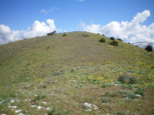
This gentle hump is the summit of Peak 6358. Livingston Douglas Photo
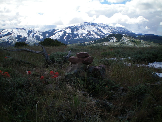
The summit cairn atop Peak 6358 with the snow-clad Bannock Range in the distance. Livingston Douglas Photo
Additional Resources
Regions: Bannock Range->SOUTHERN IDAHO
Mountain Range: Bannock Range
Longitude: -112.40239 Latitude: 42.72109