Elevation: 6,362 ft
Prominence: 342
This peak is not in the book. Published November 2022
Peak 6362 is located just northwest of Hailey. It is a modest sagebrush hump that separates Lambs Gulch from Democrat Gulch. This area is a mix of private and public land, so be careful. The Lambs Gulch Trail and much of the east side of Peak 6362 are on private land. Please obtain permission from the landowner before undertaking this climb. It is convenient to climb Peak 6362 in combination with nearby Peak 7130. USGS Hailey
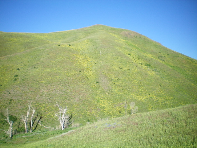
Peak 6362 and its east face. Livingston Douglas Photo
Access
From ID-75 in downtown Hailey, turn left/southwest onto Bullion Street (which becomes Croy Creek Road) and drive about 1.5 miles to a signed junction with Democrat Gulch Road. Turn right/west onto Democrat Gulch Road and drive 0.9 miles to a pullout at the unsigned trailhead for the Lambs Gulch Trail. Please note that there is no jeep road heading up Lambs Gulch as the USGS topo map indicates. It is merely a foot trail with no remnants of a road. Park at the trailhead (5,505 feet).
East Shoulder, Class 2
The Climb
From the trailhead parking area, hike north up the Lambs Gulch Trail for about a mile to reach the base of the [obvious] southwest ridge of Peak 7130. The ridge is just past a prominent dry gully that heads right/northeast from Lambs Gulch. Leave the trail here and bushwhack west up a steep face of loose scree/gravel and scrub to reach the crest of the east shoulder of Peak 6362. Follow the crest of the open shoulder northwest then west on easy scrub to reach the small summit of Peak 6362. The summit has a small cairn.
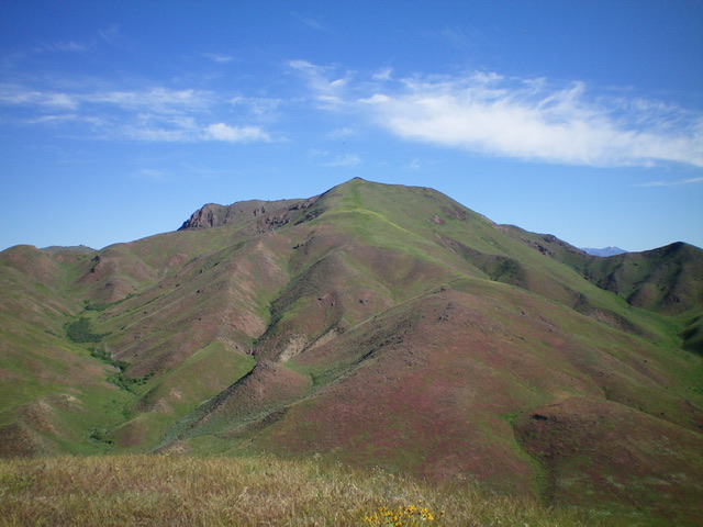
The summit of Peak 6362 with the Croy Creek Valley in the distance. Livingston Douglas Photo
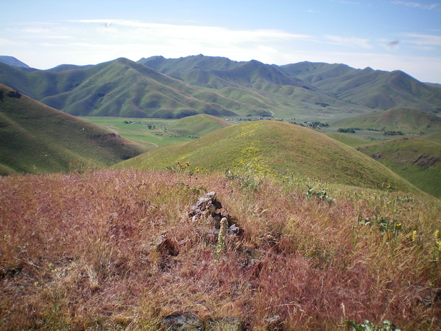
View of Peak 7254 from Peak 6362 to its south. Livingston Douglas Photo
Southeast Shoulder, Class 2
The Descent
From the summit, descend south briefly on the open ridge then head left-ish/southeast down the southeast shoulder. The terrain on this shoulder is easy scrub and it is a gentler grade than the east shoulder route. This shoulder leads directly down to the Lambs Gulch Trail just north of a side gully. A quick 0.6-mile hike down the trail returns you to the Lambs Gulch Trailhead and your parked vehicle. The southeast shoulder is a much more enjoyable (and more direct) route than the steeper, looser east shoulder route. However, if you climb Peak 6362 in combination with Peak 7130, then the east shoulder is a more convenient ascent route after you have climbed Peak 7130 from Lambs Gulch.
Additional Resources
Regions: Smoky Mountains->WESTERN IDAHO
Mountain Range: Smoky Mountains
Longitude: -114.37289 Latitude: 43.52141