Elevation: 6,378 ft
Prominence: 368
This peak is not in the book. Published November 2023
Peak 6378 is one of a pair of sagebrush hills located on the west side of Custer Road in the northern section of the Pahsimeroi Range. It is an easy scramble from a 2-track road on its east side. USGS May
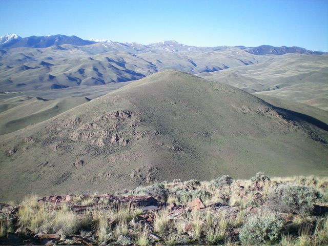
Peak 6378 (in mid-ground) as viewed from Peak 6419 to its north. Livingston Douglas Photo
Access
Park at the base of an unsigned 2-track road that is located along Custer Road at 5,016 feet (map). The pullout/parking area on the 2-track road is at 5,030 feet and 44⁰34’31”N, 113⁰57’19”W. The road junction is located 2.8 miles south of the signed junction of Custer Road and Dowton Lane. The junction is about 7 miles southeast of US-93 on Custer Road and is 11.9 miles north of the signed junction with Doublespring Road.
East Ridge, Class 2
The Climb
From the parking area near the base of the 2-track road, hike about ½ mile south up the 2-track road. Leave the road and bushwhack right/southwest across easy sagebrush to reach the mouth of the dry gully that separates Peak 6378 from Peak 6419. Hike briefly up the gully then leave it to scramble left/south up onto the east ridge of Peak 6378. Reach the ridge crest just past rocky Point 5541. Follow the ridge crest west then south (high up) to reach the cairned summit. The east ridge is a mix of grass and sagebrush and has a good rock/gravel base. There are no rocky outcrops to navigate. The final push to the summit is southward over a false summit.
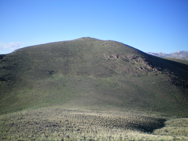
Peak 6378 (summit is right of center) and its east ridge (skyline in center) with Point 5541 at far left. The east ridge was my ascent route. Livingston Douglas Photo
North Face, Class 2
The Descent
From the summit, descend north down an easy sagebrush face to quickly reach the 6,010-foot connecting saddle with Peak 6419. This concludes the first leg of today’s 2-peak adventure. Peak 6419 is up next.
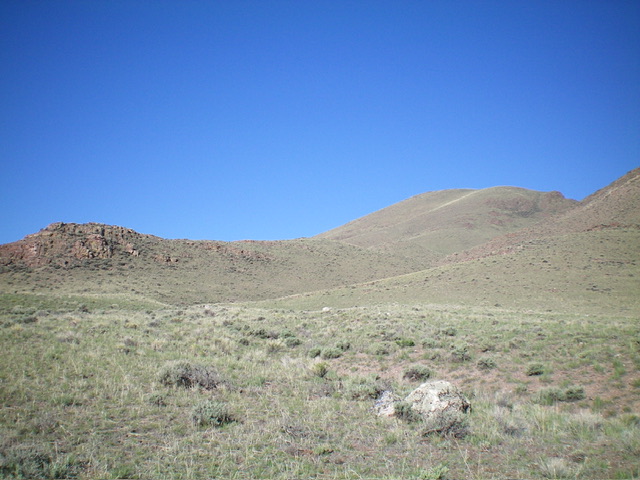
Peak 6378 and its north face (my descent route) as viewed from the north. Livingston Douglas Photo
Additional Resources
Regions: EASTERN IDAHO->Lost River Range->Pahsimeroi Range
Mountain Range: Lost River Range
Longitude: -113.9793 Latitude: 44.5613