Elevation: 6,390 ft
Prominence: 330
This peak is not in the book. Published January 2023
Peak 6390 is a minor hump located on the east side of the Cotterel Mountains and northwest of Malta. It is most easily climbed via its east side from ID-81. This climb covers 5.5 miles with 1,750 feet of elevation gain round trip from the first cattle gate. USGS Nibbs Creek
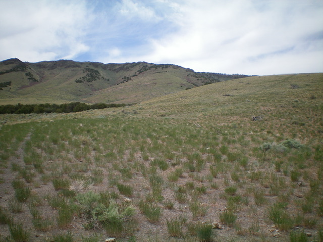
Peak 6390 as viewed from Cattle Gate #2. Livingston Douglas Photo
Access
From the junction of ID-77 and ID-81 on the north side of Malta, drive north on ID-81 for 2.4 miles to a signed junction with 1250S Road. Turn left/west onto 1250S Road and drive 0.6 miles to an unsigned junction with a 2-track road heading diagonally right/northwest. Turn right and drive 1.3 miles up the 2-track road to reach an unsigned “T” junction with a decent north-south 2-track road. Turn right/north onto this road and drive 0.2 miles to an unsigned junction with a 2-track road. Turn left/west here and drive about 100 yards up that 2-track road and park at a cattle gate (4,685 feet). You may wish to continue west on the 2-track road for another 0.8 miles and park at a second cattle gate (5,000 feet).
East Ridge, Class 2
The Climb
From the first cattle gate, hike (or drive) west for 0.8 miles to the end of the road at a second cattle gate. The east ridge is obvious from this cattle gate and lies just right/north of the gate. Jump the cattle gate and scramble diagonally right/northwest up easy scrub to reach the broad east ridge in open scrub. Follow the broad, easy ridge west up through a patch of junipers on a cattle trail. The ridge bends right-ish/northwest and heads up a minor gully to reach the upper section of the east ridge, which is narrow and rocky. Scramble northwest up through a mix of ridge boulders, rocky outcrops, and junipers to reach the final westbound section of the ridge.
Follow the narrow ridge of rock and junipers to reach an open, flat, saddle-like area. The [lower] south summit (Point 6335) is to the left. The true summit is to the right/northwest and is obvious. It is clad with junipers unlike the openness of Point 6335. From the saddle-like area, head northwest and drop 30 feet to a saddle at the head of a large gully to the right/east. Climb northwest up through a somewhat-dense juniper forest to reach the summit plateau. The high point is located to the left/west on a juniper-clad hump. The actual high point is a massive boulder with a small cairn on top. The summit offers a nice view of the antenna-clad Cotterel Mountains HP to the west.
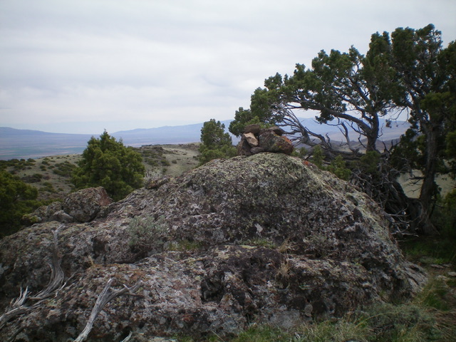
The summit of Peak 6390. Livingston Douglas Photo
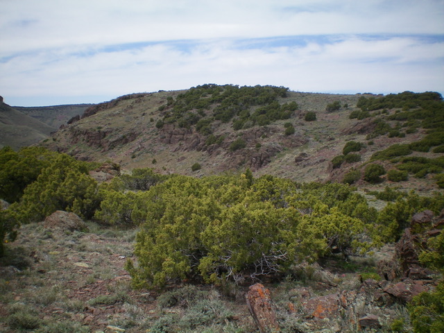
The summit plateau of Peak 6390 (mid-ground). The high point is at the left/west end. Livingston Douglas Photo
Additional Resources
Regions: Albion Range->Cotterel Mountains->SOUTHERN IDAHO
Mountain Range: Albion Range
Longitude: -113.43569 Latitude: 42.36629