Elevation: 6,428 ft
Prominence: 397
This peak is not in the book. Published 2017. Supplemented June 2018
Rabbit Peak is located roughly 6.0 miles east of Idaho City and north of Rabbit Creek. This is a section of the Boise Mountains that is crisscrossed by a lot of roads and ATV trails, some that show up on maps and some that don’t. These roads and trails provide good access to obscure ridges/peaks. They are perfect for hiking and, in some cases, for mountain biking. USGS Rabbit Creek Summit
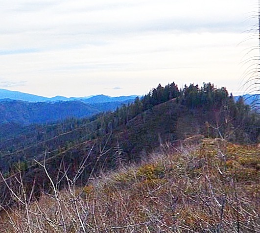
Rabbit Peak as seen from north of Rabbit Creek Road Summit. Erik Pohlmann photo.
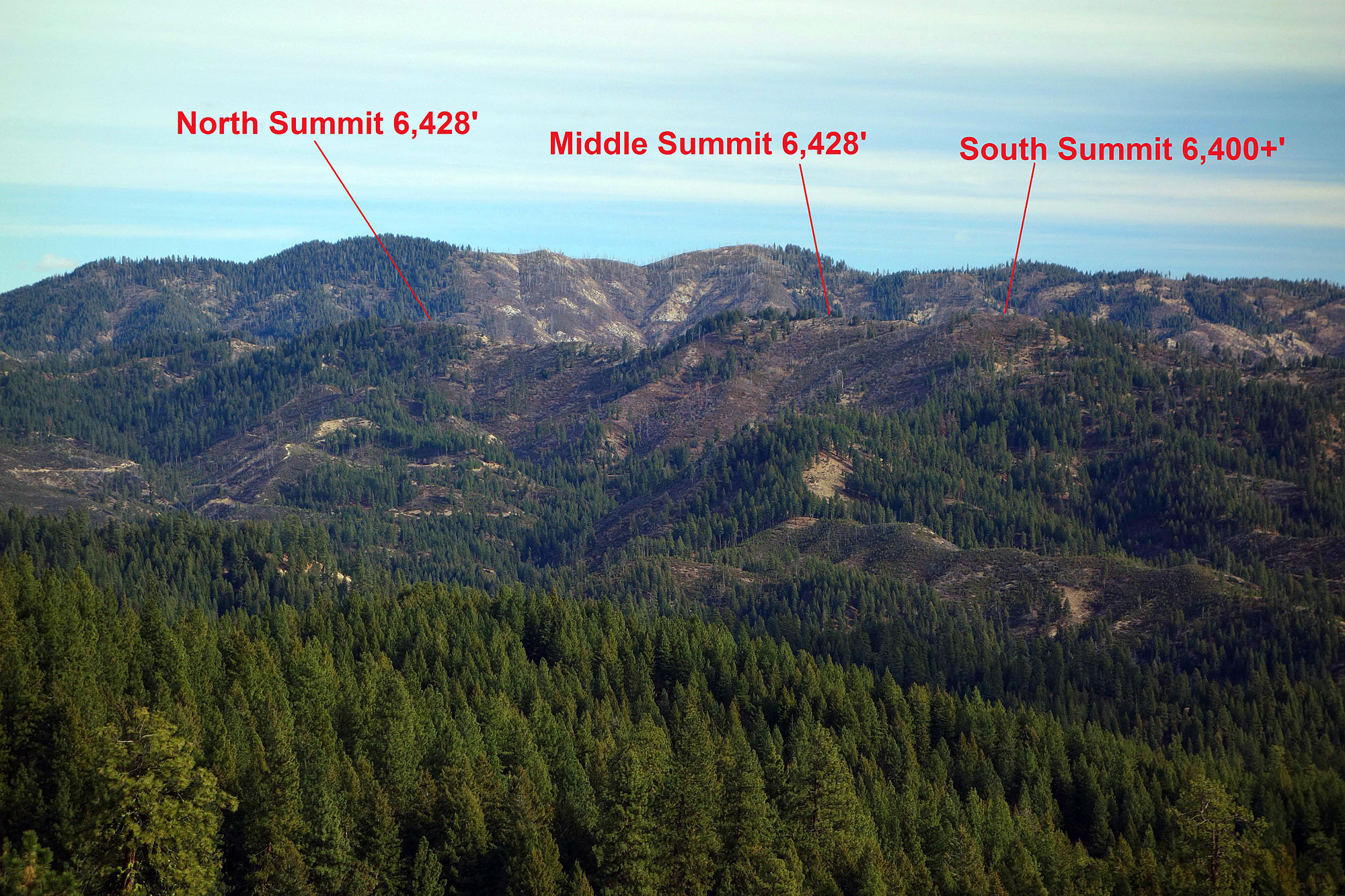
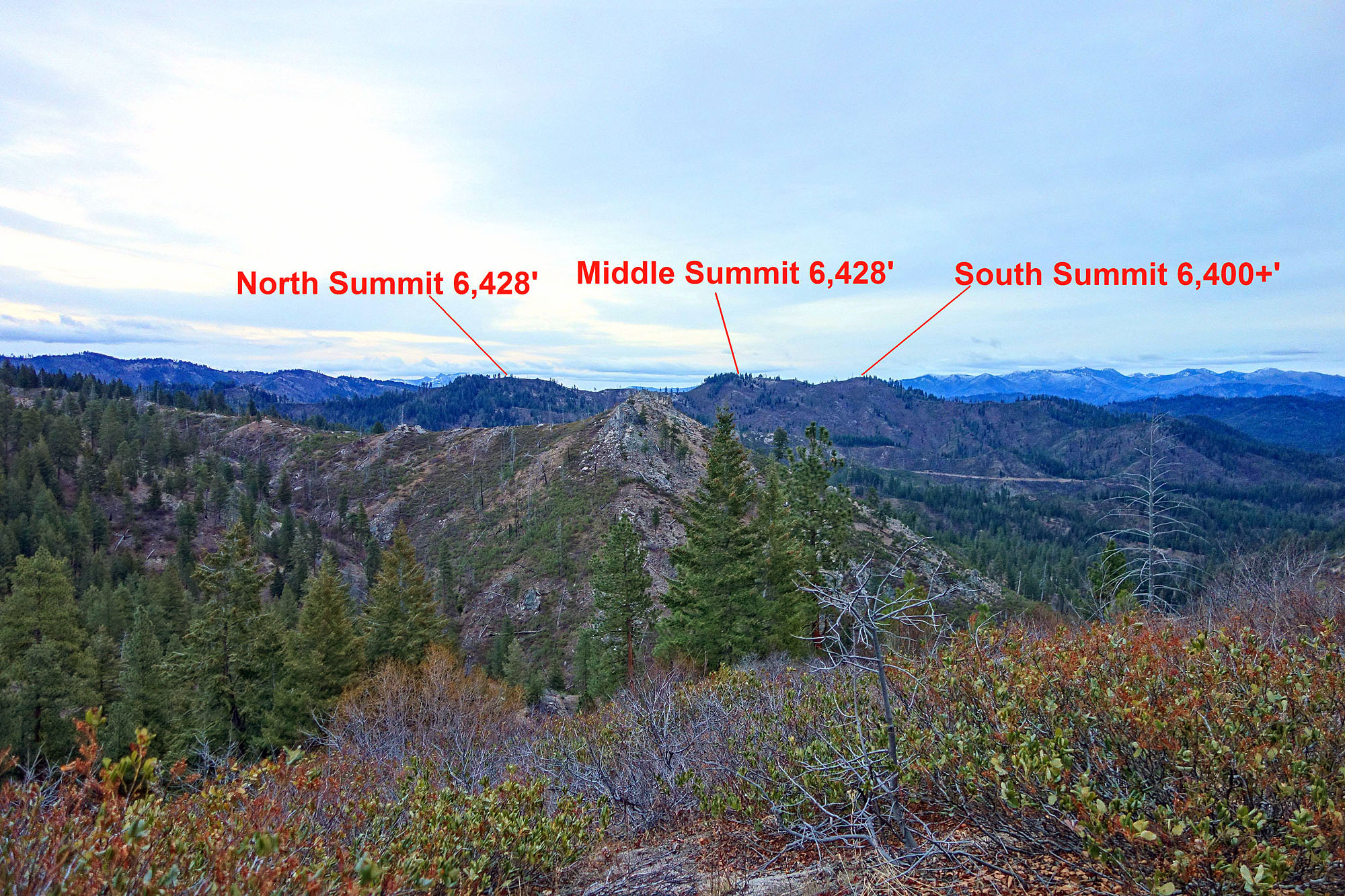
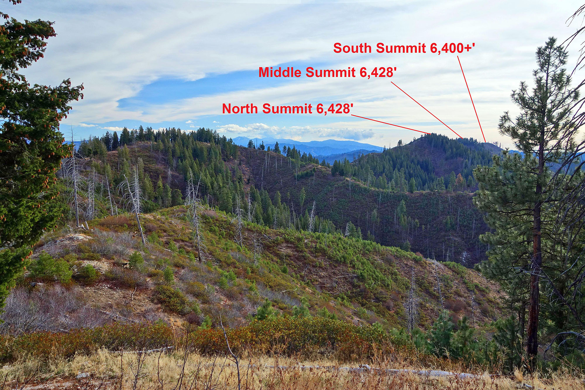
It is not clear which of this peak’s 3 highest summits is the true high point. The 2 North Points are surveyed at 6,428 feet, while the South Point is not surveyed and simply sits between the 6,400- and 6,440-foot contour lines on the topography map. This means peakbaggers must tag all 3 summits to reach the true high point, which makes for a great excuse to turn this hike into a desirable ridge walk. The ridge is quite prominent and quickly drops more than 1,000 feet on both sides.
Much of the forest has burned recently, allowing for expansive, continuous 30-mile views. The ridge is an especially good vantage point for the viewing the entire Rabbit Creek drainage and the Hungarian Ridge that towers to the north. Unfortunately, the fire damage also negatively impacts the scenery IMO, and much of the landscape now consists of brush. Fortunately, the area’s trails effectively navigate through the brush, keeping bushwhacking to a minimum.
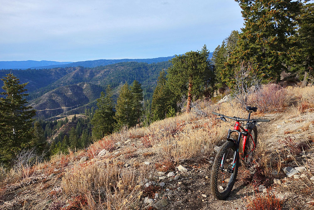
Note: It is possible to mountain bike to this peak, but be warned that the route will include a lot of hike-a-bike segments, so it may be best to save this peak for hiking. On that note, the area’s trails are designated for motorcycles, but in my experience it’s rare to run across or hear them so they don’t detract from the wilderness experience much…especially later in the season after cabin fever has subsided.
Access
To reach the peak, follow ID-21 east from Idaho City to the signed Granite Creek Road/FS-327. This road is well maintained and climbs up Granite Creek to Rabbit Creek Summit. From there, it descends Rabbit Creek to the North Fork Boise River. Follow FS-327 for approximately 10 miles to its intersection with the North Fork (NF) Rabbit Creek Road/FS-322.
Turn left/north and follow the NF Rabbit Creek Road for approximately 4 miles until the road turns left/west out of the drainage. At this point, you will see a parking area and the [signed] German Rabbit Overlook Motorcycle Trail/FST-294, which continues up the NF Rabbit Creek drainage. Park here. [Editor’s Note: As of June 2018, the last mile of the road was marred by deep ruts in a couple of spots. A 4WD vehicle is advised for the last mile.]
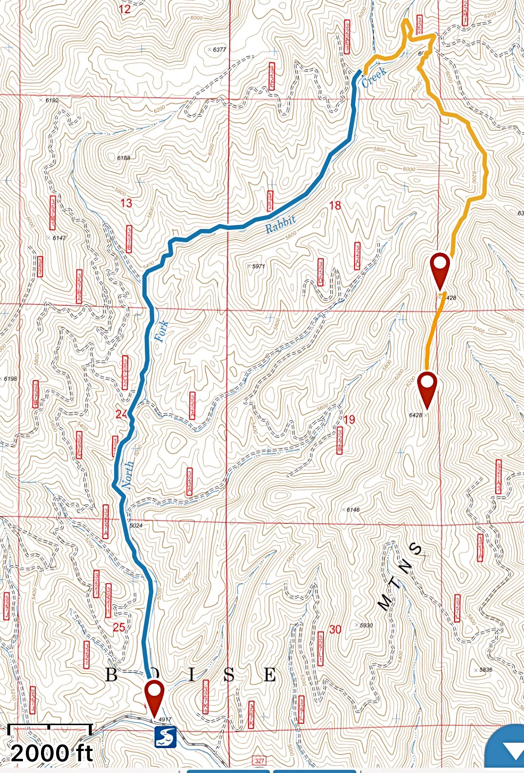
I followed Erik’s route in 2018. The blue line is FS-322. The gold line is the trail. Roundj-trip stats: 5.4 miles with 1,030 feet of elevation gain
North Ridge, Class 1
The Forest Service maps have not been updated and the first part of FST-294 has been rerouted. The trail now follows the NF Rabbit Creek up the drainage farther than the maps show before it begins heading toward a saddle at 6,031 feet. When you reach Saddle 6031, you’ll begin encountering trail intersections, but just continue following the obvious trail south along the ridge. The trail reaches the final and highest of Rabbit Peak’s 3 summits after approximately 3 miles from where you parked.
Rabbit Peak as viewed from south of Rabbit Creek Road Summit. Erik Pohlmann Photo
Rabbit Peak as viewed from the North Ridge. Erik Pohlmann Photo
View from the North Summit (6,428 feet) into the German Creek drainage. The Middle Summit (6,428 feet) is on the right and the Trinity Mountains are in the background. Erik Pohlmann Photo
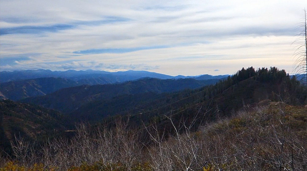
View from the Middle Summit (6,428 feet) into the North Fork Rabbit Creek drainage. Erik Pohlmann Photo
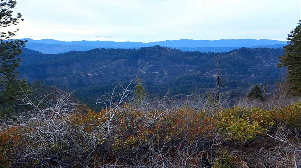
View from the South Summit (6,400+ feet), looking west. Boise Ridge is in the background with Shafer Butte on the left. Erik Pohlmann Photo
Additional Resources
Regions: Boise Mountains->WESTERN IDAHO
Mountain Range: Boise Mountains
Year Climbed: 2018
Longitude: -115.66659 Latitude: 43.84279