Elevation: 6,407 ft
Prominence: 587
This peak is not in the book. Published November 2020
Peak 6407 is located a few miles west of Pleasantview, ID on the north side of ID-38. It is a bump on the long east ridge of MLD AZ Benchmark (7,169 feet). The south ridge is a fun scramble from ID-38. This area is a mix of private ranch land and BLM land so be careful. This climb is entirely on BLM land. USGS Ireland Springs
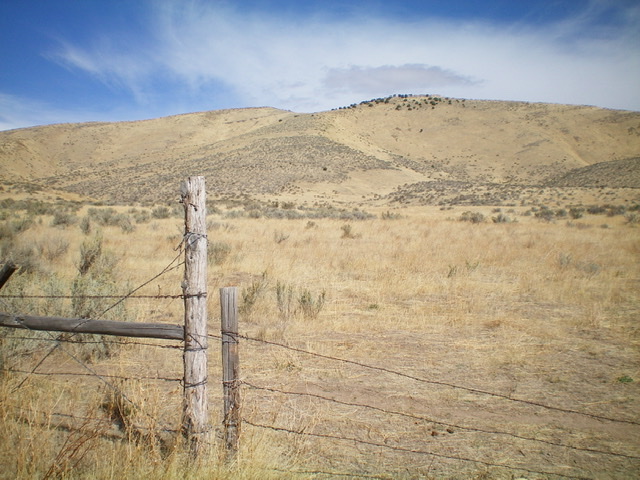
Peak 6407 and its south ridge, as viewed from the base of the ridge near ID-38. The summit hump is left of center. Livingston Douglas Photo
Access
Park on an [unsigned] short BLM spur road that is located on the north side of ID-38 exactly 2.7 miles east of Holbrook Summit and 2.5 miles west of North 5400W at the west end of Pleasantview. Park at a cattle fence about 75 yards up from the highway (5,100 feet).
South Ridge, Class 2
The Climb
From the parking area, jump the cattle fence and hike north through easy field grass then easy scrub (some loose scree and embedded talus) on a gentle upslope. The terrain steepens and the south ridge is now better defined. There is a prominent dry gully to the left/west of the ridge. Scramble up the rounded ridge, weaving around scattered mountain mahogany. Skirt left-ish/northwest past a ridge hump to reach a saddle. From the saddle, continue northwest on open scrub to the summit. The summit of Peak 6407 has a decent cairn and a nice view of nearby Peak 6620 and Stump Canyon.
![The summit area of Peak 6407, looking along the summit ridge at the [lower] northeast summit. Livingston Douglas Photo](https://www.idahoaclimbingguide.com/wp-content/uploads/309B0437-AE48-46C8-BEE3-83E2FC99FFBF.jpeg)
The summit area of Peak 6407, looking along the summit ridge at the [lower] northeast summit. Livingston Douglas Photo
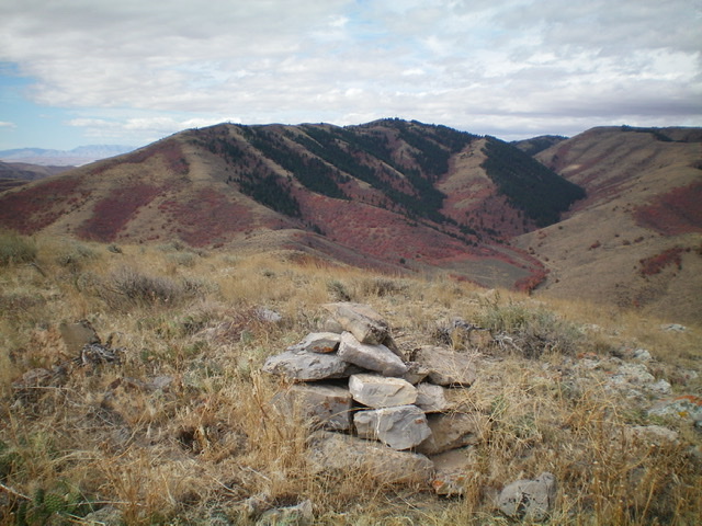
The summit cairn atop Peak 6407, looking west at antenna-clad MLD AZ Benchmark (7,169 feet) in dead center. Livingston Douglas Photo
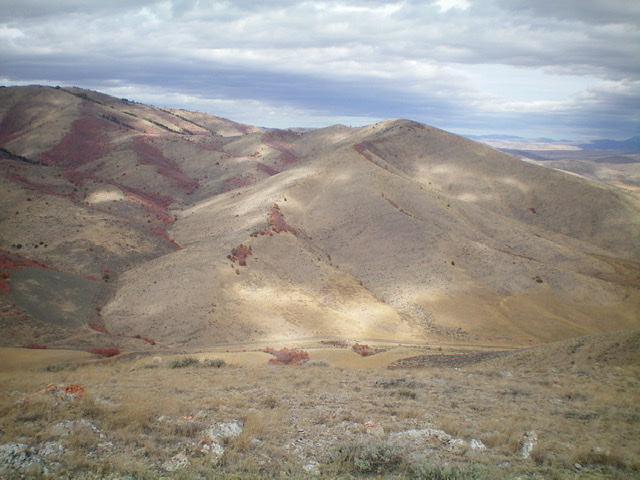
Looking north at Stump Canyon (left of center) and Peak 6620 (right of center) from the summit of Peak 6407. Livingston Douglas Photo
Additional Resources
Regions: Pleasantview Hills->SOUTHERN IDAHO
Mountain Range: Pleasantview Hills
Longitude: -112.40379 Latitude: 42.17519