Elevation: 6,415 ft
Prominence: 315
This peak is not in the book. Published December 2019
Peak 6415 is one of several rocky outcrops in the rolling hills east of Muldoon Summit. While most of the terrain is sagebrush, the tops of the hills here are rugged and rocky. The ridge crest terrain is arguably some of the worst in eastern Idaho: loose shale, charred rock/soil, and crumbly lava rock.
Peak 6415 is one of two ranked summits in this area, the other peak being Peak 7070 to the north. The land here is a patchwork of BLM land, State of Idaho land, and private land. Consult the BLM Fairfield map to stay out of trouble. USGS Little Wood River Reservoir
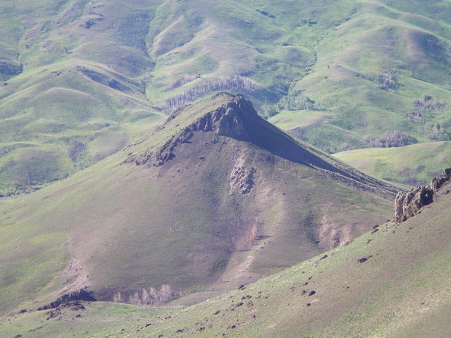
Peak 6415 as viewed from the summit of Peak 7070. The west ridge ascent route comes up from a saddle (not visible) in the lower right and then climbs up the difficult (Class 3+/4) summit cliffs to reach the top. Livingston Douglas Photo
West Ridge, Class 3+
Access
From the junction of ID-75 and Pine Street in Bellevue, drive east on Pine Street (which becomes Muldoon Canyon Road) for 8.0 miles to Muldoon Summit. Park here (6,460 feet).
The Climb
This climb is the final leg of a ridge traverse from Peak 7070 to Peak 6415. Most of this climb is Class 2. Only the summit headwall is Class 3+. From the 6,100-foot connecting saddle, scramble southeast up a steep scrub/grass slope to reach the summit headwall. Climb the headwall either on its left/north side (Class 4) or on its right/west side (Class 3+) to reach the small summit perch. The highest rocky outcrop has a decent cairn atop it.
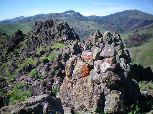
The summit cairn atop Peak 6415 with its lower rocky outcrops/towers in the background to the southeast. Livingston Douglas Photo
West Ridge/West Face, Class 3+
Access
Same as for the west ridge. This is the final leg of a loop route that begins and ends at Muldoon Summit.
The Descent
Most of this descent is Class 2. Only the summit headwall is Class 3+. Descend the summit headwall and return northwest to the 6,100-foot connecting saddle. From this saddle, your goal is to return to Point 6895 and then drop to Muldoon Summit. The problem is that there is a large gully that separates you from Point 6895, with multiple feeder gullies making the terrain quite tedious, albeit not rocky like the ridge traverse you did to get here.
The easiest way to accomplish this gully crossing is to do an angled descent to cross the primary gully at 6,000 feet. You may have to cross a minor shoulder to accomplish this task most easily. From the center of the primary gully, climb northwest up a shoulder that leads to a minor ridge hump just northeast of Point 6895. From Point 6895, follow the steep 2-track road down to Muldoon Summit.
Additional Resources
Regions: EASTERN IDAHO->Pioneer Mountains
Mountain Range: Pioneer Mountains
Longitude: -114.08949 Latitude: 43.47579