Elevation: 6,420 ft
Prominence: 320
This peak is not in the book. Published November 2022
Peak 6420 is the high point on a ridge that runs south from Richardson Summit. It sits at the head of Black Cinder Gulch in the Hailey Gold Belt. USGS Richardson Summit
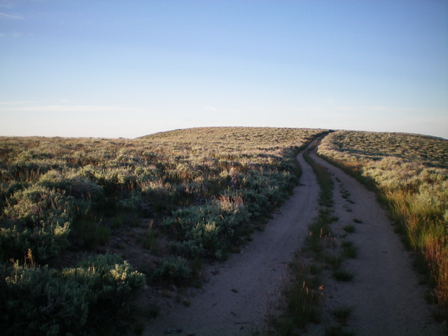
The summit hump of Peak 6420 as viewed from the north. Livingston Douglas Photo
Access
From Richardson Summit (6,107 feet) on Croy Creek Road/Camp Creek Road.
North Ridge, Class 1
The Climb
From Richardson Summit, follow a 2-track road (best suited for ATVs due to rutting and a few deep gullies) southward as it weaves and undulates its way for about 1.2 miles to an unsigned road junction at 6,389 feet. This area is a mix of private and public land, so be careful. The 2-track road crosses a section of private land but there are no indications that this is not permitted. Stay on the road just to be safe. From this junction, there is a weak side road (not shown on maps) that heads a short distance left/east to the true summit of Peak 6420. There is no summit cairn. There are three humps of similar height. The northernmost one is the true summit. Neither of the humps to the south, according to LOJ, is the true summit.
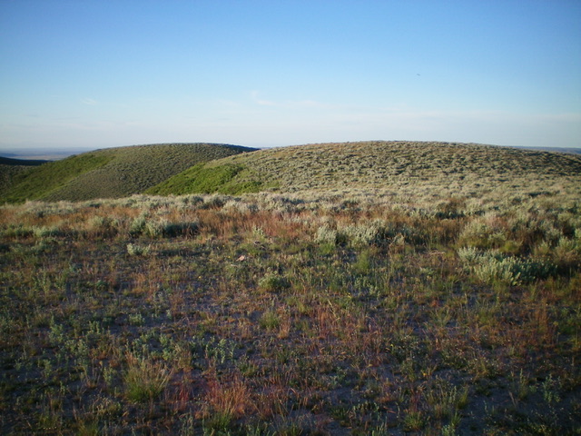
Looking south from the official summit of Peak 6420. The two humps in the photo are of similar height to the official summit hump. Livingston Douglas Photo
Additional Resources
Regions: Smoky Mountains->WESTERN IDAHO
Mountain Range: Smoky Mountains
Longitude: -114.47419 Latitude: 43.41989