Elevation: 6,420 ft
Prominence: 280
This peak is not in the book. Published November 2023
Peak 6420 is a rugged peak that towers over beautiful Williams Lake to its southwest. It is most easily climbed from the Williams Lake Campground Road to its west. Though there is a lot of private land in this area, this climb is entirely on BLM land. USGS Williams Lake
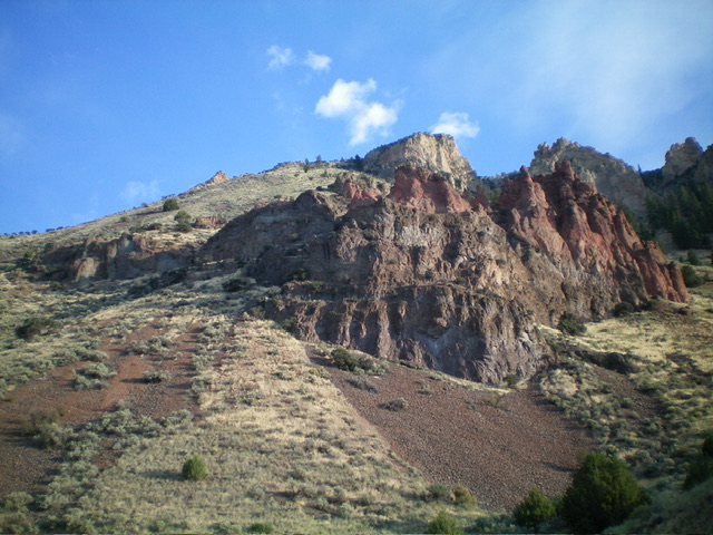
Peak 6420 as viewed from the south. The summit is the gentle hump just left of center. It is surrounded by ominous rocky crags. The left skyline is the southwest ridge, part of my ascent route. Livingston Douglas Photo
Access
From US-93 south of Salmon, drive west on [signed] Williams Creek Road/FSR-021 for 2.5 miles to a signed junction with Williams Lake Road/FSR-028. Turn left/south onto Williams Lake Road and drive 6.7 miles to a signed junction for the Williams Lake Campground. Turn right/north onto the campground spur road and drive 0.3 miles to a roadside pullout that is just before the road crosses a cattle guard and enters the campground. Park here (5,350 feet; 45⁰01’25”N, 113⁰57’46”W).
West Face/Southwest Ridge, Class 2+
The Climb
The roadside pullout sits at the base of the west face of Peak 6420. It is a rather intimidating sight. From the pullout, cross to the east side of the road and scramble up a dry gully briefly then leave it to climb diagonally right/east across steep, grass-and-gravel shoulders and minor gullies to reach the crest of the southwest ridge. The southwest ridge is rounded and somewhat ill-defined in this section. Just below is a narrower section of the ridge and a prominent rocky prow. This rocky prow is a useful navigational landmark on the descent.
Climb steeply northeast up the ridge crest in a mix of field grass, scree/gravel, and scattered mountain mahogany. Exit the ridge to its left/northwest high up to skirt some rugged, rocky ridge outcrops. The final push to the open summit is in easy, short field grass. The summit has a sagebrush bush as its high point and a few small ground boulders with triangulation wiring. I built a modest summit cairn with the few loose rocks that I could find. The view of Williams Lake from just below the summit cap is simply stunning (see photo).
The descent back to the campground spur road is loose and treacherous due to the unstable scree/gravel and steep, slippery field grass. But it is short and quick. Rather than descend into the initial ascent gully, I stayed on a nice grassy shoulder to reach the spur road about 0.1 miles northwest of the roadside pullout. Though Peak 6420 is only a soft-ranked summit, I highly recommend this climb.
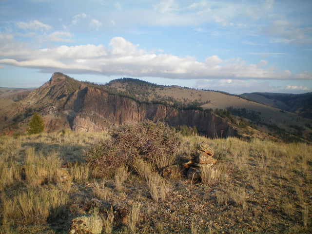
The gentle summit of Peak 6420. Livingston Douglas Photo
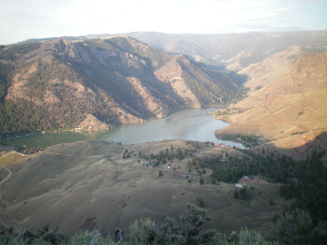
View of Williams Lake from high on Peak 6420. Livingston Douglas Photo
Additional Resources
Mountain Range: Eastern Salmon River Mountains
Longitude: -113.9546 Latitude: 45.0244