Elevation: 6,420 ft
Prominence: 360
This peak is not in the book. Published October 2020
Peak 6420 sits above The Narrows: a rugged, cliff-faced section of Wolverine Canyon in the Blackfoot Mountains. Hikers drive past this peak on their way to Taylor Mountain, which is another 2.4 miles up Wolverine Road. Peak 6420 is an easy scramble from a gully to its east and offers splendid views of the rugged cliffs and buttresses of Peak 6796 to its southeast across The Narrows. USGS Wolverine
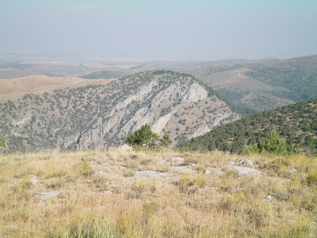
Peak 6420 (dead center, mid-ground) as viewed from Peak 6796 to its southeast. Livingston Douglas Photo
Access
From the south end of Firth, ID on US-91, drive 1.7 miles south on US-91 to [signed] East 600N. This is Wolverine Road. Turn left/east onto paved Wolverine Road and reset your odometer. At 10.4 miles, go straight at a junction with [signed] Blackfoot River Road to stay on Wolverine Road. At 14.2 miles, after driving through The Narrows, there is a large gully and grassy pullout on the left/north side of Wolverine Road. Park here (5,400 feet). Wolverine Road is paved to just before entering The Narrows. It then becomes a well-graded, smooth dirt/gravel road. Please note that the two routes described cross a short patch of private land higher up. However, I encountered no fencing or signage to prohibit entry.
Northeast Shoulder, Class 2
The Climb
Hike north on an ATV trail (not shown on any maps) up the dry, forested gully to a meadow and on to a higher, larger meadow. The ATV trail morphs into a footpath along the way. An old jeep road continues NW/W up the wide valley from the larger meadow (I used this old jeep road as part of my descent route). Leave the larger meadow and bushwhack south up an obvious gully between Point 6410 and Peak 6420. The bushwhacking here is in thick pine forest with lots of brush. Move left onto a cleaner shoulder as soon as feasible and climb steeply on easy open terrain with a decent game trail to help you.
The northeast shoulder becomes a face higher up. Continue up to the semi-open, forested summit area which is a narrow ridge line. There is a small cairn on the summit. There are partial views from the summit as firs block some of your view. Take a good look to the southeast at the northwest aspect of Peak 6796 if you plan to tackle that peak (which I did later in 2020). It is intimidating. This is a rugged area both on Peak 6420 and Peak 6796 so be very careful to stay on route lest you get hung up on one of the many cliffs and buttresses, some of which are visible but others of which are hidden.
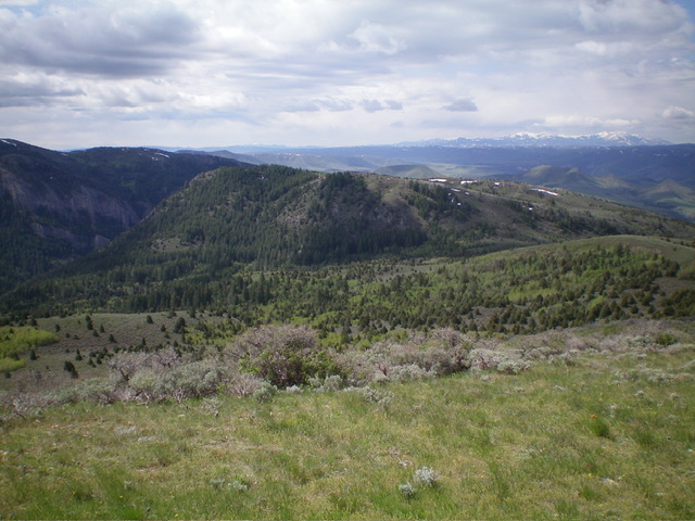
Peak 6420 (in mid-ground) as viewed from the north. Livingston Douglas Photo
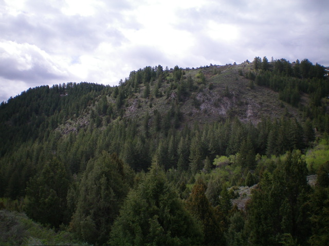
The northeast face of Peak 6420. This was my ascent route. Livingston Douglas Photo
North Gully, Class 2
The Descent
From the summit, descend through the thick forest into a dry gully initially heading northeast then bending left/north to find a good 2-track jeep road (not shown on maps) at the base of the gully. Follow this jeep road right/east back to the high, large meadow. Pick up the footpath (then ATV trail) from the middle of the meadow to return south to your parking spot near Wolverine Road.
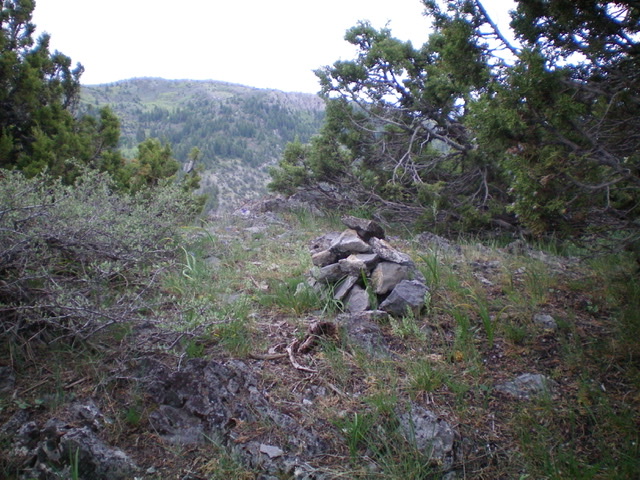
The summit cairn atop Peak 6420. Livingston Douglas Photo
Additional Resources
Regions: Blackfoot Mountains->SOUTHERN IDAHO
Mountain Range: Blackfoot Mountains
Longitude: -111.96679 Latitude: 43.27979