Elevation: 6,450 ft
Prominence: 320
This peak is not in the book. Published January 2023
Peak 6450 is located in the Chesterfield Range on the west side of Corral Creek Road. It sits west of the Blackfoot River and Blackfoot Reservoir. The summit is in Caribou County, a short distance from the boundary with Bingham County. This area is a mix of private and public land, so be careful. This climb is entirely on BLM land. USGS Paradise Valley
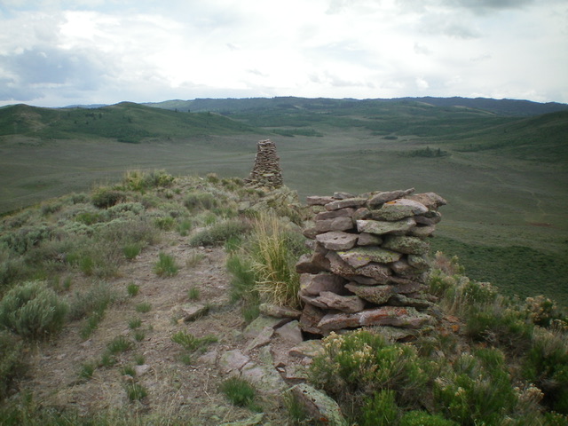
The twin summit cairns atop Peak 6450. The lower one is particularly tall. Livingston Douglas Photo
Access
From Exit 116 (Sunnyside Road) on I-15 in Idaho Falls, drive east on Sunnyside Road to its end at a signed “T” junction with Bond Road. This junction is 9.1 miles east of Ammon Road. Turn right/south onto Bone Road and drive 8.5 miles south to a signed junction with Blackfoot Reservoir Road, just south of Bone. Turn right/west onto Blackfoot Reservoir Road. The road quickly bends left/south and begins its journey to Blackfoot Reservoir.
Drive 20.5 miles on Blackfoot Reservoir Road to a signed junction at the northwest corner of Blackfoot Reservoir. Continue straight/south on Government Dam Road for 3.1 miles to a signed junction with Corral Creek Road. Turn right/west onto Corral Creek Road and drive 7.3 miles to an unsigned junction that is just north of the Bingham County line. Park at this junction (6,005 feet). GPS coordinates: 43⁰01’16”N, 111⁰50’15”W.
East Ridge/East Face, Class 2
The Climb
From the road junction, hike west up the jeep road. Almost immediately, the road forks. Take the right fork and head up the west ridge. The road levels off, bends left/south, and drops 25 feet to reach a fence corner. It then turns right/west to follow the left/south side of that fence row on public land. The 2-track road heads west up over a ridge then drops 100 vertical feet, crossing under a set of powerlines on the way. The 2-track becomes a cattle trail soon after crossing under the powerlines. Follow the cattle trail west along the left/south side of the fence row up into the forest.
Eventually, the cattle trail weakens and ends. Bushwhack west up through thick brush and bushes to reach the summit. Look for gaps and any short sections of easier brush. The terrain just to the right of a due west line is a bit easier than maintaining a straight west trajectory from the fence row. The summit has a nice cairn and a very tall second cairn a bit lower and to the south. The full length of the 2-track road (and fence row) is not shown on the USGS topo map.
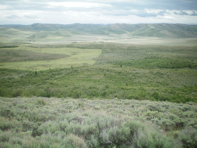
Summit view from Peak 6450 looking down the east side of the mountain. Livingston Douglas Photo
Additional Resources
Regions: Blackfoot Mountains->Chesterfield Range->SOUTHERN IDAHO
Mountain Range: Blackfoot Mountains
Longitude: -111.8633 Latitude: 43.0194