Elevation: 6,483 ft
Prominence: 383
This peak is not in the book. Published November 2022
Peak 6483 is located west of the Little Wood River and separates Dugway Canyon from Schultz Canyon. Thanks to ACCESS YES, this peak can be reached from Little Wood River Reservoir Road to its east via a crossing of private land and a climb of the northeast ridge. USGS Little Wood River Reservoir
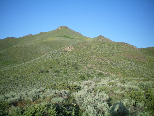
Peak 6483 (the rocky outcrop just left of center) as viewed from partway up the northeast ridge. Livingston Douglas Photo
Access
[Unsigned] Dugway Canyon Road (closed to motor vehicles) is located along Little Wood River Reservoir Road about 50 yards south of the diversion dam (shown on maps). Park in the nice gravel pullout at the diversion dam (4,986 feet). GPS coordinates at the road junction: 43⁰23’05”N, 114⁰00’00”W. This unsigned junction is located exactly 2.4 miles south of the bridge crossing of the Little Wood River. Use this link—ACCESS YES—to read about the ACCESS YES program and to learn the terms governing use of this access point.
Northeast Ridge, Class 2+
The Climb
From the base of Dugway Canyon Road, cross the wooden cattle gate and head west on the 2-track road. You almost immediately reach an unsigned junction. Go right/northeast here to remain on Dugway Canyon Road. Hike northwest then west up the 2-track road into Dugway Canyon. Leave the road at an unsigned junction in a cattle meadow. A weaker 2-track road heads left/south up a dry gulch from here. This junction sits at the base of the [obvious] northeast ridge of Peak 6483.
Leave the road and bushwhack southwest up endless sagebrush (thick at times) directly at the northeast ridge. The underlying terrain is loose shale so the bushwhack is a bit tedious. Once on the ridge crest, follow the ridge (with two minor ups and downs)in sagebrush and lots of loose talus/scree higher up to reach the rocky summit cap. There is a final, Class 2+ scramble up a combination of boulders/talus and sagebrush to reach the boulder-and-sagebrush summit of Peak 6483. There is a modest cairn atop the small summit area.
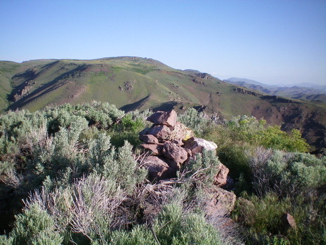
The summit cairn atop Peak 6483. Livingston Douglas Photo
Additional Resources
Regions: EASTERN IDAHO->Pioneer Mountains
Mountain Range: Pioneer Mountains
Longitude: -114.66889 Latitude: 43.43539