Elevation: 6,500 ft
Prominence: 390
This peak is not in the book. This peak is in an area identified as the Fish Creek Range. It is a small subrange of the Portneuf Range. Published November 2023
Peak 6500 is a forest-and-scrub hump that sits just south of US-30 and Petticoat Peak. It is most easily climbed from Fish Creek Road to its south. This area is a mix of private and public land, so be careful. This climb is entirely on BLM land. USGS Sedgwick Peak
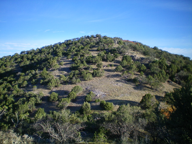
Peak 6500 as viewed from Point 6288 to its south. Livingston Douglas Photo
Access
From US-30 east of Lava Hot Springs, turn right/south onto [signed] Fish Creek Road. This junction is located 0.5 miles east of the major paved road that heads north to the “Pebble Area.” From the junction, drive 2.6 miles east then briefly south on [paved] Fish Creek Road to a signed junction. Turn left/east to remain on Fish Creek Road. It is now a gravel road that heads east to a pass that sits between Peak 6500 and Peak 6540. There are communication towers on the south side of this pass. Park in a small pullout on the pass or just up from it near the base of the service road to the towers. I parked in the latter spot (6,125 feet; 42⁰36’52”N, 111⁰55’12”W).
South Ridge, Class 2
The Climb
From the parking spot, drop down to Fish Creek Road and cross to its north side. Scramble north up the rounded ridge in a juniper forest to reach rocky Point 6288. From the rocky ridge point, descend 40 vertical feet to a gentle scrub saddle. Continue north up the rounded ridge to the open, ridge-crest summit. The upper ridge has scattered junipers all the way to near the summit perch. The summit has a few ground boulders but no summit cairn. The summit offers a splendid view of Petticoat Peak to the north. The south ridge is surprisingly rocky with a lot of embedded talus on it hiding below the junipers and the scrub.
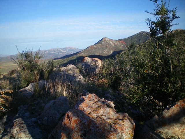
The summit boulders atop Peak 6500. Livingston Douglas Photo
Additional Resources
Regions: Fish Creek Range->Portneuf Range->SOUTHERN IDAHO
Mountain Range: Portneuf Range
Longitude: -111.9218 Latitude: 42.6195