Elevation: 6,511 ft
Prominence: 371
This peak is not in the book. Published November 2023
Peak 6511 sits at the head of Cyanide Gulch and towers over Gibbonsville to its northwest. Due to private land, it is most easily climbed via its northeast spur/north ridge from Gibbonsville Road/FSR-079. This area is a mix of private and public land, so be careful. This climb is entirely on National Forest land. USGS Gibbonsville
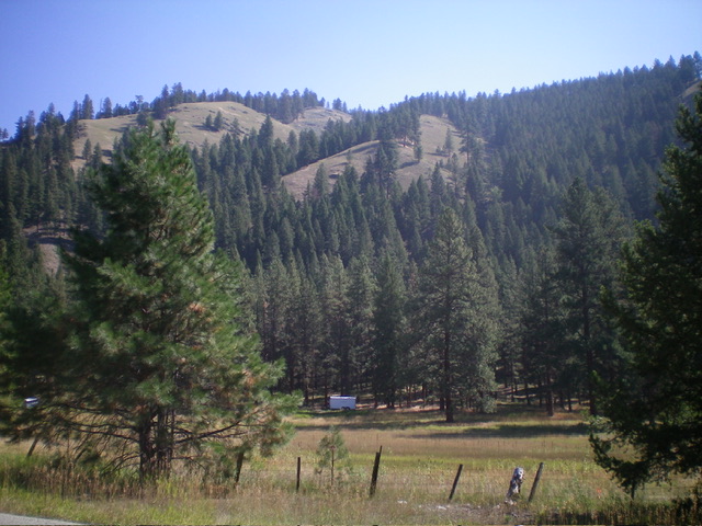
The west side of Peak 6511 as viewed from US-93. The summit hump is not visible from here. Livingston Douglas Photo
Access
From US-93 at Gibbonsville, turn right/east onto [signed] Gibbonsville Road/FSR-079 and drive 2.1 miles northeast then east to the Salmon National Forest boundary sign at a side spur road (that leads to a campsite) on the left/north side of the road. Park here (4,740 feet; 45⁰33’26”N, 113⁰53’45”W).
Northeast Spur/North Ridge, Class 3
The Climb
From the road junction, walk east along FSR-079 for about 1/8 mile to reach a suitable place to bushwhack across Dahlanega Creek. Find a downed tree to cross the creek. Once across the creek, bushwhack southeast up a short, steep, wicked patch of forest and brush (Class 3) to reach the [blessed] crest of the northeast spur. Follow an on-and-off use/game trail southwest up the ridge crest. The terrain on the northeast spur is a mix of pines, deadfall, field grass, and brush. It is an endless, steep uphill grind to reach an obvious juncture with the north ridge in semi-open terrain.
Go left/north onto the north ridge and scramble up the ridge, using an on-and-off use/game trail that is sometimes buried by deadfall. Reach a flattish ridge area at about 6,320 feet where a good use trail appears from the right/west. The trail appears to come up from Cyanide Gulch to the west. This trail heads left/east to the ridge crest and goes all the way to the summit. It makes the final 10-minute hike to the summit much easier than would otherwise be the case. The summit is in a logged are and has cut-down tree stumps. It had no summit cairn so I built one. As per the USGS topo map, the high point is at then northeast end of a tilted, open field in the middle of a nearby pine forest.
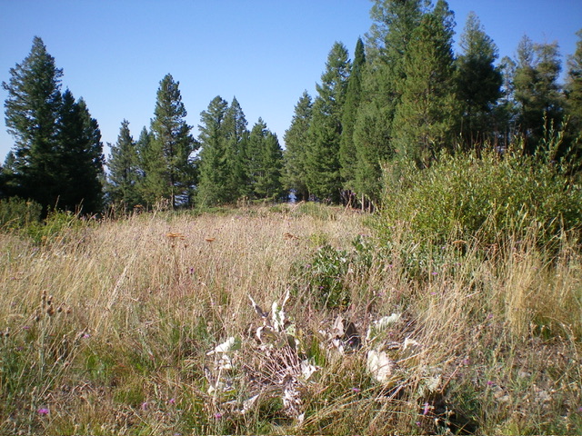
The summit of Peak 6511. Livingston Douglas Photo
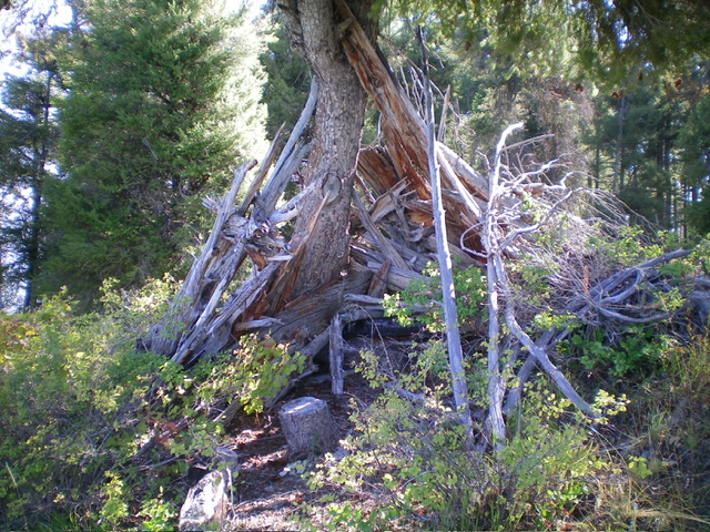
A hunter’s blind high on the north ridge of Peak 6511. Livingston Douglas Photo
Additional Resources
Regions: Beaverhead Range->EASTERN IDAHO
Mountain Range: Beaverhead Range
Longitude: -113.8994 Latitude: 45.5433