Elevation: 6,583 ft
Prominence: 403
This peak is not in the book. The name was proposed by Rick Baugher. Published October 2025
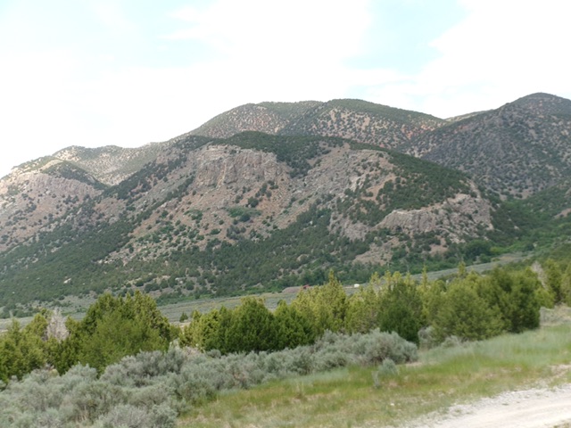
Peak 6583 (in mid-ground) as viewed from the south. Livingston Douglas Photo
Peak 6583 is a forested hump with some very rocky aspects. It sits on the east side of I-15 just north of Cherry Creek, ID. The north and west sides of Peak 6583 are very steep and have significant areas of cliffs. The easiest way to the top is from the south. USGS Henderson Creek
Access
Same as for Peak 5198. From the junction of Old Highway 191 and Samaria Road (signed as 6700S), drive east on 6700S for 0.5 miles through an underpass to reach the east side of I-15 and a signed junction with 1500E (also signed for the Cherry Creek Cemetery). Drive north then east on 1500E to the Cherry Creek Cemetery (0.7 miles) and continue east on a decent 2-track road (shown as a “jeep trail” on maps) for another 0.4 miles and park in a pullout just before the road turns into a narrow, rugged jeep/ATV trail [4,855 feet; 42°05’39.9”N, 112°12’13.9”W].
Map Errors
South Cherry Creek Road (heading northeast then east from the Cherry Creek Cemetery) no longer exists. The jeep/ATV trail continues much farther up into West Cherry Creek Canyon than the USGS topo map indicates. It bends right/east to head up an unnamed gulch that heads east then northeast. Though this jeep/ATV trail crosses private land to get up into West Cherry Creek Canyon, public access is allowed. Based on GPS and altimeter readings, this peak is at most 6,550 feet, contrary to the map measurement.
West Cherry Creek Approach, Class 1
From the pullout, hike east then north on the jeep/ATV trail. Reach a cattle fence crossing at West Cherry Creek. The road now becomes a rugged ATV trail. Cross [small] West Cherry Creek almost immediately after the cattle gate crossing and continue north then northeast up the ATV trail as it bends right/northeast up a dry side drainage. Find a good spot to leave the ATV trail. This concludes the approach hike.
South Spur/South Ridge, Class 2
The Climb
From the ATV trail, find a good spot to leave it and scramble north up toward the south ridge in steep, but easy, gravel and scattered junipers. Stay on the face/shoulder terrain and avoid the gully to the left/west. The south ridge is angling right/northeast in this area so you do not have to head left-ish/northwest to reach it. Just bushwhack northward to intercept it. Reach the crest of a shoulder at about 6,100 feet. Head north up this shoulder until it merges into the south ridge. The ridge terrain on the shoulder is thick-ish junipers with gaps and some areas of gravel, field grass, and short scrub.
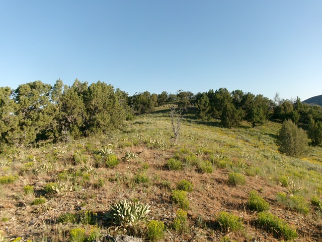
Approaching the summit on the south ridge. This was my ascent route. Livingston Douglas Photo
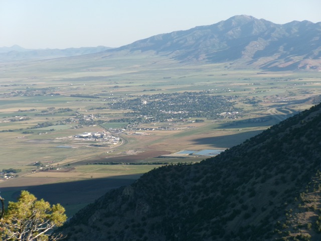
Malad City as viewed from the summit. Livingston Douglas Photo
Once on the south ridge, head north-northeast to a flattish area at 6,350 feet. The ridge terrain is now semi-open with scattered junipers. It goes quickly. The ridge bends left-ish/north then northwest to approach the summit cap. A final, short job left/west puts you on the cairned high point. There are magnificent views from the top. Be very careful in climbing this peak. It has numerous areas of impossible cliffs, even on its south side. Thread this needle carefully, particularly on the descent.
Additional Resources
Regions: Bannock Range->Malad Range->SOUTHERN IDAHO
Mountain Range: Bannock Range
Longitude: 112.1954 Latitude: 42.1170