Elevation: 6,540 ft
Prominence: 400
This peak is not in the book. This peak is in an area identified as the Fish Creek Range. It is a small subrange of the Portneuf Range. Published November 2023
Peak 6540 is a forested, ridgeline hump that sits on a high ridge at the north end of the Fish Creek Range. It is most easily climbed from Fish Creek Road to its north. This area is a mix of private and public land, so be careful. This climb is entirely on BLM land. USGS Sedgwick Peak
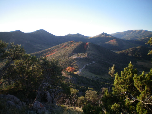
Peak 6540 (in mid-ground) as viewed from Peak 6500 to its north. Livingston Douglas Photo
Access
From US-30 east of Lava Hot Springs, turn right/south onto [signed] Fish Creek Road. This junction is located 0.5 miles east of the major paved road that heads north to the “Pebble Area.” From the junction, drive 2.6 miles east then briefly south on [paved] Fish Creek Road to a signed junction. Turn left/east to stay on Fish Creek Road. The road is now a gravel road that heads east to a pass that sits between Peak 6500 and Peak 6540. There are communication towers on the south side of this pass.
Park in a small pullout on the pass or just up from it near the base of the service road to the towers. I parked in the latter spot (6,125 feet; 42⁰36’52”N, 111⁰55’12”W). This is the first leg of a 2-peak adventure that includes Peak 6540 and Peak 6575. It covers 4.0 miles with 1,675 feet of elevation gain round trip.
North Ridge, Class 2
The Climb
From the parking spot, hike south up the steep, rock-and-gravel service road to the communication towers. From there, scramble south then southeast up the narrow, clogged (mostly with mountain mahogany) ridge crest. The ridge crest is a mix of rocky outcrops, mountain mahogany, and junipers. After a few ups and downs, reach the southeast end of the summit ridge crest and the high point of Peak 6540. The high point is either a boulder at the base of a juniper tree or a large, open ground boulder about 20 feet away. I built a summit cairn atop the highest ground boulder. The summit perch is a small area that is a mix of ridge rock and junipers.
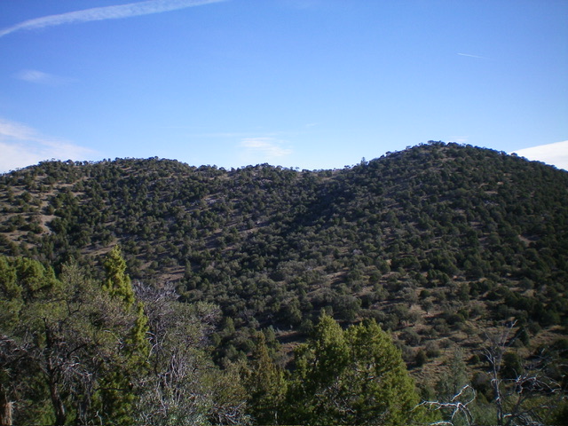
Peak 6540 (summit is right of center) and its long north ridge as viewed from the southwest. Livingston Douglas Photo
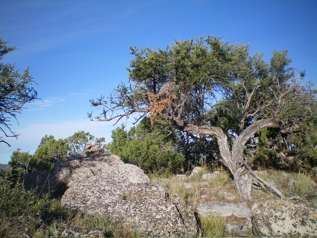
The summit of Peak 6540 with its newly-built summit cairn. Livingston Douglas Photo
Southwest Face, Class 2
The Descent (then Ascent)
From the summit, descend southwest through a forest of gapped junipers and mountain mahogany to reach a gentle saddle at 6,140 feet. This is the connecting saddle between Peak 6540 and Peak 6575. It concludes the first leg of today’s 2-peak adventure. Peak 6575 is up next.
Additional Resources
Regions: Fish Creek Range->Portneuf Range->SOUTHERN IDAHO
Mountain Range: Portneuf Range
Longitude: -111.9162 Latitude: 42.6067