Elevation: 6,543 ft
Prominence: 523
This peak is not in the book. Published January 2023
Peak 6543 is located above the Sublett Guard Station and the junction of the North Fork and Station Fork of Sublett Creek. Its north ridge is a magnificent scramble in mostly open terrain with beautiful views of the surrounding area. USGS Sublett Troughs
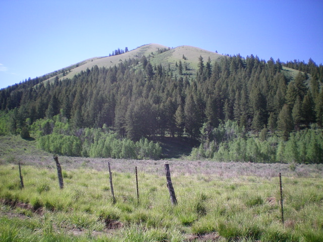
Peak 6543 as viewed from the road junction at the base of its north ridge (my descent route). Livingston Douglas Photo
Access
From Exit 245 (Malta/Sublett) on I-84, drive southeast on Sublett Road. Continue on the road as it bends east then north and passes the west side of Sublett Reservoir. At 10.0 miles, reach a signed junction with Lake Fork Road/FSR-564 at the northwest end of the reservoir. Turn right/east here onto FSR-565 and reset your odometer. At 2.9 miles, reach a signed junction with FSR-563. Go left to remain on FSR-565. At 5.3 miles, reach a signed junction with FSR-562. Go right onto FSR-562 and drive 0.1 miles to the Sublett Guard Station and park (5,625 feet).
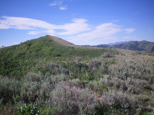
The summit hump of Peak 6543 (left of center) as viewed from high on the north ridge. Livingston Douglas Photo
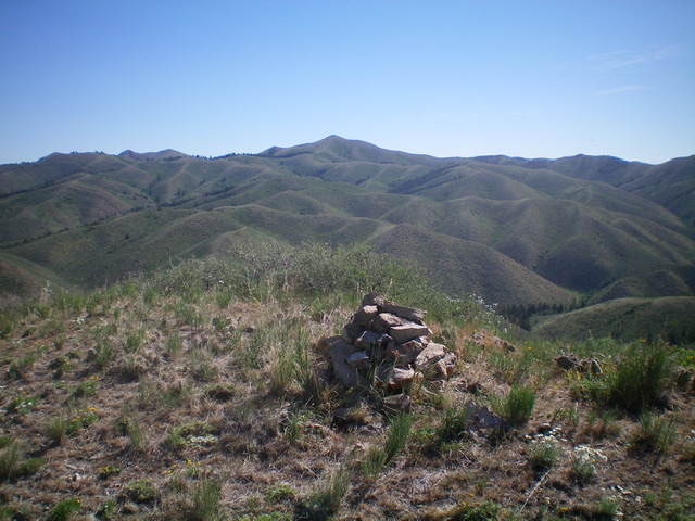
The summit cairn atop Peak 6543 with a sea of Subletts in the background. Livingston Douglas Photo
North Face/North Ridge, Class 2
The Climb
From the west end of the Sublett Guard Station, hike south along a fence row and cross a small stream to enter the pine forest at the base of the north ridge. Bushwhack straight uphill through the steep but easy, open forest and quickly reach open terrain. The scrub thins out soon and the climb becomes a plod up the steep slope of short grass/scrub and broken scree. Upon reaching the crest of the north ridge, follow the ridge south to the summit. The ridge weaves a bit high up and has a 15-foot drop just before reaching the summit high point. The summit has a decent cairn.
North Ridge/Northwest Spur, Class 2
The Descent
From the summit, follow the ridge northward down to a point where you can continue north down the north face or head left-ish down the northwest spur. The northwest spur is open terrain initially and seems like an easier route than the north face which has a section of steep forest. But it isn’t. Alas, the open terrain quickly morphs from easy scrub into thick sagebrush and other brush. The descent to the valley floor is very steep and loose (scrub and broken shale). Once on the valley floor, follow a small stream right/east to the fence row and back to the Guard Station.
Additional Resources
Regions: SOUTHERN IDAHO->Sublett Range
Mountain Range: Sublett Range
Longitude: -113.9716 Latitude: 42.3465