Elevation: 6,549 ft
Prominence: 489

This peak is not in the book. Published June 2020
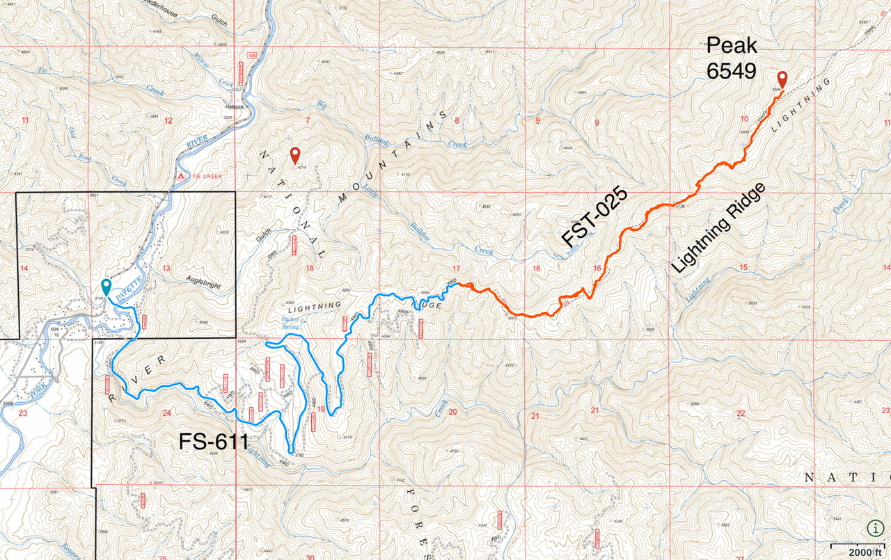
This peak is located on the south end of Lightning Ridge and north of the South Fork Payette River. Lightning Ridge is a rugged, steep, forested divide. Bolt Peak is the southernmost ranked summit on the ridge. USGS Lightning Ridge
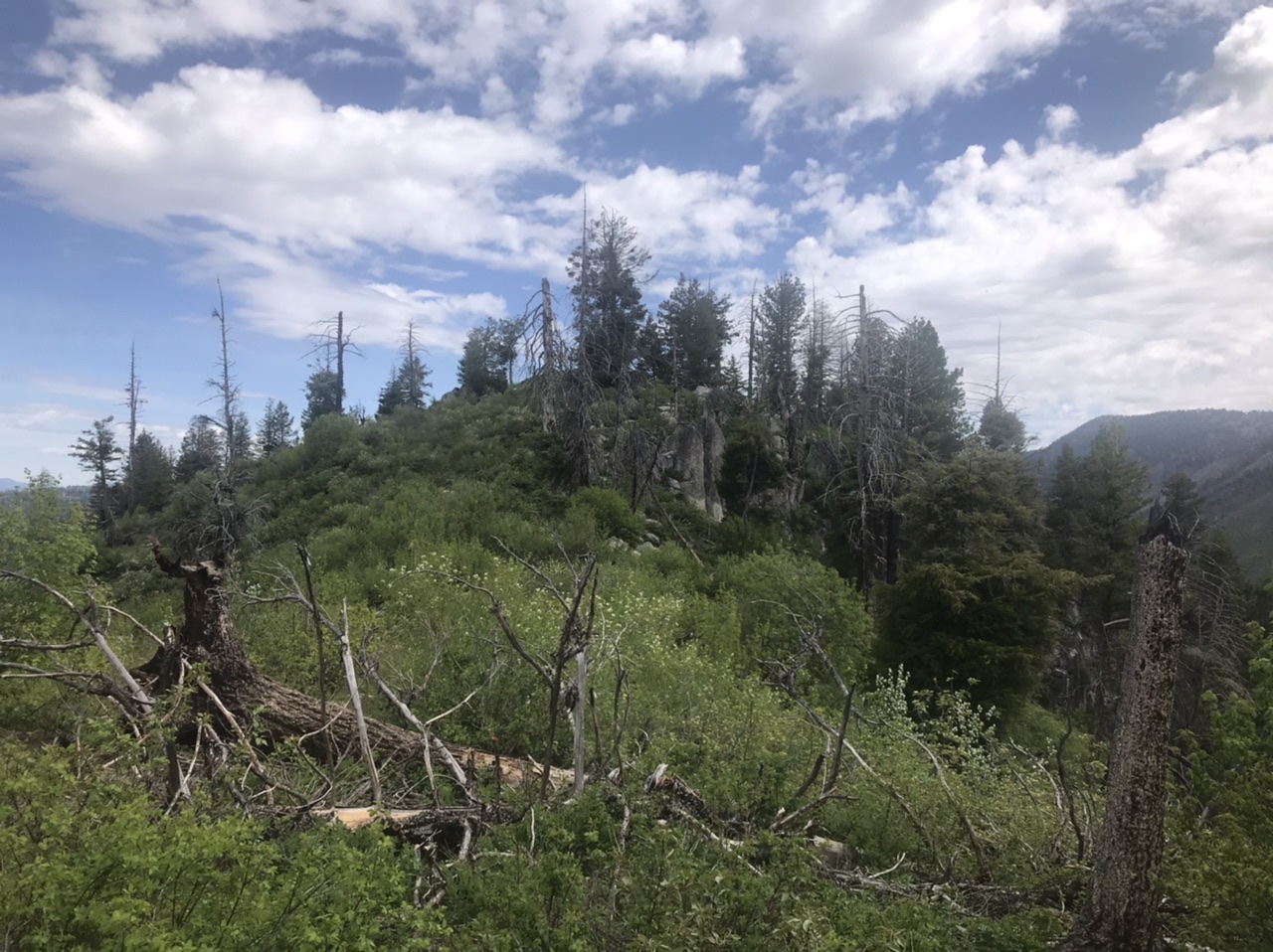
The brushy summit as viewed from the south.
Access
Primary access is from the Middle Fork Payette River Road [(D)(1.1) on Page 140]. Follow the Middle Fork Payette River Road north through Crouch for 7.9 miles to its junction with FS-611/Lightning Creek Road (signed in 2020). Turn right/east onto FS-611. Follow FS-611 to its end in 6.3 miles. The road is listed as a 4WD road on Forest Service maps but it is, for the most part, much better. A high clearance vehicle and dry conditions are recommended.
FST-025, Class 1+
Follow FST-025 to a point just south of the summit. Leave the trail and walk 100 feet through the brush to the summit. In 2020, the trail’s tread was visible until the last 0.5 miles to the peak. The trail needed to be brushed out and there were six trees down on the trail. The deadfall was not a problem. Beware that there were lots of ticks. Round trip stats: 7.3 miles with 2,000 feet of elevation gain.
Additional Resources
Regions: Central Salmon River Mountains->Log Mountain - Deadwood Divide Peaks->Salmon River Mountains->WESTERN IDAHO
Mountain Range: Central Salmon River Mountains
Year Climbed: 2020
Longitude: -115.84289 Latitude: 44.21679