Elevation: 6,562 ft
Prominence: 302
This peak is not in the book. Rick Baugher suggested the name in honor of the disappearing settlement. Published January 2023
Peak 6562 is a scrub hump that is located at the south end of a long ridgeline that terminates at a sharp bend in Pegram Road and in the Bear River. It is located entirely on private land. You must secure permission from the land owner to climb this peak. Peak 6562 is most easily climbed from Pegram Road to its west. USGS Pegram
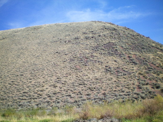
Peak 6562 and its steep west face (my ascent route) as viewed from Pegram Road (start of climb). Livingston Douglas Photo
Access
Park along [paved] Pegram Road about a mile north of its signed junction with Poverty Flat Road and about 0.2 miles south of a bridge crossing and a crossing of the UPRR tracks. The parking spot (no actual pullout here) is at 6,010 feet. GPS coordinates: 42⁰08’38”N, 111⁰09’04”W.
West Face/Southwest Ridge, Class 2
The Climb
From Pegram Road, follow an old 2-track diagonally left/northeast to reach the UPRR tracks to avoid the beaver ponds. Walk briefly right/south along the railroad tracks then descend east into a dry gully with VERY TALL field grass that is thick and intimidating. Aim for a gate (of sorts) on the fence row at the base of the west face/ridge. Cross the somewhat-dilapidated cattle fence just right/south of the “gate” at an easy spot where the top barbed wire isn’t too high.
Once across the fence, scramble east up very steep scrub with a loose talus/scree base. Stay left/north of boulder/talus patches. The face is grassier and easier than the rockier, brushier ridge crest to the right/south. Higher up, the slope eases. Move right/south onto the [rounded] southwest ridge. Follow the ridge left/northwest in reasonable sagebrush to the summit. The summit of Peak 6562 has a cairn (of sorts) and offers magnificent views of [the weaving] Bear River in the farmland below.
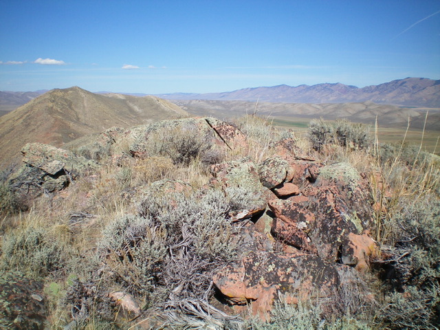
The rocky summit of Peak 6562. Livingston Douglas Photo
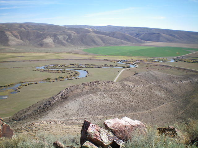
View of the weaving Bear River from the summit of Peak 6562. Livingston Douglas Photo
Additional Resources
Regions: Peale Mountains->Pruess Range->SOUTHERN IDAHO
Mountain Range: Peale Mountains
Longitude: -111.1468 Latitude: 42.1436