Elevation: 6,562 ft
Prominence: 302
This peak is not in the book. Livingston Douglas climbed the peak from the west. His route is set out below mine. Updated January 2023
Peak 6562 is located at the south end of the Cotterel Mountains at the top of the Rice Creek drainage. While this section of the Cotterel Mountains is covered by junipers, the summit of Peak 6562 is open and has excellent views of the Albion Range. USGS Nibbs Creek
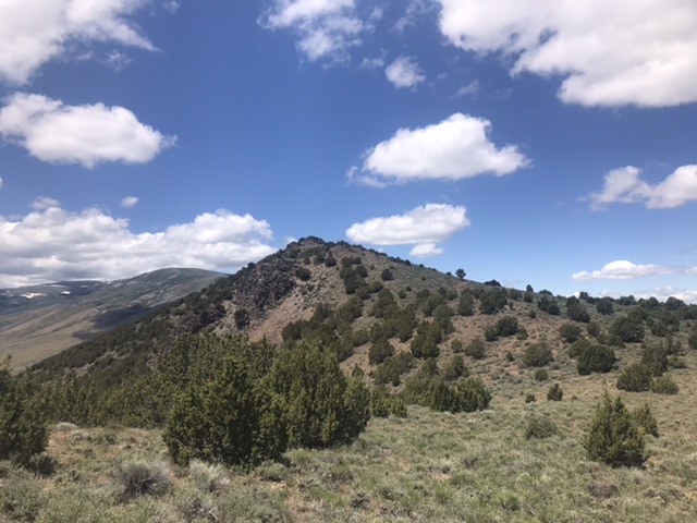
Peak 6562 as viewed from the east
Access
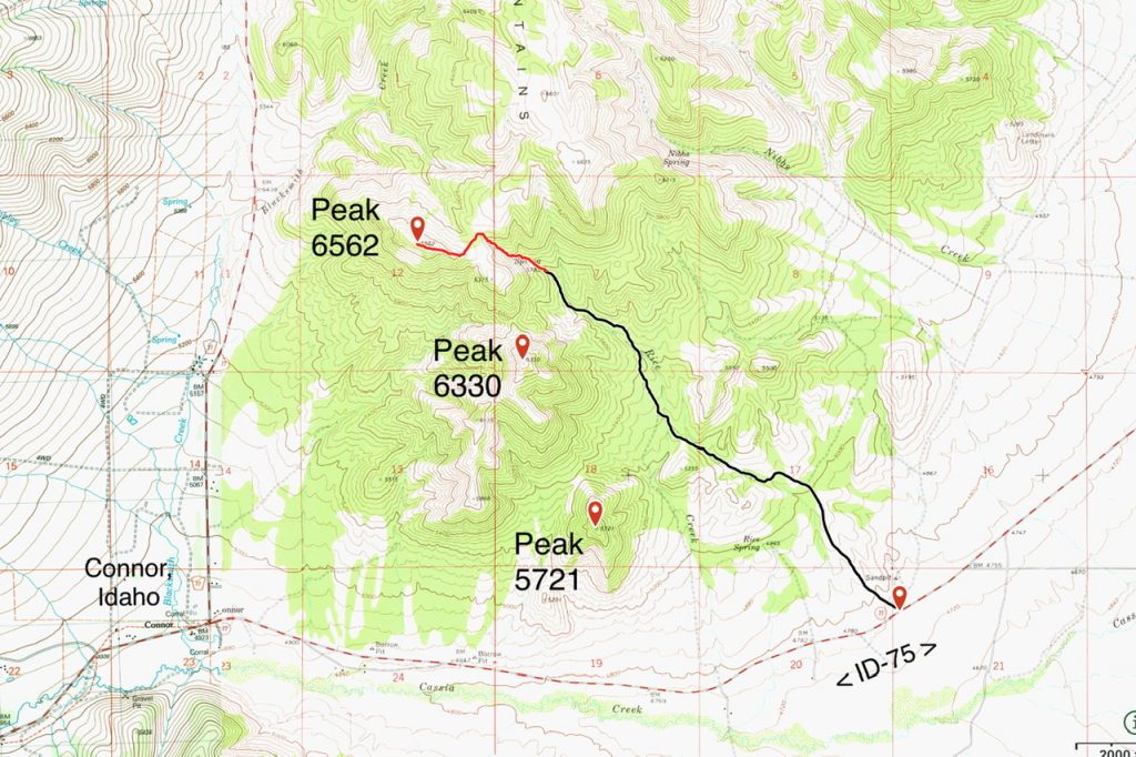
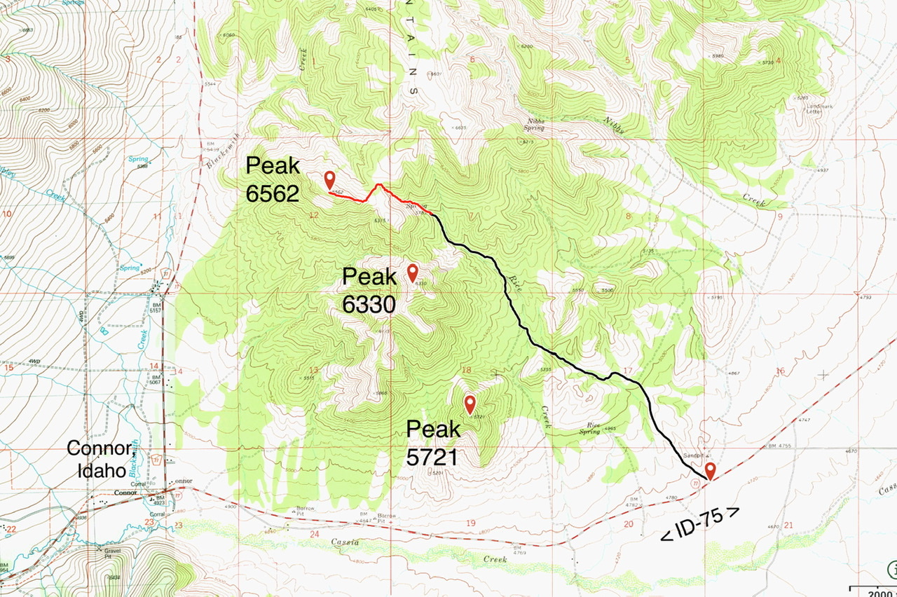
Access is from ID-77. ID-77 makes a 90-degree turn at a junction in the former town of Connor, Idaho. Follow ID-77 east from this junction for 3.6 miles. Turn left/north onto a BLM road with a cattleguard. Follow this 4WD road northwest to its end at a spring at 5,785 feet. See the map below. Park here. You can also access Peak 6330 and Peak 5721 from this road.
North Ridge, Class 2
The spring at the end of the road is fenced. A good cattle trail starts on the south side of the fence. Follow this trail up the Rice Creek drainage to the pass on Peak 6562’s north ridge. There is a fence line that runs up the ridge. Hike up the east side of the fence until you reach the base of the peak’s summit ridge. Cross under the fence and hike west to the summit. It is 0.9 miles from the spring to the summit with just under 700 feet of elevation gain. Notes: There is a gate on the saddle that can be used to negotiate the fence. In 2020, the fence was down near the summit ridge.
 Livingston Douglas Approach and Route
Peak 6562 is one of three ranked hills at the south end of the Cotterel Mountains west of Malta. This is the second leg of a 2-peak journey that climbs Peak 6330 and Peak 6562 from ID-77 to the west. This adventure covers 6.0 miles with 2,100 feet of elevation gain round trip. The shortest and easiest ascent route comes directly up the northwest ridge from ID-77 but there is only a very short patch of BLM land along ID-77 to work with, so be very careful if undertaking this route. A longer route comes up the Rice Creek jeep road and then climbs the southeast ridge.
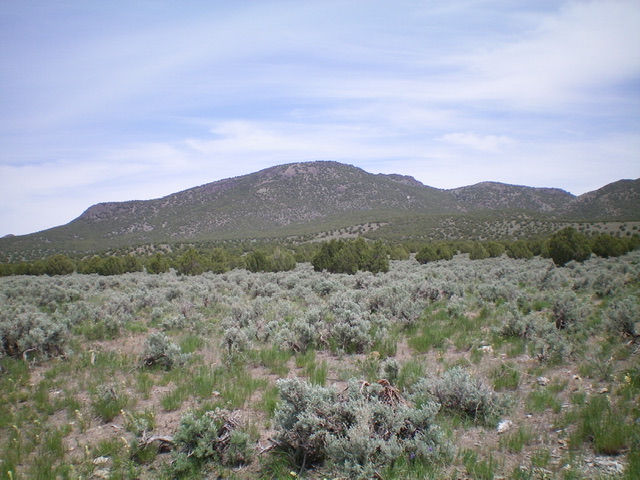
Peak 6562 as viewed from ID-77 at the base of the 2-track road to its southwest. Livingston Douglas Photo
Access
Same as for Peak 6330. This is the second leg of a 2-peak journey that begins along ID-77 to the south of Peak 6562.
Southeast Ridge, Class 3
The Climb
From the 5,980-foot connecting saddle with Peak 6330, climb north over a rocky ridge outcrop (Class 3). It is best to stay on the steep ridge crest because the sides are steep, loose shale. Once past this ridge outcrop, the going is much easier on scrub/scree on the ridge crest that leads up to the elongated summit of Peak 6562. The summit has a modest cairn.
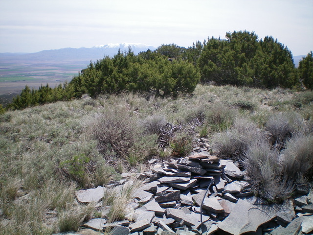
The summit area of Peak 6562. Livingston Douglas Photo
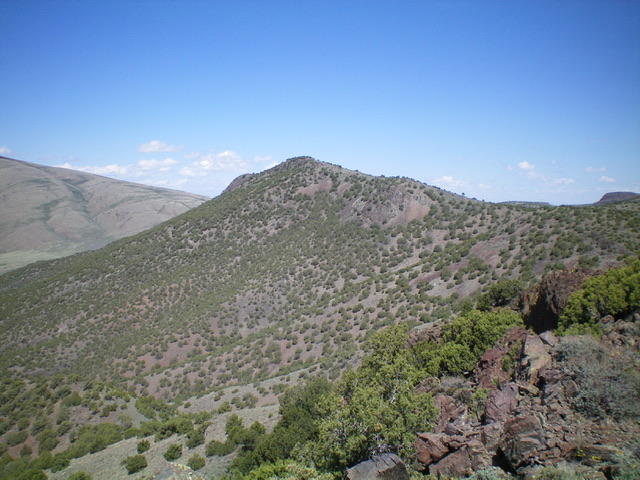
Peak 6562 as viewed from Peak 6330 to its southeast. Livingston Douglas Photo
Southwest Face, Class 2+
The Descent
From the summit, descend southwest down the steep upper face (Class 2+ initially) to reach a juniper-clad shoulder of sorts. Continue descending southwest on much more stable rock (broken rock instead of steep, loose scree) and a thinner juniper forest. This shoulder becomes better defined as you descend and visibility is decent so that you can maintain a good southwest line that will lead you back to your parking spot. Lower down, the slope eases and the terrain is open sagebrush. Weave through the sagebrush to reach the starting point of today’s journey and your awaiting vehicle.
Additional Resources
Regions: Albion Range->Cotterel Mountains->SOUTHERN IDAHO
Mountain Range: Albion Range
Year Climbed: 2020
Longitude: -113.48069 Latitude: 42.30879