Elevation: 6,570 ft
Prominence: 620
This peak is not in the book. Published November 2019
Peak 6570 is the southernmost ranked summit in the Lemhi Range. It is located northeast of Howe, ID. There is a lot of private ranch land in this area so be careful. Both routes discussed are entirely on public land. The [lower] east aspects of the mountain are on Idaho National Laboratory (INL) land, also closed to the public. Peak 6570 has an extraordinary number of ridges and gullies emanating from its summit. It can be a bit confusing. Navigational skills are important to stay on whichever route you choose. USGS Little Lost River Sinks
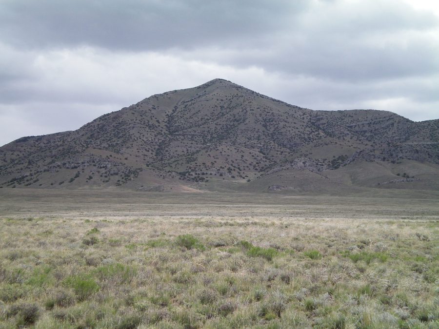
The west face of Peak 6570 as viewed from the parking spot. A prominent gully splits the west face. The west ridge—NORTH follows the ridge just left/north of the gully. The west ridge—SOUTH follows the ridge just right/south of the gully. Livingston Douglas Photo
West Ridge SOUTH, Class 3
Access
Drive north from Howe on the Little Lost River Highway for 3.4 miles to a [signed] junction with 3800N (“Berenice Road”). Turn right/east onto 3800N and drive 5.2 miles to a signed junction with 1200W. Turn left/north and drive 1.1 miles on 1200W to an unsigned junction on the right/east side of the road. This junction is located 0.1 mile past a gravel pit that is located on the left/west side of the road. Turn right/east and drive 0.5 miles on a 2-track jeep road to a sharp right/south turn at a fence corner. Park here (4,880 feet). Please note that the USGS map incorrectly shows the west face of Peak 6570 as being heavily forested. Not true. The west face is completely open.
The Climb
From the parking spot, scramble almost two miles straight across a grass and scrub/sage field, heading directly at the summit of Peak 6570. You will cross a few dry gullies on the way. When you reach the base of the west face, you can see a ridge just right of center that looks do-able. But you cannot see all of the embedded rock ribs/strata in it. When you climb it, it takes some Class 3 scrambling to either climb over or around the rock strata. Overall, it’s not too bad. In between the rock strata, the terrain is easy short grass/scrub. The summit of Peak 6570 is small but has a large cairn and a tall triangulation post nearby. A juniper bush accompanies the aforementioned man-made items. The Lemhi Mountains to the north are intimidating. They tower over this [much-lower] peak.
West Ridge NORTH, Class 3
Access
Same as for the West Ridge—SOUTH
The Descent
From the summit, descend north on a ridge briefly to pass the head of a large gully that splits the west face. This gully separates the west ridge NORTH from the west ridge SOUTH. Once past the gully, you reach the top of the west ridge NORTH. Follow the ridge west then west-southwest until the ridge ends in a minor gully. This is a nice gully with short grass and a scree base that quickly leads you down to the valley floor, reaching the base of the west ridge SOUTH.
The west ridge NORTH is rockier and has more difficult rock strata to contend with than the west ridge SOUTH. Several of these cliff bands are Class 5 faces and must be circumvented, mostly on the left/south side. This is a tougher Class 3 route than the west ridge SOUTH. But it goes at Class 3 and the finish is magnificent. Trek across almost two miles of grass/sagebrush to return to your parked vehicle.
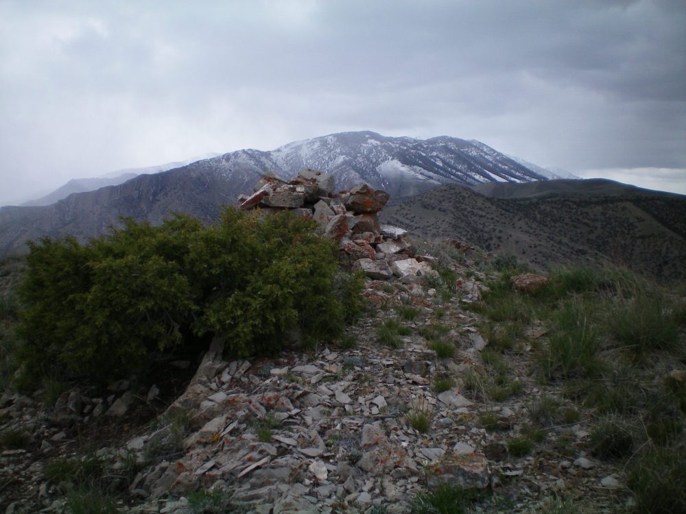
The summit cairn atop peak 6570. The snow-dusted Lemhi Mountains to the north are in the background. Livingston Douglas Photo
Additional Resources
Regions: EASTERN IDAHO->Lemhi Range
Mountain Range: Lemhi Range
First Ascent Information:
- Other First Ascent: West Ridge--SOUTH
- Year: 2019
- Season: Spring
- Party: Livingston Douglas
- Other First Ascent: West Ridge—NORTH —Descent
- Year: 2019
- Season: Spring
- Party: Livingston Douglas
Longitude: -112.88069 Latitude: 43.85301