Elevation: 6,587 ft
Prominence: 287
This peak is not in the book. Published November 2020
Peak 6587 sits above the convergence of Blacktail Canyon and Fall Creek Canyon. It is overshadowed by higher peaks surrounding it but it almost qualifies as a ranked summit and is a fun scramble from Blacktail Canyon Road. Unlike many of the Caribou Range peaks in this area, Peak 6587 requires no difficult bushwhacking to reach its open summit. That alone makes it a worthwhile endeavor! USGS Conant Valley
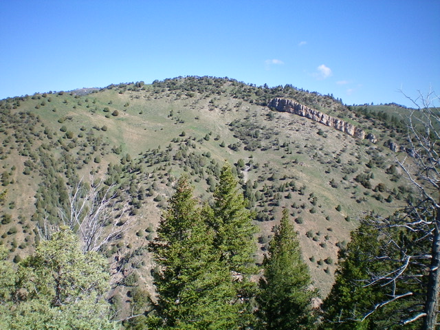
Peak 6587 as viewed from the southeast. The left skyline is the south ridge. Livingston Douglas Photo
Access
Blacktail Canyon Road/FSR-066 is located along Fall Creek Road exactly 5.8 miles northeast from the junction of Fall Creek Road and Kepps Crossing Road. Blacktail Canyon Road can also be reached from US-26 near Swan Valley. Leave US-26 at the bridge crossing of the Snake River a few miles west of Swan Valley. There is a signed junction with Snake River Road here. Drive south on Snake River Road for 1.2 miles to the [signed] junction with Fall Creek Road. Turn right/west onto Fall Creek Road and drive 8.0 miles to the [unsigned] junction with Blacktail Canyon Road/FSR-066. Park at this junction (5,710 feet). Please note that this junction is signed for “Blacktail Canyon” but has no road number or road sign.
South Face/South Ridge, Class 2
The Climb
From the parking area near the base of Blacktail Canyon Road (dispersed campsite here), scramble straight north at the south face. With the exception of a few small forested patches down low, the terrain is relatively open so the route is quite visible. You must jump across the relatively-small Blacktail Canyon Creek in a forested area almost immediately. Climb a steep slope of scrub and broken scree after exiting the forest.
Make your way up to a prominent rocky cliff band that you must surmount. Go left/west to find a Class 2 gap to climb up through the cliff band and reach the crest of the south ridge. Follow the semi-open ridge to the summit. Junipers stud the ridge and there is one minor hump to cross. The summit of Peak 6587 had a small cairn so I built it up. The summit offers a splendid view of both Point Lookout and Peak 7119 (my next hike of the day) and its west spur/northwest ridge.
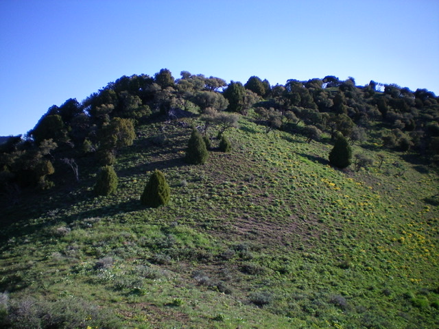
Looking up the south ridge at the semi-open summit of Peak 6587. Livingston Douglas Photo
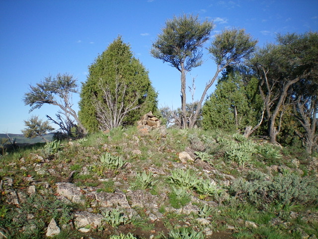
The summit of Peak 6587. Livingston Douglas Photo
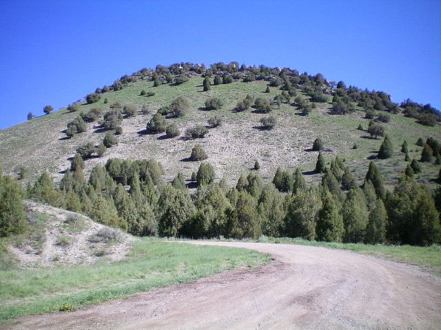
The steep south face of Peak 6587. It is much steeper than the photo suggests. Livingston Douglas Photo
Additional Resources
Regions: Caribou Range->SOUTHERN IDAHO
Mountain Range: Caribou Range
Longitude: -111.48829 Latitude: 43.38159