Elevation: 6,628 ft
Prominence: 328
This peak is not in the book. Published November 2023
Peak 6628 is a minor bump on a north-south ridgeline that sits on the east side of Jimmie Creek and south of Deer Creek. Due to extensive, posted private land along Deer Creek and the difficult prospect of fording Deer Creek, Peak 6628 is best approached from the south. USGS Mahoney Butte
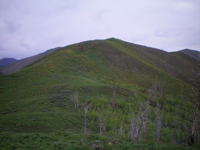
Peak 6628 as viewed from the south. The south ridge (my ascent route) is left of center. Livingston Douglas Photo
Access
Same as for Peak 7254. This is the second leg of a 2-peak adventure that includes Peak 7254 and Peak 6628. It covers 9.0 miles with 3,550 feet of elevation gain round trip. Peak 6628 is entirely on private land. Please obtain permission from the landowner before undertaking this climb.
South Ridge, Class 2
The Climb
From the 6,100-foot drainage crossing at the base of the west face of Peak 7254, bushwhack diagonally upward and left/northwest through sagebrush. Cross two more wet gullies to reach the north ridge of Point 6955. This is a miserable side-hilling effort so it is best to climb to the ridge sooner (and higher) than you have to. The ridge terrain is much easier.
Once on the ridge crest, descend north in a combination of easy scrub, one or two minor rocky outcrops, and thick aspens. Elk trails assist in navigating the ridge crest so look for them. You will quickly reach the 6,300-foot saddle at the base of the south ridge of Peak 6628 in open terrain. Scramble north up the somewhat thick sagebrush on the ridge using game trails to ease the bushwhacking. The ridgeline summit of Peak 6628 has a small cairn amidst the summit scrub.
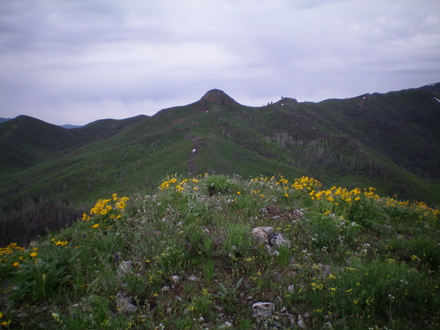
The summit of Peak 6628, looking south at imposing Point 6955. Livingston Douglas Photo
Descent back to Democrat Gulch Road, Class 2
I must caution you that this “descent” is mostly uphill. From the summit, descend south back to the 6,300-foot ridge saddle. Bushwhack south to approach Point 6955, a major rocky block/outcrop). This bushwhack is a mix of scrub and scree/gravel. Elk trails assist in working through this terrain. But there is a hidden blessing. There is an old roadbed (visible from Peak 6628) about 75 feet below the summit of Point 6955. It heads right/southwest to skirt the west side of Point 6955 to reach a saddle just southwest of Point 6955.
From the saddle, scramble southwest then south up over Point 6920+ in thick-ish scrub then quickly southwest down to another ridge saddle. From this saddle, bushwhack southeast down a sagebrush gully in easy scrub to reach a minor saddle and the top of Democrat Gulch Road. Follow the weaving road south then southeast back to the pullout and your parked vehicle.
Additional Resources
Regions: Smoky Mountains->WESTERN IDAHO
Mountain Range: Smoky Mountains
Longitude: -114.3981 Latitude: 43.5523