Elevation: 6,664 ft
Prominence: 463
This peak is not in the book. Published November 2020
Peak 6664 (Antelope Twins North) is one of two humps of nearly identical height located on the southeast side of the Antelope Valley and just south of the bridge crossing of Antelope Creek on Antelope Creek Road. It is best to climb both of these peaks together since they are close neighbors. This area is a mix of public and private land so be careful how you climb these two peaks. USGS Grouse
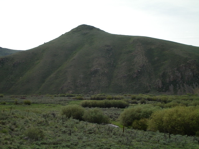
Antelope Twins North as viewed from across Antelope Valley to the northwest. Livingston Douglas Photo
Access
Antelope Creek Road/FSR-137 is located 11.5 miles north of the Conoco gas station at the south end of Arco, ID on US-93. The junction is poorly signed, so look for the road itself. Drive 10.9 miles southwest on FSR-137 to a signed junction at a bridge crossing of Antelope Creek. Go left and cross the Antelope Creek on a good bridge to continue on Antelope Creek Road. From the signed junction at the bridge crossing, drive 0.9 miles farther up Antelope Creek Road to a pullout on the left/southeast side of the road at a gully that separates Antelope Twins North from Antelope Twins South. Park here (6,050 feet).
West Ridge, Class 2
The Climb
From the base of the gully, follow a cattle trail briefly southeast up the gully. Leave the gully and scramble east up easy scrub on the west ridge to reach the cairned summit of Antelope Twins North.

The summit cairn and tattered American flag atop Antelope Twins North. Livingston Douglas Photo
Southwest Face, Class 2
The Descent
From the summit, descend southwest on easy scrub/sagebrush to a grassy saddle. This saddle connects Antelope Twins North to Antelope Twins South. This concludes the first leg of today’s two-peak adventure. Antelope Twins South is up next.
Additional Resources
Regions: EASTERN IDAHO->Pioneer Mountains
Mountain Range: Pioneer Mountains
Longitude: -113.56629 Latitude: 43.69639