Elevation: 6,660 ft
Prominence: 649
This peak is not in the book. Published January 2023
Peak 6660 is located on the west side of the Van Camp Creek drainage and is northwest of Sublett Reservoir. Pine Grove Spring is just to its east. This climb covers 5.0 miles with 1,700 feet of elevation gain round trip. USGS Sublett Reservoir
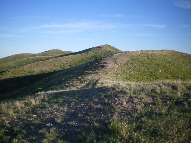
Peak 6660 (pyramidal hump in dead center) as viewed from high on the southeast ridge. Livingston Douglas Photo
Access
From Exit 245 (Malta/Sublett) on I-84, drive southeast on Sublett Road. Continue on the road as it bends east then north and passes the west side of Sublett Reservoir. At 10.0 miles, reach a signed junction with Lake Fork Road/FSR-564 at the northwest end of the reservoir. Drive 0.2 miles north up Lake Fork Road to a signed junction with Van Camp Creek Road/FSR-754. Turn left/northwest onto FSR-754 and drive 0.4 miles to the mouth of a prominent gully on the left/west side of the road. Park here in a large pullout area (5,445 feet).
East Spur/Southeast Ridge, Class 2
The Climb
From the parking area at the mouth of the large gully, scramble west-southwest straight up a steep knoll of somewhat-thick sagebrush and other brush (weaving required). Stay to the left/south to mitigate some of the worse brush. Once atop the knoll, climb west up a ridge on the right/north side of the wide gully all the way to the [obvious] prominent southeast ridge of Peak 6660. The east spur heads right-ish/northwest initially from the knoll then bends left/west and even a little left-ish/southwest near its junction with the southeast ridge.
The east spur is a bit thick with sagebrush early on but the brush soon thins and shortens and the upper 2/3 of the spur is not too bad. Once on the southeast ridge, follow a good 2-track road on it and follow it, with several ups and downs, to the summit of Peak 6660. The first ridge hump is a rocky outcrop that the 2-track skirts on its left/south side. It is critical to remember this rocky outcrop in order to descend the correct spur/shoulder when you return. The summit of Peak 6660 has a decent cairn. The high point is the third ridge hump of four. The fourth hump is lower and is to the northwest of the true summit.
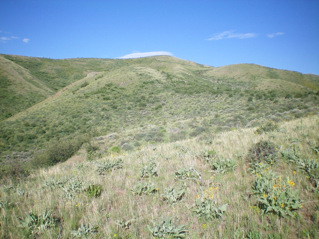
Looking up the east spur and the southeast ridge (skyline left of center) from low on the east spur. Livingston Douglas Photo
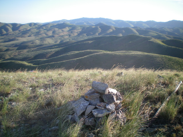
The summit cairn atop Peak 6660 with a sea of Subletts in the distance. Livingston Douglas Photo
Additional Resources
Regions: SOUTHERN IDAHO->Sublett Range
Mountain Range: Sublett Range
Longitude: -113.09031 Latitude: 42.34249