Elevation: 6,660 ft
Prominence: 320
This peak is not in the book. Published November 2023
Peak 6660 is a gentle hump that is located on the east side of Arbon Valley. It sits on the north-south border of Power County and Oneida County in southern Idaho. Peak 6660 is most easily climbed from East Bowen Lane to its west. USGS Dairy Creek
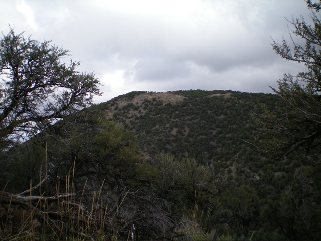
Peak 6660 as viewed from the south. Livingston Douglas Photo
Access
Same as for Peak 6980. This is the second leg of a 2-peak adventure that includes Peak 6980 and Peak 6660. It covers 6.0 miles with 2,320 feet of elevation gain round trip. This area is a mix of private and public land, so be careful. Peak 6660 can be climbed almost entirely on BLM land.
Map Errors
The USGS topo map mislabels Bowen Lane as “Johnson Road.” The USGS topo map shows Bowen Lane as heading east then making a sharp left/north turn. The road actually heads east then bends northeast then bends north just before reaching the unsigned road junction for the start of this climb. Bowen Lane continues northward past this junction. That section of the road is not shown on the USGS topo map.
Southeast Shoulder, Class 2
The Climb
From the 6,120-foot gully crossing in a meadow that separates Peak 6980 from Peak 6660, follow a cattle trail that heads north-northeast up a narrow gully. This side gully is the left/northern of two gullies here. The right/east gully has an old 2-track road in it. After getting partway up the left gully, leave it to bushwhack left/north-northwest up a grass-and-sagebrush face to reach the southeast shoulder. Once on the shoulder, weave through junipers and mountain mahogany in semi-open terrain to reach the open summit of Peak 6660. There is a triangulation post/wiring laying on the ground at the high point. There was no summit cairn so I built one.
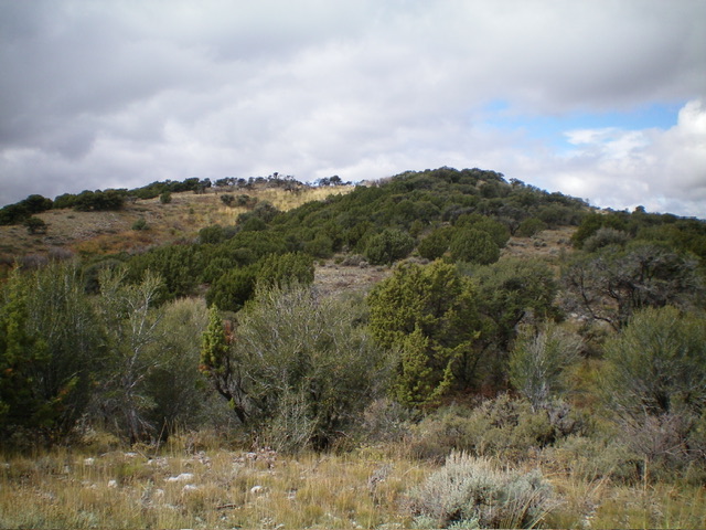
The summit hump of Peak 6660 (left of center) as viewed from midway up the southeast shoulder. Livingston Douglas Photo
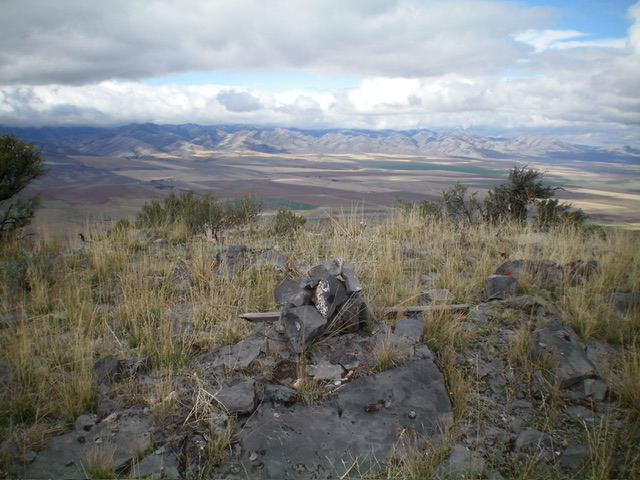
The newly-built summit cairn atop Peak 6660. Livingston Douglas Photo
North Ridge/West Gully, Class 2
The Descent
From the summit, descend north then northwest on a ridgeline to about 6,500 feet. Leave the ridge here as it is heading north towards private property. Bushwhack west down a face section in a mix of thick junipers, mountain mahogany, brush, and loose scree. This quickly leads into a side gully that heads west then northwest down to the main gulch that separates Peak 6980 from Peak 6660. Stay on the right/north side of the side gully to skirt the thick junipers/mahogany in its center. Approach the main gulch from its right/east side and find a good spot to descend into it. The main gulch has an old 2-track road in its center.
Once on the 2-track road, follow it north down past a cabin (on the right) and continue north briefly. [To avoid the private land in this area, you can exit the gulch and bushwhack left/west up across the north ridge of Peak 6980 to return to the road junction where you are parked.] Leave the 2-track road where it is about to come up over a rise and get close to a homestead on the right/east side of the gulch. Bushwhack left/west down through thick/tall field grass and brush to re-enter the gulch. Follow the gulch northward to the main side road. The gulch has some deadfall to work around in addition to somewhat-thick brush. Once you reach the side road, follow it west for just over 0.3 miles to return to the road junction and your parked vehicle.
Additional Resources
Regions: Bannock Range->SOUTHERN IDAHO
Mountain Range: Bannock Range
Longitude: -112.4985 Latitude: 42.4850