Elevation: 6,660 ft
Prominence: 370
This peak is not in the book. Published December 2019
Peak 6660 is located southeast of Succor Creek Reservoir and east of US-95. The peak has an impressive west face. USGS Swisher Mountain
Access
The road from Mile Point 1 on US-95 is posted private property but you can get to the south end of Succor Creek Reservoir from the road at the state line. This road barely clips private land but through access is allowed. The road is steep in places and is rough at the reservoir. One of the side roads is posted. Surprisingly, Google Maps is spot on with directions to the south end of the reservoir. I parked near the reservoir.
Northwest Ridge/North Ridge, Class 3
I approached from Succor Creek Reservoir which is a very long approach but I think it can be accessed from the east from the road you use to access Peak 7380. The route climbed over two unranked peaks (Table Rock and Captain Butte) before dropping into the Jackson Creek drainage. The route then climbed Peak 6630 via its northern slopes. From Peak 6630, drop down to a saddle east of Peak 6660. Climb the peak’s Northeast Ridge to the North/Summit Ridge which you then follow to the high point.
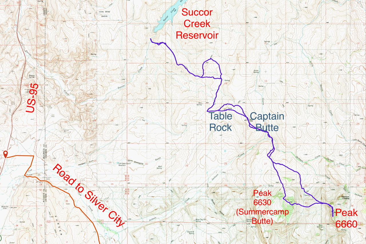
Brett Sergenian’s GPS track from Succor Creek Reservoir to Peak 6630 and Peak 6660. His round trip stats: 18 miles with 3,770 feet of elevation gain
Additional Resources
Regions: Owyhee Mountains->SOUTHERN IDAHO
Mountain Range: Owyhee Mountains
Longitude: -116.88449 Latitude: 43.11569