Elevation: 6,702 ft
Prominence: 332
This peak is not in the book. Published January 2023
Peak 6702 is located in the Chesterfield Range on the west side of Corral Creek Road. It sits at the head of the Negro Creek drainage and west of the Blackfoot River and Blackfoot Reservoir. ATV trails help in climbing the east ridge, but the final 300 vertical feet of brush-bashing is not fun. USGS Grizzly Creek
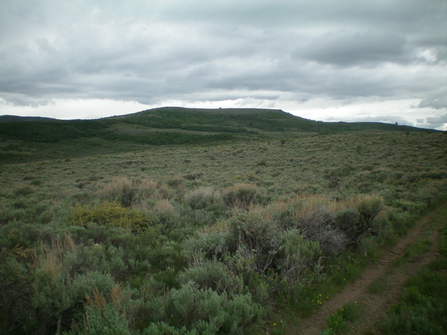
Peak 6702 is the flat-topped ridge in the center of the photo. This view is from midway up the east ridge. Livingston Douglas Photo
Access
From Exit 116 (Sunnyside Road) on I-15 in Idaho Falls, drive east on Sunnyside Road to its end at a signed “T” junction with Bond Road. This junction is 9.1 miles east of Ammon Road. Turn right/south onto Bone Road and drive 8.5 miles south to a signed junction with Blackfoot Reservoir Road, just south of Bone. Turn right/west onto Blackfoot Reservoir Road. The road quickly bends left/south and begins its journey to Blackfoot Reservoir.
Drive 20.5 miles on Blackfoot Reservoir Road to a signed junction at the northwest corner of Blackfoot Reservoir. Continue straight/south on Government Dam Road for 3.1 miles to a signed junction with Corral Creek Road. Turn right/west onto Corral Creek Road and drive 4.9 miles to an unsigned junction with the Negro Creek ATV Trail. Park at this junction (6,020 feet). GPS coordinates: 42⁰59’31”N, 111⁰48’27”W.
East Ridge, Class 2
The Climb
From the road junction, hike south up the Negro Creek ATV Trail for about 0.5 miles to an unsigned junction. Go right/west up another ATV trail that climbs up the east ridge. Follow this trail up to an unsigned junction on an east shoulder high up. Leave the ATV trail here and bash your way west up through thick brush to reach the open summit. The summit has a decent cairn but there is a lot of thick brush right up to, and around, the summit cairn. The high point is at the south end of an elongated ridge crest.
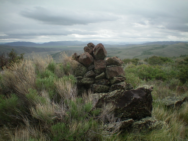
The summit cairn atop Peak 6702. Livingston Douglas Photo
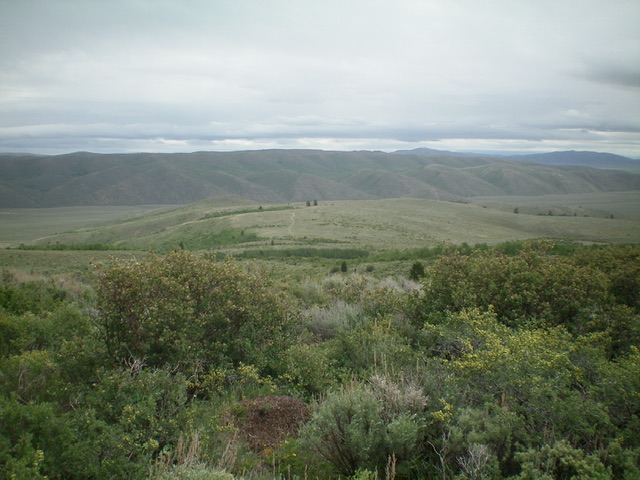
Summit view from atop Peak 6702, looking down the east ridge. Livingston Douglas Photo
Additional Resources
Regions: Blackfoot Mountains->Chesterfield Range->SOUTHERN IDAHO
Mountain Range: Blackfoot Mountains
Longitude: -111.8394 Latitude: 42.9819