Elevation: 6,705 ft
Prominence: 485
This peak is not in the book. Published November 2023
Peak 6705 sits high on a ridgeline that separates the headwaters of Big Silverlead Creek from the headwaters of Wagonhammer Creek. It is an absolutely beautiful mountain when viewed from a distance. I couldn’t resist climbing it, though it wasn’t initially on my agenda. The easiest access to Peak 6705 is from the Wagonhammer Creek Trailhead. USGS North Fork
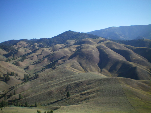
Peak 6705 as viewed from Peak 5954 to its west. Livingston Douglas Photo
Access
Wagonhammer Creek Road (signed) is located along US-93 just south of North Fork at virtual MM324.2. This junction is 1.9 miles south of the General Store in North Fork and is 3.3 miles north of [signed] Fourth of July Creek Road. From the junction, drive up a dirt road for 0.2 miles to the large trailhead parking area for FST-137/Wagonhammer Creek Trail. Park here (3,785 feet; 45⁰23’31”N, 113⁰57’40”W).
Map Errors
FSR-072/Wagonhammer Creek Road ends after 0.2 miles up from US-93. The USGS topo map incorrectly shows FSR-072 continuing up Wagonhammer Creek but it is now only a foot trail (FST-137).
South Ridge, Class 2
The Climb
From the trailhead, hike 1-1/4 miles east then northeast up FST-137/Wagonhammer Creek Trail to a signed junction with FST-130/Lewis and Clark Trail. Continue straight/northeast on FST-137 up Wagonhammer Creek for another mile to reach the base of the south ridge in a large meadow. The south ridge is a beautiful, rounded, grassy ridge with a few scattered pines when viewed from this meadow.
Leave the trail and bushwhack across a patch of sagebrush to reach the toe of the south ridge. Scramble up a gravelly spur on the left/west side of the toe to quickly reach the ridge crest. Follow a use/game trail up the ridge through steep, short grass with loose underlying scree/gravel. The trail zigzags from one side of the ridge crest to the other. There are a few ridge pines and a small amount of deadfall to navigate to reach Point 5600+ and flatter terrain.
The ridge now becomes semi-forested and is a mix of deadfall (more than you would expect), thicker brush, taller grass, and loose underlying talus/scree. The ridge descends to a minor saddle then bends hard left/northwest in a forested area to climb up to Point 5805. Point 5805 is at a juncture of two forks that form the south ridge. You just climbed the right/southeast fork to get here. From Point 5805, descend 70 feet in semi-open forest through tedious downed trees and thick-ish grass/scrub. Continue north then northeast to Point 6295 in more tedious blowdown and grass/scrub.
From Point 6295, descend 45 feet to a grassy saddle then climb up a steep-ish ridge section with loose underlying scree/gravel to reach the final, flattish, forested ridgeline push to the summit. The summit of Peak 6705 is at the north end of the ridge crest and is semi-open. There were no signs of previous ascent so I built a summit cairn on an open rocky spot about 50 feet south-southwest of the high point. The partial view to the southeast from the summit is stunning.
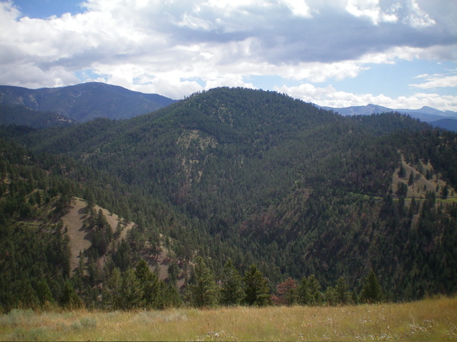
Looking up the south ridge from the final saddle. Livingston Douglas Photo
South Ridge/Southeast Spur, Class 2+
The Descent
From the summit, return to Point 6295 and follow the south ridge briefly to find the top of the mostly-open southeast spur. Descend this steep, narrow ridge spur of [mostly] field grass and scattered pines. Midway down, there is a patch of nasty ridge rock with more pines nearby. Lower down, the ridge terrain is a mix of grass and pines which goes quickly. As you near the valley floor (at about 5,100 feet), the ridge ends in a gully (as per the USGS topo map). The gully is narrow with steep sides and lots of deadfall.
Stay on the angled grass on the left/east side of the gully and contour onto a grassy shoulder. Once on the crest of the shoulder, descend it to FST-137. The final drop to the trail is in thick forest and brush, though it is short-lived. Once on FST-137, follow the narrow footpath for ¾ mile (with four creek crossings) back to the trail departure point for the south ridge climb. Continue another mile (with two more creek crossings) to the signed trail junction with FST-130. Proceed for the final 1-1/4 miles southwest down FST-137 to the Wagonhammer Creek Trailhead.
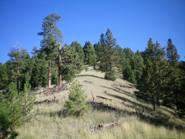
Peak 6705 as viewed from the southwest. Livingston Douglas Photo
Additional Resources
Regions: Beaverhead Range->EASTERN IDAHO
Mountain Range: Beaverhead Range
Longitude: -113.9252 Latitude: 45.4388