Elevation: 6,710 ft
Prominence: 370
This peak is not in the book. Published January 2023
Peak 6710 is a scrub-and-forest hump that is located just south of Pine Gap and west of Pegram Creek on the Bear Lake Plateau. This area is a mix of private and public land, so be careful. Peak 6710 can be reached entirely on BLM land, but it requires a lengthy up-and-down traverse from Indian Creek Road. The peak itself is almost entirely on BLM land. The peak is most easily climbed via its north ridge. USGS Pegram Creek
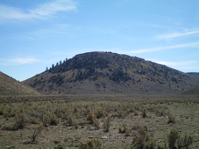
Peak 6710 as viewed from the north. Livingston Douglas Photo
Access
Park along Indian Creek Road about 0.2 miles west of an unsigned junction of Indian Creek Road and a 2-track road that heads south up to Pine Gap. This junction is 1.4 miles south of the junction of Indian Creek Road and Sorenson Road (see the Peak 6623 page for specific on how to reach that junction). The land south of Indian Creek Road is fenced but not posted and is initially private land. Surprisingly, there is no fencing (nor any signage) along the private/public property lines shown on the LOJ land management map in the area of Peak 6710. Most of Peak 6710 is on BLM land. The parking pullout on the south side of Indian Creek Road is at 6,090 feet. GPS coordinates: 42⁰06’29”N, 111⁰09’57”W.
Map Errors
The 1.4-mile stretch of Indian Creek Road from Sorenson Road south to the unsigned junction with the 2-track road is in excellent condition, contrary to what the USGS map indicates. The Caribou-Targhee National Forest Map fails to show Sorenson Road, a well-graded, wide road.
Northwest Face/North Ridge, Class 2
The Climb
From the roadside pullout along Indian Creek Road, bushwhack south through tall, gapped sagebrush. Cross a dry stream bed and then cross a cattle fence to reach the base of the [obvious] northwest face of Peak 6710. Scramble southeast up the steep face of grass (easy), brush, some scattered trees, and sections of boulders to reach the gentler, flatter, easier scrub on the summit ridge. Head south along the flattish summit ridge for almost ½ mile to reach the large boulders that seem to be the high point of Peak 6710. There were no signs of previous ascent.
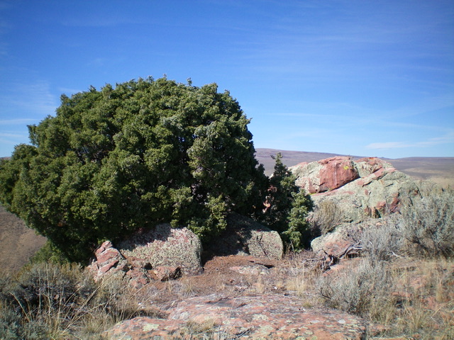
The summit of Peak 6710. The high point is the large boulders on the right side of the photo. Livingston Douglas Photo
North Ridge/Northeast Face, Class 2
The Descent
From the summit, return north along the summit ridge then descend northeast on steep boulders and brush to reach grassy, easy terrain lower down. Cruise northeast to Pine Gap (a saddle) and a 2-track road that passes through it. Follow the 2-track road northwest and quickly reach a cattle fence and wire gate. Cross the fence (no signage or orange paint) and continue northwest then north along the 2-track to its unsigned junction with Indian Creek Road. Walk west for 0.2 miles on Indian Creek Road to your parked vehicle.
Additional Resources
Regions: Bear Lake Plateau->SOUTHERN IDAHO
Mountain Range: Bear Lake Plateau
Longitude: -111.1636 Latitude: 42.0928