Elevation: 6,710 ft
Prominence: 544
This peak is not in the book. Published November 2019
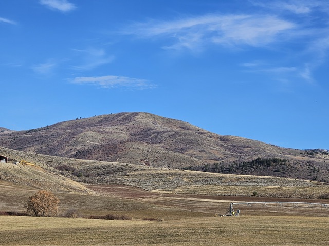
Peak 6710 is a massive hump located above Worm Creek. It is positioned on the southwest end of a ridge that begins at the high peaks surrounding North Worm Creek Basin and South Worm Creek Basin. The summit is just outside the bounds of the Cache National Forest. However, the peak can be approached on National Forest land to the east and northeast. Peak 6710 is thickly covered with tall sagebrush, willows, and brush. It is an unpleasant bushwhack to the top. The easiest access is via Cub River Road to the south. USGS Mink Creek
Misery Hill. Russ Durrant Photo
Southeast Face/Northeast Ridge, Class 2
Access
Cub River Road is located on US-91 between Franklin, ID and Preston, ID. From the junction of US-91 and ID-34 in Preston, Cub River Road is 5.5 miles south on US-91. From Franklin, Cub River Road is 2.3 miles north of Main Street on US-91. Cub River Road heads northeast from US-91 and passes through an extensive area of residential homes and private property. The road is paved for the first 8.5 miles and is a fast drive.
The following mileage marks are calibrated from the base of Cub River Road at US-91. At 8.5 miles, the pavement ends. At 8.8 miles, enter the Cache National Forest and the road becomes FSR-406. At 9.3 miles, Albert Moser Campground is on the right. At 9.4 miles, the Cub River Trailhead (and a large parking lot) is located on the left side of the road. Park here (5,270 feet).
The Climb
Hike up Cub River Trail briefly to reach a cattle fence. Leave the trail here and cross the fence. Bushwhack northwest up through an open forest to reach a shoulder that is to the left/west of a prominent drainage. Follow the shoulder upward to where the forest ends and the slope eases. Do a diagonal, westward scramble across a wide gully on reasonably easy scrub. Unfortunately, the ground boulders/talus will slow you down. Use cattle trails to ease the difficulty of the clunky terrain.
After crossing the wide gully, angle right/northwest to head directly up the brush-covered slope to reach the thick brushy mess that is the northeast ridge. Stay to the right/northeast of thicker, steeper brush to the southwest as you make this punishing climb to the ridge. You should reach the ridge at about 6,350 feet. The brush/scrub gets taller as you gain altitude, an uncommon phenomenon. The northeast ridge is rounded, ill-defined, and only begrudgingly gains elevation. However, you will find cattle trails amongst this mess of tall bushes and scrub. It’s remarkable that cattle spend any time in here.
Stay near the ridge crest or just to the left/southeast of it. The right/northwest side of the ridge is truly wicked. Avoid it. Higher up, you will actually find some patches of open scrub on the south side of the ridge crest, which has become more of a face at that point. Finish the climb to the elusive summit by heading west through any open gaps you can find. The summit of Peak 6710 is an open area of large boulders and sagebrush/willows. There are no fences or signs prohibiting entry onto the summit area. There were no signs of previous ascent. I suspect that this brushy peak is rarely visited.
When you descend, your visibility will often be nil due to the tall shrubs/brush. It’s even more difficult to determine where exactly to drop off the ridge to descend into the large basin/gully that splits the southeast face. Use an altimeter or GPS to help you gauge the appropriate departure point from the ridge. After you finally reach the short scrub in the center of the face (lower down) and cross the dry gully, you will be greatly relieved. Traverse eastward to find the shoulder that you climbed earlier in the day. Descend the shoulder through the open forest to find the Cub River Trail. Follow the trail back to the trailhead parking area.
This area around Cub River is arguably some of the worse bushwhacking that I have ever experienced in the State of Idaho. If you do other peaks near here in South Worm Creek Basin (or North Worm Creek Basin), you will suffer as badly, or worse, than you did today on Peak 6710. You would have to be full-blown masochist to enjoy peakbagging in this area. It really is THAT AWFUL. I will never come back to this area, not in this life nor in any future lives.
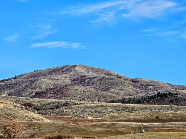
Misery Hill. Russ Durrant Photo
Additional Resources
Regions: Bear River Range->SOUTHERN IDAHO
Mountain Range: Bear River Range
Longitude: -111.72209 Latitude: 42.14109