Elevation: 6,722 ft
Prominence: 372
This peak is not in the book. Published January 2023
Peak 6722 is located on a long ridgeline that is sandwiched between Corral Creek and Grizzly Creek, west of Blackfoot Reservoir. It is most easily reached via a 2-track road that crosses its northwest ridge and then a weak 2-track road on the ridge itself. This climb is the first leg of a 2-peak adventure that includes Peak 6722 and Sawmill Ridge (7,102 feet). The journey covers 11.0 miles with 2,225 feet of elevation gain round trip. USGS Grizzly Creek
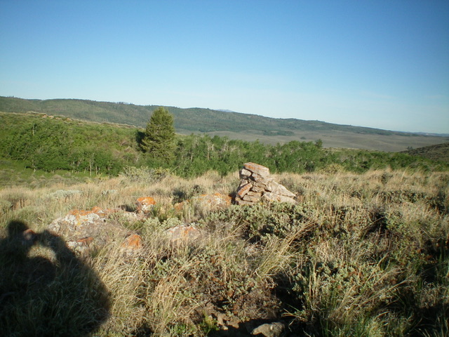
Summit view from the top of Peak 6722 with Sawmill Ridge in the distance. Livingston Douglas Photo
Access
From Exit 116 (Sunnyside Road) on I-15 in Idaho Falls, drive east on Sunnyside Road to its end at a signed “T” junction with Bond Road. This junction is 9.1 miles east of Ammon Road. Turn right/south onto Bone Road and drive 8.5 miles south to a signed junction with Blackfoot Reservoir Road, just south of Bone. Turn right/west onto Blackfoot Reservoir Road. The road quickly bends left/south and begins its journey to Blackfoot Reservoir. Drive 20.5 miles on Blackfoot Reservoir Road to a signed junction at the northwest corner of Blackfoot Reservoir.
Continue straight/south on Government Dam Road for 3.1 miles to a signed junction with Corral Creek Road. Turn right/west onto Corral Creek Road and drive 3.0 miles to an unsigned junction with Cow Camp Road. Turn left/southwest onto well-graded Cow Camp Road and drive 0.2 miles to an unsigned junction with a 2-track road heading right/west. Park in a pullout along Cow Camp Road near this junction (6,090 feet).
Northeast Shoulder/North Ridge, Class 2
The Climb
From the road junction, hike (or drive) up the narrow 2-track road (4WD recommended) for about a mile to an unsigned junction with a weaker 2-track heading left/southeast. Hike briefly southeast on this 2-track road to a flat, dirt saddle (cattle/sheep have been here). Leave the 2-track here and scramble south across a dry gully of somewhat thick sagebrush. Once across the gully, bash your way up through thick sagebrush and other brush to reach the northeast shoulder. Climb southwest up the shoulder to reach the high ridge crest and continue south-southeast through more sagebrush to reach the cairned summit.
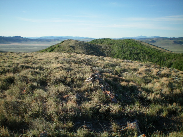
Looking southeast along the ridgeline from the summit of Peak 6722. Livingston Douglas Photo
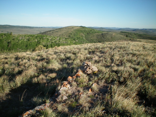
Looking northwest at Point 6712 from the summit of Peak 6722. Livingston Douglas Photo
Southwest Face, Class 2
The Descent
From the summit, descend west-southwest to a minor gap then scramble west up onto the [lower] west summit (6,700+). From there, follow the open ridge crest northwest briefly then descend left/southwest down a sagebrush shoulder (tedious) to its end in a dry gully that heads left-ish/south. Follow the south then west (with the help of a cattle trail lower down) to reach the powerlines and the valley floor at Grizzly Creek. Hike south briefly on a 2-track road and cross Grizzly Creek (often dry). This concludes the first leg of today’s 2-peak journey. Sawmill Ridge is up next.
Additional Resources
Regions: Blackfoot Mountains->Chesterfield Range->SOUTHERN IDAHO
Mountain Range: Blackfoot Mountains
Longitude: -111.7890 Latitude: 42.9576