Elevation: 6,727 ft
Prominence: 347
This peak is not in the book. Published January 2023
Peak 6727 is a modest hill that is located at the north end of the Jim Sage Mountains, east of the main ridge crest. It is most easily climbed via its north side from a nearby BLM road. This area is a mix of private and public land, so be careful. This climb is entirely on public land. USGS Kane Canyon
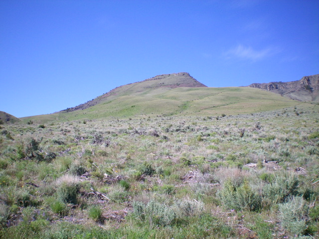
Peak 6727 as viewed from the northeast (my ascent route). Livingston Douglas Photo
Access
From Malta, drive west on ID-77 for 4.9 miles to a signed junction with 1760E. Turn left/south onto 1760E and drive 0.3 miles to BLM land at a 3-way “T” junction. Go right/west at this junction and drive 0.2 miles to a sharp left/southwest bend in the road. Continue 1.4 miles farther up this 2-track road to a cattle fence crossing. Park in a pullout alongside this fence (5,145 feet). The road gets much narrower and more overgrown from here. GPS coordinates: 42⁰15’21”N, 113⁰28’22”W.
Northeast Face, Class 2
The Climb
From the cattle fence crossing, first get a visual of the correct peak to climb. It is NOT the rugged, rocky hump directly to the south (Point 6200+). Peak 6727 is the peak to its right/west and is southwest of your current position. Knowing this, you can now see the ascent route clearly from here. Hike southwest up the BLM 2-track road to an unsigned junction. Go right/west here onto another 2-track road that heads west up a large drainage and follows the left/south edge of a juniper forest. After about 0.2 miles on this side road, leave the road and bushwhack south-southwest straight at the summit. The northeast face is a rolling mix of rounded shoulders and dry gullies and goes pretty easily.
The terrain is easy sagebrush and other scrub with lots of dead juniper branches (thanks to BLM) with a modest uphill slope. Higher up, the slope steepens and the terrain is mostly easy, short field grass. As you approach the summit, there are cliff bands to skirt left of and some scree/talus slopes to cross. Head southwest from 5,500 feet up and then bend left/south high up. Scramble up through an easy cliff band just below the summit then climb an easy slope of embedded talus/scree to the rocky summit cap. There is a modest cairn on top.
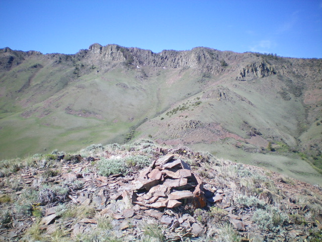
The summit cairn atop Peak 6727 with the main, rugged crest of the Jim Sage Mountains in the background. Livingston Douglas Photo
North Ridge, Class 3
The Descent
From the summit, descend north straight down the steep, rocky north ridge through cliff bands. Once past the cliff bands, descend a steep, loose talus slope to reach the easier grassy slopes below. Bend right/northeast and cross a minor saddle to retrace the ascent route and return to the 2-track side road then the main 2-track road and your parked vehicle.
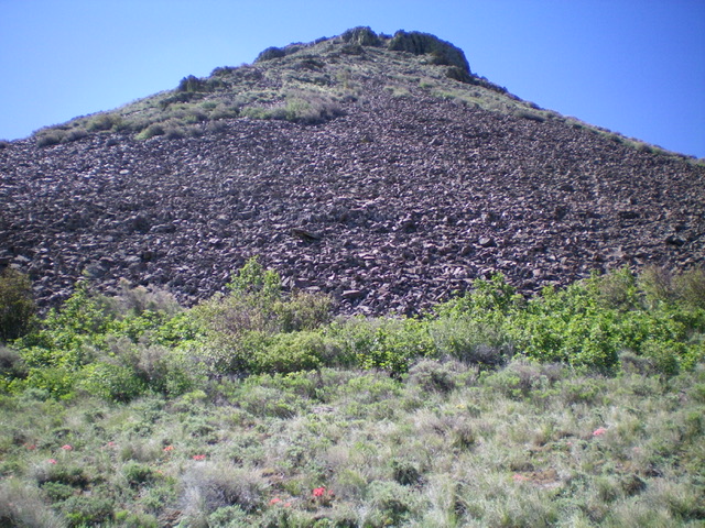
Looking up the steep, Class 3 north ridge (my descent route). Livingston Douglas Photo
Additional Resources
Regions: Albion Range->Jim Sage Mountains->SOUTHERN IDAHO
Mountain Range: Albion Range
First Ascent Information:
- Other First Ascent: North Ridge -Descent
- Year: 2023
- Season: Summer
- Party: Livingston Douglas
Longitude: -113.4894 Latitude: 42.2359