Elevation: 6,745 ft
Prominence: 405
This peak is not in the book. Published November 2022
Peak 6745 is located northwest of Little Wood River Reservoir and sits above Cold Spring Creek. This area is a mix of private and public land, so be careful. Both of the routes detailed below are entirely on BLM land. USGS Baugh Creek
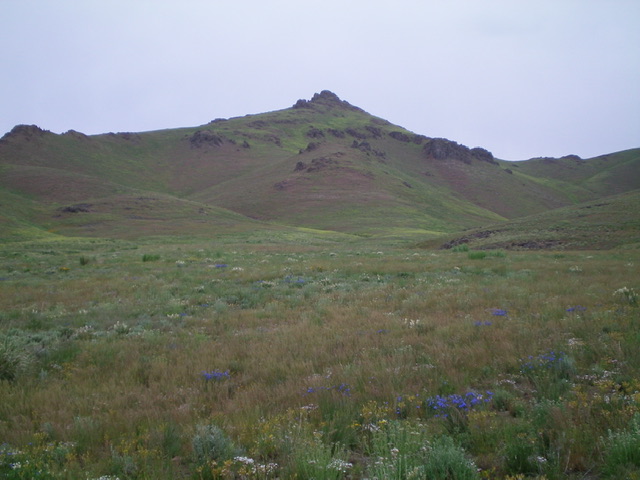
Peak 6745 as viewed from the south. The south ridge (my descent route) is in dead center and the southwest ridge (my ascent route) is the skyline left of center. Livingston Douglas Photo
Access
From the unsigned junction of Muldoon Canyon Road and Little Wood River Reservoir Road, drive west up Muldoon Canyon Road for 1.8 miles and park on an old 2-track side road on the left/south side of Muldoon Canyon Road (5,640 feet). GPS coordinates: 43⁰30’29”N, 114⁰05’59”W.
South Shoulder/Southwest Ridge, Class 2
The Climb
From the 2-track road, hike briefly west on Muldoon Canyon Road to cross a gully/stream. Leave the road and scramble northwest up onto a shoulder of sorts. Aim for the left/west of two shoulders as you proceed from here (see photo). The left/south shoulder is gentler and heads directly up to the southwest ridge. The terrain is relatively easy sagebrush, field grass, and other vegetation. Once on the southwest ridge, the terrain changes dramatically. It is much rockier and has a few rocky ridge outcrops to skirt. Reaching the summit requires a minor Class 2 rock scramble. The summit has a modest cairn. The block to its east (Point 6640+) is much more impressive but is lower in elevation. It also has a cairn atop it.
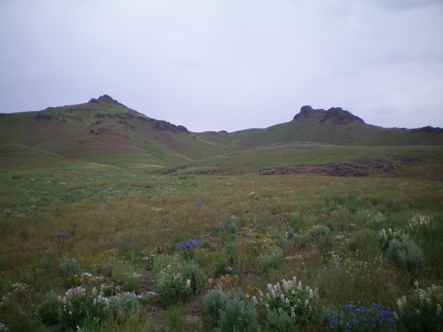
Peak 6745 and Point 6640+ as viewed from the south. Be sure to climb the correct one! They look pretty close in height. Livingston Douglas Photo
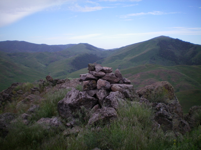
The summit cairn atop Peak 6745. Livingston Douglas Photo
South Ridge, Class 2
The Descent
From the summit, descend due south, staying left/east of the obvious southwest ridge of the ascent route. The terrain on the south ridge is a combination of rocky outcrops and tall vegetation. Lower down, the terrain is much less rocky and is mostly sagebrush. Reach a flat ridge area at 5,860 feet. Climb 20 feet over an easy ridge hump then angle right-ish/southwest and cross a gully near the bottom to reach Muldoon Canyon Road just west of the old 2-track road and your parked vehicle. Both of the aforementioned routes have much more of a rocky base underneath the vegetation than initially appears to be the case. The South Shoulder/Southwest Ridge Route is preferable to the rougher, thicker terrain on the South Ridge Route.
Additional Resources
Regions: EASTERN IDAHO->Pioneer Mountains
Mountain Range: Pioneer Mountains
Longitude: -114.10249 Latitude: 43.52139