Elevation: 6,780 ft
Prominence: 280
This peak is not in the book. Published December 2020
Peak 6780 is a rather inconsequential ridgeline hump that sits above Deer Creek to its south. It is best climbed from Deer Creek Road/FSR-156. Be advised that the bushwhacking here is pretty rough. The open areas shown on the USGS topo map are now dense with aspens. Combine this peak with a climb of nearby Old Man Ridge (6,785 feet) for a more worthwhile adventure. USGS Thayne West
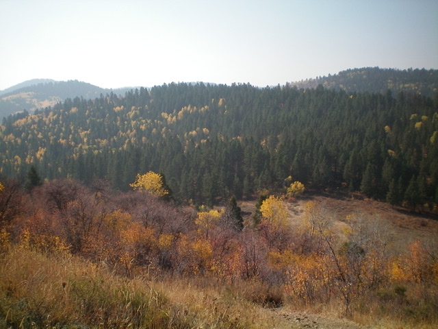
Peak 6780 (forested, mid-ground) as viewed from the northeast. Livingston Douglas Photo
Access
From the major intersection at the Mormon Church in the center of Freedom (WY), drive south on a paved county road for 1.4 miles. Turn right/west at an unsigned junction onto a good gravel/dirt road. This road becomes Deer Creek Road/FSR-156. Reset your odometer at this junction. At 1.5 miles, reach the Caribou National Forest boundary at a cattle guard. At 2.2 miles, reach a signed junction with FSR-023 on the right/north side of the road. Park at this junction (6,165 feet) or drive a short distance up FSR-023 to a large meadow and dispersed camping area and park there.
East Face/Southeast Ridge, Class 2
The Climb
From the road junction, hike up FSR-023 to a large meadow and dispersed camping area. Leave the road and walk west through the camping area then bushwhack west up through a wickedly thick aspen forest to reach the brushy (but aspen-free) southeast ridge. There are some scanty game/use trails in the aspen forest, but not enough to make much of a difference.
Once on the southeast ridge, scramble northwest up the narrow, brush-and-rock ridge crest to reach the summit area. There is a large, tall summit cairn located about 75 feet northwest of the highest boulder/hump. The summit offers partial views. Regrettably, you cannot see Old Man Ridge from here and, if that is your next objective (as it was for me), you will be disappointed.
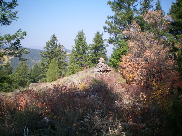
The large summit cairn atop Peak 6780. Livingston Douglas Photo
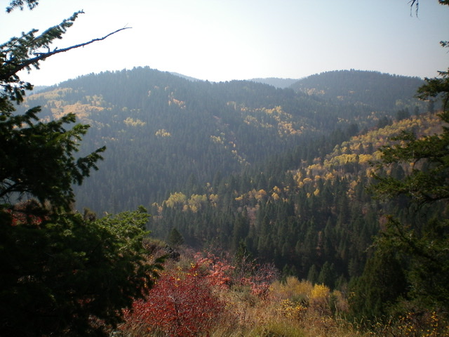
The view from the summit of Peak 6780, looking west. Notice the mix of pines and aspens in the forested areas here. Livingston Douglas Photo
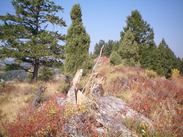
A dinner-plate shale hunter’s blind on the upper southeast ridge of Peak 6780. Livingston Douglas Photo
Northeast Face, Class 2
The Descent
From the summit, descend northwest along the summit ridge briefly then leave the ridge to do a miserable, diagonal (then straight) bushwhack northeast down through a thick pine forest with too many aspens mixed in. If you do this right, you will pop out on the open terrain of the connecting saddle with Old Man Ridge at 6,460 feet. The saddle is short field grass. It has one ATV trail crossing it from southeast-to-northwest and another ATV trail heading northeast straight up the slope to Old Man Ridge. Neither of the ATV trails is signed. Please note that the USGS topo map shows none of the ATV trails on or near Old Man Ridge but the Caribou-Targhee National Forest Map does. This concludes the first leg of today’s two-peak journey. Old Man Ridge is up next.
Additional Resources
Regions: Peale Mountains->SOUTHERN IDAHO->Webster Range
Mountain Range: Peale Mountains
Longitude: -111.08919 Latitude: 42.96079